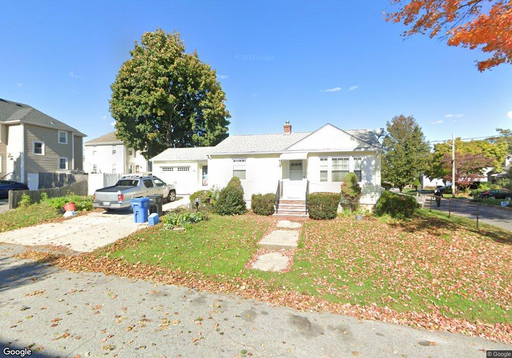
167 Arthur St Cranston, RI 02910
Auburn NeighborhoodEstimated Value: $311,914 - $421,000
2
Beds
1
Bath
720
Sq Ft
$506/Sq Ft
Est. Value
About This Home
This home is located at 167 Arthur St, Cranston, RI 02910 and is currently estimated at $364,229, approximately $505 per square foot. 167 Arthur St is a home located in Providence County with nearby schools including Eden Park Elementary School, Park View Middle School, and Cranston High School East.
Ownership History
Date
Name
Owned For
Owner Type
Purchase Details
Closed on
Sep 24, 2001
Sold by
Alba Michael J
Bought by
Hirst Jennie E
Current Estimated Value
Purchase Details
Closed on
Jan 8, 1999
Sold by
Dossantos Michael and Dossantos Diane
Bought by
Alba Michael J
Purchase Details
Closed on
Dec 9, 1996
Sold by
Alba Michael J
Bought by
Dossantos Michael and Dossantos Diane
Purchase Details
Closed on
Nov 30, 1994
Sold by
Drinwater Robert W and Quinn Janet D
Bought by
Alba Michael J
Create a Home Valuation Report for This Property
The Home Valuation Report is an in-depth analysis detailing your home's value as well as a comparison with similar homes in the area
Home Values in the Area
Average Home Value in this Area
Purchase History
| Date | Buyer | Sale Price | Title Company |
|---|---|---|---|
| Hirst Jennie E | $98,000 | -- | |
| Alba Michael J | $65,000 | -- | |
| Dossantos Michael | $77,500 | -- | |
| Alba Michael J | $72,000 | -- |
Source: Public Records
Mortgage History
| Date | Status | Borrower | Loan Amount |
|---|---|---|---|
| Open | Alba Michael J | $59,599 | |
| Open | Alba Michael J | $109,258 |
Source: Public Records
Tax History
| Year | Tax Paid | Tax Assessment Tax Assessment Total Assessment is a certain percentage of the fair market value that is determined by local assessors to be the total taxable value of land and additions on the property. | Land | Improvement |
|---|---|---|---|---|
| 2025 | $3,160 | $227,700 | $93,600 | $134,100 |
| 2024 | $3,099 | $227,700 | $93,600 | $134,100 |
| 2023 | $3,304 | $174,800 | $64,600 | $110,200 |
| 2022 | $3,236 | $174,800 | $64,600 | $110,200 |
| 2021 | $3,146 | $174,800 | $64,600 | $110,200 |
| 2020 | $3,109 | $149,700 | $61,300 | $88,400 |
| 2019 | $3,109 | $149,700 | $61,300 | $88,400 |
| 2018 | $3,037 | $149,700 | $61,300 | $88,400 |
| 2017 | $2,751 | $119,900 | $45,200 | $74,700 |
| 2016 | $2,692 | $119,900 | $45,200 | $74,700 |
| 2015 | $2,692 | $119,900 | $45,200 | $74,700 |
| 2014 | $2,654 | $116,200 | $45,200 | $71,000 |
Source: Public Records
Map
Nearby Homes
- 144 Laurens St
- 181 Grace St
- 124 Clarence St
- 80 Colonial Ave
- 363 Pontiac Ave
- 10 Dale Ave
- 152 Woodbine St
- 288 Pontiac Ave
- 90 Garden St
- 10 Woburn St
- 55 Melrose St
- 33 Hemlock Ave
- 167 Forest Ave
- 103 Harper Ave
- 64 Holburn Ave
- 43 Woodbine St
- 11 Griswold Ave
- 47 Holburn Ave
- 140 Eldridge St
- 25 Sharon St Unit 2
- 153 Potter St
- 160 Richard St
- 156 Richard St
- 163 Potter St
- 151 Potter St
- 164 Richard St
- 150 Richard St
- 160 Potter St
- 154 Potter St
- 163 Richard St
- 163 Richard St Unit A
- 163 Richard St Unit B
- 146 Richard St
- 49 Hodsell St
- 168 Richard St
- 150 Potter St
- 45 Hodsell St
- 141 Potter St
- 146 Potter St
- 526 Pontiac Ave
Your Personal Tour Guide
Ask me questions while you tour the home.