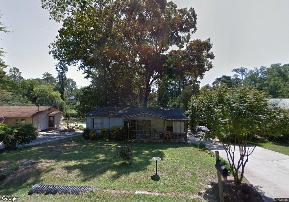
167 Carter Cir Warner Robins, GA 31093
Estimated Value: $72,729 - $147,000
--
Bed
--
Bath
--
Sq Ft
0.43
Acres
About This Home
This home is located at 167 Carter Cir, Warner Robins, GA 31093 and is currently estimated at $116,682. 167 Carter Cir is a home with nearby schools including Westside Elementary School, Northside Middle School, and Northside High School.
Ownership History
Date
Name
Owned For
Owner Type
Purchase Details
Closed on
Jun 11, 2015
Sold by
Bjbs Rentals Llc
Bought by
Holt Billy
Current Estimated Value
Home Financials for this Owner
Home Financials are based on the most recent Mortgage that was taken out on this home.
Original Mortgage
$17,315
Interest Rate
3.92%
Mortgage Type
New Conventional
Purchase Details
Closed on
Dec 31, 2014
Sold by
Blakely Lisa A
Bought by
Bjb'S Rentals Llc
Purchase Details
Closed on
Jun 1, 1987
Sold by
Blakely Don Eric
Bought by
Blakely Lisa A
Purchase Details
Closed on
Oct 22, 1985
Sold by
Langley Delmer L and Novice Ann
Bought by
Blakely Don Eric
Purchase Details
Closed on
Feb 18, 1971
Sold by
Bone Taylor
Bought by
Langley Delmer L and Novice Ann
Purchase Details
Closed on
Sep 30, 1963
Sold by
Bone C T
Bought by
Bone Taylor
Create a Home Valuation Report for This Property
The Home Valuation Report is an in-depth analysis detailing your home's value as well as a comparison with similar homes in the area
Home Values in the Area
Average Home Value in this Area
Purchase History
| Date | Buyer | Sale Price | Title Company |
|---|---|---|---|
| Holt Billy | $16,940 | -- | |
| Bjb'S Rentals Llc | -- | -- | |
| Blakely Lisa A | -- | -- | |
| Blakely Don Eric | -- | -- | |
| Langley Delmer L | -- | -- | |
| Bone Taylor | -- | -- |
Source: Public Records
Mortgage History
| Date | Status | Borrower | Loan Amount |
|---|---|---|---|
| Closed | Holt Billy | $17,315 |
Source: Public Records
Tax History Compared to Growth
Tax History
| Year | Tax Paid | Tax Assessment Tax Assessment Total Assessment is a certain percentage of the fair market value that is determined by local assessors to be the total taxable value of land and additions on the property. | Land | Improvement |
|---|---|---|---|---|
| 2024 | $206 | $8,600 | $6,200 | $2,400 |
| 2023 | $137 | $5,680 | $3,280 | $2,400 |
| 2022 | $137 | $5,680 | $3,280 | $2,400 |
| 2021 | $109 | $4,480 | $3,280 | $1,200 |
| 2020 | $109 | $4,480 | $3,280 | $1,200 |
| 2019 | $109 | $4,480 | $3,280 | $1,200 |
| 2018 | $109 | $4,480 | $3,280 | $1,200 |
| 2017 | $109 | $4,480 | $3,280 | $1,200 |
| 2016 | $110 | $4,480 | $3,280 | $1,200 |
Source: Public Records
Map
Nearby Homes
- 209 Knodishall Dr
- 109 Fisher St
- 129 Maryjay Dr
- 111 Hawthorne Rd
- 501 Pinecrest Dr
- 301 Millside Dr
- 112 Peacock Dr
- 110 Westcliff Cir Unit C
- 106 Westcliff Cir
- 221 Gilchrist Dr
- 725 B East Side Dr
- 103 Westcliff Cir Unit A
- 103 Westcliff Cir Unit A
- 303 Pinecrest Dr
- 141 Peacock Dr
- 318 Somerset Dr
- 86 Westcliff Cir
- 102 Westcliff Center St Unit D
- 110 Westcliff Center St
- 115 Wray St
- 165 Carter Cir
- 169 Carter Cir
- 171 Carter Cir
- 168 Carter Cir
- 166 Carter Cir
- 170 Carter Cir
- 173 Carter Cir
- 164 Carter Cir
- 164 Carter Cir
- 127 Carter Cir
- 121 Carter Cir
- 121 Carter Cir Unit 123 Carter Circle
- 174 Carter Cir
- 160 Carter Cir
- 129 Carter Cir
- 114 Fisher St
- 118 Fisher St
- 117 Carter Cir
- 120 Carter Cir
- 110 Fisher St