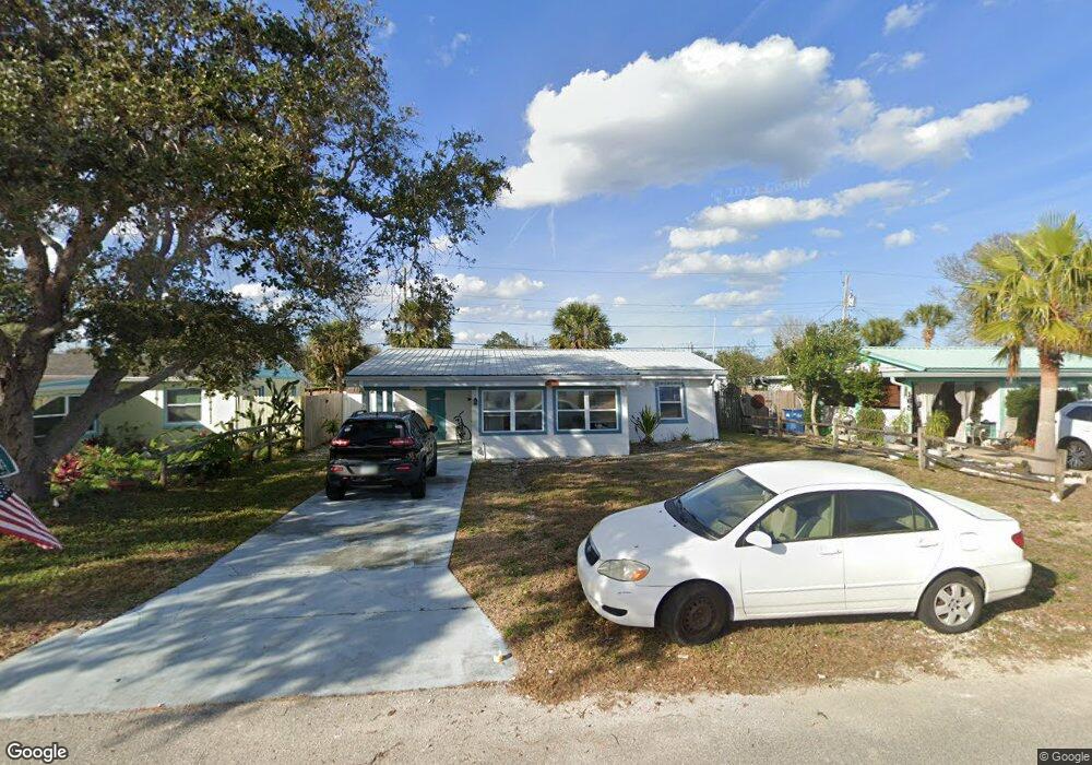
167 Laurie Dr Unit R Ormond Beach, FL 32176
Estimated Value: $285,524 - $305,000
2
Beds
1
Bath
974
Sq Ft
$303/Sq Ft
Est. Value
About This Home
This home is located at 167 Laurie Dr Unit R, Ormond Beach, FL 32176 and is currently estimated at $295,131, approximately $303 per square foot. 167 Laurie Dr Unit R is a home located in Volusia County with nearby schools including Ormond Beach Middle School, Seabreeze High School, and St Brendan Catholic School.
Ownership History
Date
Name
Owned For
Owner Type
Purchase Details
Closed on
Apr 19, 2024
Sold by
Mendoza Liza and Salter Liza
Bought by
Fenerty Kyle Ty
Current Estimated Value
Home Financials for this Owner
Home Financials are based on the most recent Mortgage that was taken out on this home.
Original Mortgage
$304,000
Outstanding Balance
$298,609
Interest Rate
6.88%
Mortgage Type
New Conventional
Estimated Equity
-$3,478
Purchase Details
Closed on
May 24, 2021
Sold by
Clapacs Jeffrey Daniel and Janiga Kyle
Bought by
Mendoza Liza
Home Financials for this Owner
Home Financials are based on the most recent Mortgage that was taken out on this home.
Original Mortgage
$286,711
Interest Rate
3%
Mortgage Type
FHA
Purchase Details
Closed on
Jul 31, 2019
Sold by
Morrow Walter and Morrow Mary Ellen
Bought by
Clapacs Jeffrey Daniel and Janiga Kyle
Home Financials for this Owner
Home Financials are based on the most recent Mortgage that was taken out on this home.
Original Mortgage
$186,900
Interest Rate
3.8%
Mortgage Type
New Conventional
Purchase Details
Closed on
Jun 29, 2017
Sold by
Tierney Pamela J and Thompson Marcia J Hall
Bought by
Morrow Walter and Morrow Mary Ellen
Purchase Details
Closed on
Apr 15, 1998
Sold by
Donald Stephen A and Donald Dana G
Bought by
Hall Kenneth E
Home Financials for this Owner
Home Financials are based on the most recent Mortgage that was taken out on this home.
Original Mortgage
$46,400
Interest Rate
7.14%
Purchase Details
Closed on
Feb 28, 1994
Sold by
Reed Wrex M
Bought by
Donald Stephen A and Donald Dana G
Home Financials for this Owner
Home Financials are based on the most recent Mortgage that was taken out on this home.
Original Mortgage
$45,000
Interest Rate
7.04%
Purchase Details
Closed on
Aug 15, 1980
Bought by
Hall Kenneth E
Purchase Details
Closed on
Nov 15, 1978
Bought by
Hall Kenneth E
Purchase Details
Closed on
Feb 15, 1971
Bought by
Hall Kenneth E
Create a Home Valuation Report for This Property
The Home Valuation Report is an in-depth analysis detailing your home's value as well as a comparison with similar homes in the area
Home Values in the Area
Average Home Value in this Area
Purchase History
| Date | Buyer | Sale Price | Title Company |
|---|---|---|---|
| Fenerty Kyle Ty | $320,000 | East Coast Title | |
| Fenerty Kyle Ty | $320,000 | East Coast Title | |
| Mendoza Liza | $292,000 | First American Title Ins Co | |
| Clapacs Jeffrey Daniel | $203,000 | Adams Cameron Title Svcs Inc | |
| Morrow Walter | $155,000 | Adams Cameron Title Services | |
| Hall Kenneth E | $58,900 | -- | |
| Donald Stephen A | $50,000 | -- | |
| Hall Kenneth E | $42,000 | -- | |
| Hall Kenneth E | $32,500 | -- | |
| Hall Kenneth E | $14,000 | -- |
Source: Public Records
Mortgage History
| Date | Status | Borrower | Loan Amount |
|---|---|---|---|
| Open | Fenerty Kyle Ty | $304,000 | |
| Closed | Fenerty Kyle Ty | $304,000 | |
| Previous Owner | Mendoza Liza | $286,711 | |
| Previous Owner | Clapacs Jeffrey Daniel | $186,900 | |
| Previous Owner | Hall Kenneth E | $46,400 | |
| Previous Owner | Donald Stephen A | $45,000 |
Source: Public Records
Tax History
| Year | Tax Paid | Tax Assessment Tax Assessment Total Assessment is a certain percentage of the fair market value that is determined by local assessors to be the total taxable value of land and additions on the property. | Land | Improvement |
|---|---|---|---|---|
| 2026 | $5,031 | $269,729 | $100,375 | $169,354 |
| 2025 | $5,031 | $267,015 | $100,375 | $166,640 |
| 2024 | $5,222 | $287,100 | $100,375 | $186,725 |
| 2023 | $5,222 | $285,012 | $92,950 | $192,062 |
| 2022 | $4,754 | $241,238 | $74,250 | $166,988 |
| 2021 | $1,918 | $122,979 | $0 | $0 |
| 2020 | $1,882 | $121,281 | $0 | $0 |
| 2019 | $3,078 | $137,822 | $49,500 | $88,322 |
| 2018 | $2,991 | $132,043 | $43,450 | $88,593 |
| 2017 | $2,763 | $118,172 | $42,350 | $75,822 |
| 2016 | $958 | $70,457 | $0 | $0 |
| 2015 | $980 | $69,967 | $0 | $0 |
| 2014 | $968 | $69,412 | $0 | $0 |
Source: Public Records
Map
Nearby Homes
- 56 Margaret Rd
- 59 Margaret Rd
- 4310 John Anderson Dr
- 55 Seaside Dr
- 20 Concord Dr
- 36 River Shore Dr
- 29 Ocean Shore Dr
- 37 Seaside Dr
- 31 River Shore Dr
- 4 Ocean Shore Dr
- 51 Rivocean Dr
- 30 Azalea Dr
- 1575 Ocean Shore Blvd Unit 304
- 1575 Ocean Shore Blvd Unit 603
- 1575 Ocean Shore Blvd Unit J010
- 1575 Ocean Shore Blvd Unit 901
- 1510 Ocean Shore Blvd Unit 3150
- 1510 Ocean Shore Blvd Unit 4140
- 1510 Ocean Shore Blvd Unit 4150
- 1510 Ocean Shore Blvd Unit 406
Your Personal Tour Guide
Ask me questions while you tour the home.