Estimated Value: $179,198 - $267,000
--
Bed
2
Baths
1,488
Sq Ft
$147/Sq Ft
Est. Value
About This Home
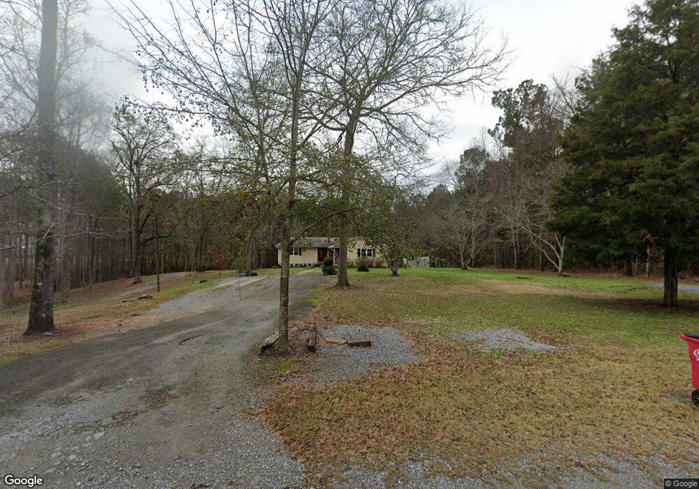
This home is located at 167 Liberty Ridge Dr, Gray, GA 31032 and is currently estimated at $218,800, approximately $147 per square foot. 167 Liberty Ridge Dr is a home located in Jones County with nearby schools including Dames Ferry Elementary School, Gray Station Middle School, and Jones County High School.
Ownership History
Date
Name
Owned For
Owner Type
Purchase Details
Closed on
Sep 28, 2006
Sold by
Not Provided
Bought by
Murray Mary M and Murray William R
Current Estimated Value
Home Financials for this Owner
Home Financials are based on the most recent Mortgage that was taken out on this home.
Original Mortgage
$130,000
Outstanding Balance
$77,144
Interest Rate
6.36%
Mortgage Type
New Conventional
Estimated Equity
$141,656
Purchase Details
Closed on
Jul 29, 2005
Sold by
Hampton Sue Ella
Bought by
Boulineau Michael R
Home Financials for this Owner
Home Financials are based on the most recent Mortgage that was taken out on this home.
Original Mortgage
$119,400
Interest Rate
5.48%
Mortgage Type
New Conventional
Create a Home Valuation Report for This Property
The Home Valuation Report is an in-depth analysis detailing your home's value as well as a comparison with similar homes in the area
Home Values in the Area
Average Home Value in this Area
Purchase History
| Date | Buyer | Sale Price | Title Company |
|---|---|---|---|
| Murray Mary M | $130,000 | -- | |
| Boulineau Michael R | $119,400 | -- |
Source: Public Records
Mortgage History
| Date | Status | Borrower | Loan Amount |
|---|---|---|---|
| Open | Murray Mary M | $130,000 | |
| Previous Owner | Boulineau Michael R | $119,400 |
Source: Public Records
Tax History Compared to Growth
Tax History
| Year | Tax Paid | Tax Assessment Tax Assessment Total Assessment is a certain percentage of the fair market value that is determined by local assessors to be the total taxable value of land and additions on the property. | Land | Improvement |
|---|---|---|---|---|
| 2023 | $1,437 | $39,999 | $6,644 | $33,355 |
| 2022 | $1,287 | $39,534 | $6,179 | $33,355 |
| 2021 | $1,212 | $37,415 | $6,179 | $31,236 |
| 2020 | $1,213 | $37,415 | $6,179 | $31,236 |
| 2019 | $1,123 | $34,919 | $3,683 | $31,236 |
| 2018 | $1,123 | $34,919 | $3,683 | $31,236 |
| 2017 | $1,071 | $33,473 | $3,683 | $29,790 |
| 2016 | $1,071 | $33,473 | $3,683 | $29,790 |
| 2015 | $1,010 | $33,473 | $3,683 | $29,790 |
| 2014 | $936 | $33,473 | $3,683 | $29,790 |
Source: Public Records
Map
Nearby Homes
- 0 Sandra Dr Unit M179018
- 0 Sandra Dr Unit 52382
- 0 Sandra Dr Unit 10487926
- 0 Sandra Dr Unit 252106
- 139 Jackson Ave
- LOT 1 C Georgia 18
- 236 Old Clinton Rd
- 177 Patton Rd
- 0 Clinton Crossing Unit 10637924
- 266 Clinton Crossing Dr
- 146 Lite N Tie Rd
- 1023 Boulder Dr Unit LOT 65
- 1023 Boulder Dr
- Bedford Plan at Stone Brooke
- Auburn Plan at Stone Brooke
- Franklin Plan at Stone Brooke
- Peachwood Plan at Stone Brooke
- Woodbury Plan at Stone Brooke
- 0 Clinton Crossing Dr Unit M181966
- 254 Crestview Trace
- 163 Liberty Ridge Dr
- 168 Liberty Ridge Dr
- 156 Liberty Ridge Dr
- 147 Liberty Ridge Dr
- 425 Comer Rd
- 423 Comer Rd
- 501 Greene Settlement Rd
- 489 Greene Settlement Rd
- 119 Carl Williams Sr Rd
- 517 Greene Settlement Rd
- 531 Greene Settlement Rd
- 493 Greene Settlement Rd
- 429 Comer Rd
- 557 Greene Settlement Rd
- 000 Old Eatonton Rd
- 178 Hitchcock
- 0 Turkey Trot Ln Unit 125758
- - Turkey Trot Ln
- 0 Comer Rd Unit 7092581
- 482 Greene Settlement Rd