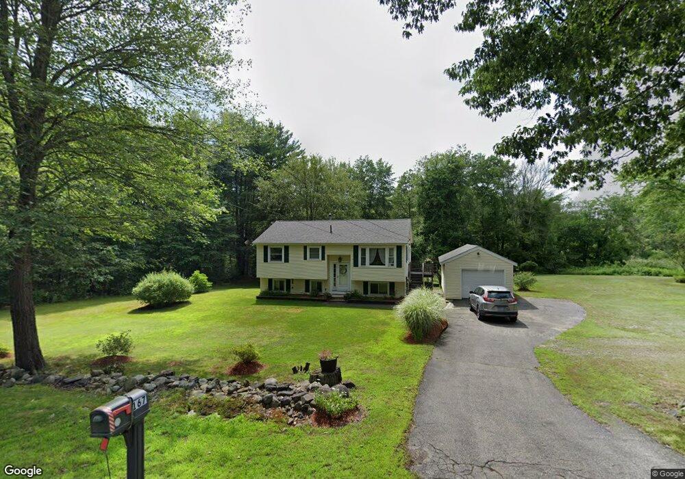
167 Mammoth Rd Londonderry, NH 03053
Estimated Value: $434,000 - $501,000
2
Beds
1
Bath
924
Sq Ft
$499/Sq Ft
Est. Value
About This Home
This home is located at 167 Mammoth Rd, Londonderry, NH 03053 and is currently estimated at $460,923, approximately $498 per square foot. 167 Mammoth Rd is a home with nearby schools including Matthew Thornton Elementary School, Londonderry Middle School, and Londonderry Senior High School.
Ownership History
Date
Name
Owned For
Owner Type
Purchase Details
Closed on
Apr 1, 2016
Sold by
Trow Alison M
Bought by
Arnold Donna M
Current Estimated Value
Purchase Details
Closed on
Dec 27, 2012
Sold by
Gorsch Michael F
Bought by
Trow Alison M
Home Financials for this Owner
Home Financials are based on the most recent Mortgage that was taken out on this home.
Original Mortgage
$102,000
Interest Rate
3.38%
Mortgage Type
Purchase Money Mortgage
Create a Home Valuation Report for This Property
The Home Valuation Report is an in-depth analysis detailing your home's value as well as a comparison with similar homes in the area
Home Values in the Area
Average Home Value in this Area
Purchase History
| Date | Buyer | Sale Price | Title Company |
|---|---|---|---|
| Arnold Donna M | $170,000 | -- | |
| Trow Alison M | -- | -- |
Source: Public Records
Mortgage History
| Date | Status | Borrower | Loan Amount |
|---|---|---|---|
| Previous Owner | Trow Alison M | $102,000 |
Source: Public Records
Tax History Compared to Growth
Tax History
| Year | Tax Paid | Tax Assessment Tax Assessment Total Assessment is a certain percentage of the fair market value that is determined by local assessors to be the total taxable value of land and additions on the property. | Land | Improvement |
|---|---|---|---|---|
| 2024 | $6,232 | $386,100 | $199,900 | $186,200 |
| 2023 | $6,042 | $386,100 | $199,900 | $186,200 |
| 2022 | $5,963 | $322,700 | $149,800 | $172,900 |
| 2021 | $5,931 | $322,700 | $149,800 | $172,900 |
| 2020 | $5,184 | $257,800 | $117,200 | $140,600 |
| 2019 | $4,999 | $257,800 | $117,200 | $140,600 |
| 2018 | $4,678 | $214,600 | $95,800 | $118,800 |
| 2017 | $4,638 | $214,600 | $95,800 | $118,800 |
| 2016 | $4,614 | $214,600 | $95,800 | $118,800 |
| 2015 | $4,511 | $214,600 | $95,800 | $118,800 |
| 2014 | $4,526 | $214,600 | $95,800 | $118,800 |
| 2011 | -- | $219,400 | $95,800 | $123,600 |
Source: Public Records
Map
Nearby Homes
- 74 Boulder Dr Unit 74
- 14 Mohawk Dr
- 1 Lily Ln
- 19 Lily Ln
- 17 Lily Ln
- 5 Elise Ave Unit Lot 94
- 14 Reed St
- 11 Midridge Cir Unit 116
- 27 Midridge Cir
- 31 Midridge Cir
- 34 Pleasant Dr
- 171 Londonderry Rd
- 111 Winterwood Dr
- 7 Oakwood St
- 12 Morrison Dr
- 149 Londonderry Rd
- 95 Bayberry Ln
- 47 Winding Pond Rd
- 69 Bayberry Ln
- 214 Winding Pond Rd
- 169 Mammoth Rd
- 164 Mammoth Rd
- 162 Mammoth Rd
- 160 Mammoth Rd
- 166 Mammoth Rd
- 163 Mammoth Rd
- 10 Kendall Pond Rd
- 158 Mammoth Rd
- 168 Mammoth Rd
- 12 Kendall Pond Rd
- 16 Kendall Pond Rd
- 52 Boulder Dr Unit 7
- 52 Boulder Dr Unit 52
- 13A Kendall Pond Rd
- 13 Kendall Pond Rd
- 13 Kendall Pond Rd Unit B
- 2 Boulder Dr
- 53 Boulder Dr
- 54 Boulder Dr Unit 54
- 54 Boulder Dr