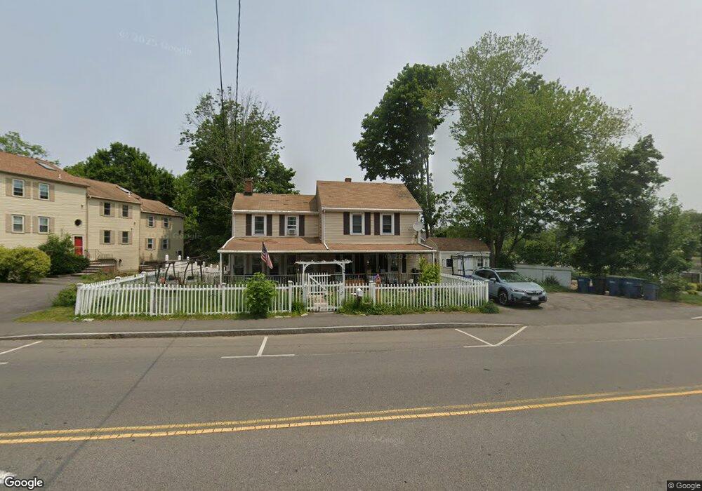
167 Neponset St Canton, MA 02021
Estimated Value: $699,000 - $774,000
4
Beds
3
Baths
1,618
Sq Ft
$452/Sq Ft
Est. Value
About This Home
This home is located at 167 Neponset St, Canton, MA 02021 and is currently estimated at $731,075, approximately $451 per square foot. 167 Neponset St is a home located in Norfolk County with nearby schools including Canton High School, St. John the Evangelist School, and Chabad Day School of School.
Ownership History
Date
Name
Owned For
Owner Type
Purchase Details
Closed on
Jun 10, 1988
Sold by
Mcelroy Douglas E
Bought by
Sturgis Edward F
Current Estimated Value
Home Financials for this Owner
Home Financials are based on the most recent Mortgage that was taken out on this home.
Original Mortgage
$137,000
Interest Rate
10.21%
Mortgage Type
Purchase Money Mortgage
Create a Home Valuation Report for This Property
The Home Valuation Report is an in-depth analysis detailing your home's value as well as a comparison with similar homes in the area
Home Values in the Area
Average Home Value in this Area
Purchase History
| Date | Buyer | Sale Price | Title Company |
|---|---|---|---|
| Sturgis Edward F | $163,900 | -- |
Source: Public Records
Mortgage History
| Date | Status | Borrower | Loan Amount |
|---|---|---|---|
| Closed | Sturgis Edward F | $137,000 | |
| Previous Owner | Sturgis Edward F | $68,000 |
Source: Public Records
Tax History Compared to Growth
Tax History
| Year | Tax Paid | Tax Assessment Tax Assessment Total Assessment is a certain percentage of the fair market value that is determined by local assessors to be the total taxable value of land and additions on the property. | Land | Improvement |
|---|---|---|---|---|
| 2025 | $6,488 | $656,000 | $262,500 | $393,500 |
| 2024 | $6,292 | $631,100 | $252,500 | $378,600 |
| 2023 | $6,072 | $574,500 | $252,500 | $322,000 |
| 2022 | $5,851 | $515,500 | $240,400 | $275,100 |
| 2021 | $5,701 | $467,300 | $218,600 | $248,700 |
| 2020 | $5,447 | $445,400 | $208,200 | $237,200 |
| 2019 | $5,268 | $424,800 | $178,700 | $246,100 |
| 2018 | $4,952 | $398,700 | $161,700 | $237,000 |
| 2017 | $5,005 | $391,300 | $158,600 | $232,700 |
| 2016 | $4,920 | $384,700 | $154,700 | $230,000 |
| 2015 | $4,764 | $371,600 | $150,200 | $221,400 |
Source: Public Records
Map
Nearby Homes
- 83 Neponset St Unit 83
- 1 Revolution Way Unit 208
- 59 Walpole St Unit 116
- 30 Coppersmith Way Unit 209
- 30 Coppersmith Way Unit 409
- 30 Coppersmith Way Unit 301
- 30 Coppersmith Way Unit 112
- 30 Coppersmith Way Unit 109
- 30 Coppersmith Way Unit 206
- 30 Coppersmith Way Unit 110
- 30 Coppersmith Way Unit 113
- 30 Coppersmith Way Unit 104
- 30 Coppersmith Way Unit 213
- 30 Coppersmith Way Unit 103
- 30 Coppersmith Way Unit 407
- 30 Coppersmith Way Unit 311
- 30 Coppersmith Way Unit 201
- 30 Coppersmith Way Unit 107
- 30 Coppersmith Way Unit 204
- 30 Coppersmith Way Unit 111
- 177 Neponset St Unit 3
- 177 Neponset St Unit 2
- 177 Neponset St Unit 1
- 192 Neponset St Unit 1
- 192 Neponset St Unit 192
- 192 Neponset St
- 176 Neponset St
- 170 Neponset St Unit 172
- 170 Neponset St Unit 1
- 180 Neponset St
- 193 Neponset St
- 184 Neponset St
- 184 Neponset St Unit Rear
- 184 Neponset St Unit 2
- 184 Neponset St Unit R
- 190 Neponset St
- 190 Neponset St Unit 2
- 190 Neponset St Unit 1
- 158 Neponset St Unit 13
- 158 Neponset St Unit 12