Estimated Value: $480,036 - $789,000
--
Bed
--
Bath
1,808
Sq Ft
$349/Sq Ft
Est. Value
About This Home
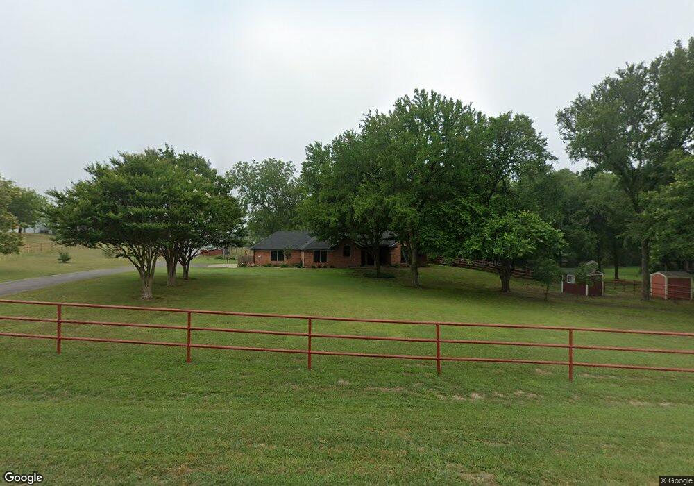
This home is located at 167 Red Baron Ct, Rhome, TX 76078 and is currently estimated at $630,759, approximately $348 per square foot. 167 Red Baron Ct is a home located in Wise County with nearby schools including Decatur High School.
Ownership History
Date
Name
Owned For
Owner Type
Purchase Details
Closed on
Jun 13, 2022
Sold by
Porter Charles D
Bought by
Porter Cheryl G
Current Estimated Value
Purchase Details
Closed on
Apr 22, 1999
Sold by
Chisum Kenneth and Chisum Connie
Bought by
Porter Charles D and Porter Cherlyn G
Purchase Details
Closed on
May 30, 1995
Bought by
Porter Charles D and Porter Cherlyn G
Purchase Details
Closed on
Jun 1, 1994
Bought by
Porter Charles D and Porter Cherlyn G
Purchase Details
Closed on
Jan 1, 1901
Bought by
Porter Charles D and Porter Cherlyn G
Create a Home Valuation Report for This Property
The Home Valuation Report is an in-depth analysis detailing your home's value as well as a comparison with similar homes in the area
Home Values in the Area
Average Home Value in this Area
Purchase History
| Date | Buyer | Sale Price | Title Company |
|---|---|---|---|
| Porter Cheryl G | -- | None Listed On Document | |
| Porter Charles D | -- | -- | |
| Porter Charles D | -- | -- | |
| Porter Charles D | -- | -- | |
| Porter Charles D | -- | -- |
Source: Public Records
Tax History Compared to Growth
Tax History
| Year | Tax Paid | Tax Assessment Tax Assessment Total Assessment is a certain percentage of the fair market value that is determined by local assessors to be the total taxable value of land and additions on the property. | Land | Improvement |
|---|---|---|---|---|
| 2025 | $847 | $533,969 | -- | -- |
| 2024 | $847 | $485,426 | $0 | $0 |
| 2023 | $5,331 | $441,296 | $0 | $0 |
| 2022 | $6,156 | $401,178 | $0 | $0 |
| 2021 | $5,847 | $395,230 | $130,640 | $264,590 |
| 2020 | $5,349 | $359,220 | $107,530 | $251,690 |
| 2019 | $5,179 | $324,320 | $97,420 | $226,900 |
| 2018 | $4,864 | $294,880 | $77,770 | $217,110 |
| 2017 | $4,422 | $249,100 | $46,730 | $202,370 |
| 2016 | $3,934 | $241,230 | $46,730 | $194,500 |
| 2015 | -- | $215,120 | $38,970 | $176,150 |
| 2014 | -- | $207,610 | $38,380 | $169,230 |
Source: Public Records
Map
Nearby Homes
- 0 May Reed Dr
- 140 Dr
- TBD Joseph Dr
- 279 Private Road 4418
- 172 Roark Dr
- 156 Tilley Ln
- 126 Tilly Ln
- 172 Billy Jo Ln
- 175 Private Road 4420
- TBD Lot 1-3 Private Road 4219
- 0000 Private Road 4219
- 112 Sunset Mesa Dr
- 308 Coyote Trail
- 276 Coyote Trail
- 220 Coyote Trail
- 146 Ridge Trail
- 164 Ranya Loop
- 173 Prairie Trail
- 279 Ridge Trail
- 130 Longbranch Dr
- 203 Red Baron Ct
- 145 Red Baron Ct
- 212 Red Baron Ct
- 164 Red Baron Ct
- 1406 Heritage Creek Dr
- 130 Red Baron Ct
- 1376 Heritage Creek Dr
- 215 Red Baron Dr
- 1394 Heritage Creek Dr
- 236 Red Baron Dr
- 315 Red Baron Dr
- 1368 Heritage Creek Dr
- 161 Red Baron Dr
- 296 Red Baron Dr
- 218 Red Baron Dr
- 298 Red Baron Dr
- 321 Red Baron Dr
- 1371 Heritage Creek Dr
- 1395 Heritage Creek Dr
- 312 Red Baron Dr