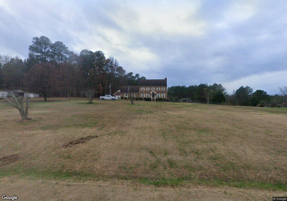
167 Sam Horton Rd Louisburg, NC 27549
Estimated Value: $447,317 - $575,000
4
Beds
3
Baths
2,407
Sq Ft
$208/Sq Ft
Est. Value
About This Home
This home is located at 167 Sam Horton Rd, Louisburg, NC 27549 and is currently estimated at $500,829, approximately $208 per square foot. 167 Sam Horton Rd is a home located in Franklin County with nearby schools including Louisburg Elementary School, Bunn Middle School, and Bunn High School.
Ownership History
Date
Name
Owned For
Owner Type
Purchase Details
Closed on
Oct 6, 2016
Sold by
Franklin Edward Boate
Bought by
Steven Michael and Brazie Tammy
Current Estimated Value
Home Financials for this Owner
Home Financials are based on the most recent Mortgage that was taken out on this home.
Original Mortgage
$20,000
Outstanding Balance
$15,927
Interest Rate
3.42%
Estimated Equity
$484,902
Purchase Details
Closed on
Jun 18, 2007
Sold by
Niedomanski Kenneth B and Tharp Jessica
Bought by
Brazie Michael Steven and Brazie Tammy L
Home Financials for this Owner
Home Financials are based on the most recent Mortgage that was taken out on this home.
Original Mortgage
$193,600
Interest Rate
6.12%
Mortgage Type
Adjustable Rate Mortgage/ARM
Purchase Details
Closed on
Apr 17, 2002
Bought by
Niedomanski Kenneth B
Create a Home Valuation Report for This Property
The Home Valuation Report is an in-depth analysis detailing your home's value as well as a comparison with similar homes in the area
Home Values in the Area
Average Home Value in this Area
Purchase History
| Date | Buyer | Sale Price | Title Company |
|---|---|---|---|
| Steven Michael | -- | -- | |
| Brazie Michael Steven | $242,000 | None Available | |
| Niedomanski Kenneth B | $223,500 | -- |
Source: Public Records
Mortgage History
| Date | Status | Borrower | Loan Amount |
|---|---|---|---|
| Open | Steven Michael | $20,000 | |
| Closed | Steven Michael | -- | |
| Previous Owner | Brazie Michael Steven | $193,600 |
Source: Public Records
Tax History Compared to Growth
Tax History
| Year | Tax Paid | Tax Assessment Tax Assessment Total Assessment is a certain percentage of the fair market value that is determined by local assessors to be the total taxable value of land and additions on the property. | Land | Improvement |
|---|---|---|---|---|
| 2025 | $2,545 | $427,210 | $70,190 | $357,020 |
| 2024 | $2,502 | $427,210 | $70,190 | $357,020 |
| 2023 | $2,521 | $280,330 | $35,820 | $244,510 |
| 2022 | $2,511 | $280,330 | $35,820 | $244,510 |
| 2021 | $2,539 | $280,330 | $35,820 | $244,510 |
| 2020 | $2,555 | $280,330 | $35,820 | $244,510 |
| 2019 | $2,519 | $280,330 | $35,820 | $244,510 |
| 2018 | $2,519 | $280,330 | $35,820 | $244,510 |
| 2017 | $2,404 | $242,710 | $31,150 | $211,560 |
| 2016 | $2,489 | $242,710 | $31,150 | $211,560 |
| 2015 | $2,489 | $242,710 | $31,150 | $211,560 |
| 2014 | $2,336 | $242,710 | $31,150 | $211,560 |
Source: Public Records
Map
Nearby Homes
- 70 Rough Ln
- 45 Horsecreek Rd
- Lot 3 Rembert Run Ct
- Lot 1 Rembert Run Ct
- Lot 5 Rembert Run Ct
- 10 Wilders Ln
- 25 Rembert Run Ct
- 563 Arnold Rd
- 35 Cotton Dr
- 60 Harley Ct
- 444 Barnette Rd
- 4009 Nc 39 Hwy S
- 180 Normandy Rd
- 7187 Pearces Rd
- 80 Shartree Farms Ln
- 7397 Pearces Rd
- 7030 Pearces Rd
- 3986 US 401 Hwy S
- 6964 Pearce Rd
- 100 Cedarwood Dr
- 161 Sam Horton Rd
- 221 Sam Horton Rd
- 148 Sam Horton Rd
- 133 Sam Horton Rd
- 223 Sam Horton Rd
- 279 Sam Horton Rd
- 124 Sam Horton Rd
- 564 Dick Baker Rd
- 101 Sam Horton Rd
- 486 Dick Baker Rd
- 38 Sam Horton Rd
- 707 Mc Wilder Rd
- 655 Mc Wilder Rd
- 655 Mc Wilder Rd
- 731 Mc Wilder Rd
- 639 Mc Wilder Rd
- 409 Sam Horton Rd
- 665 Mc Wilder Rd
- 675 Mc Wilder Rd
- 797 Mc Wilder Rd