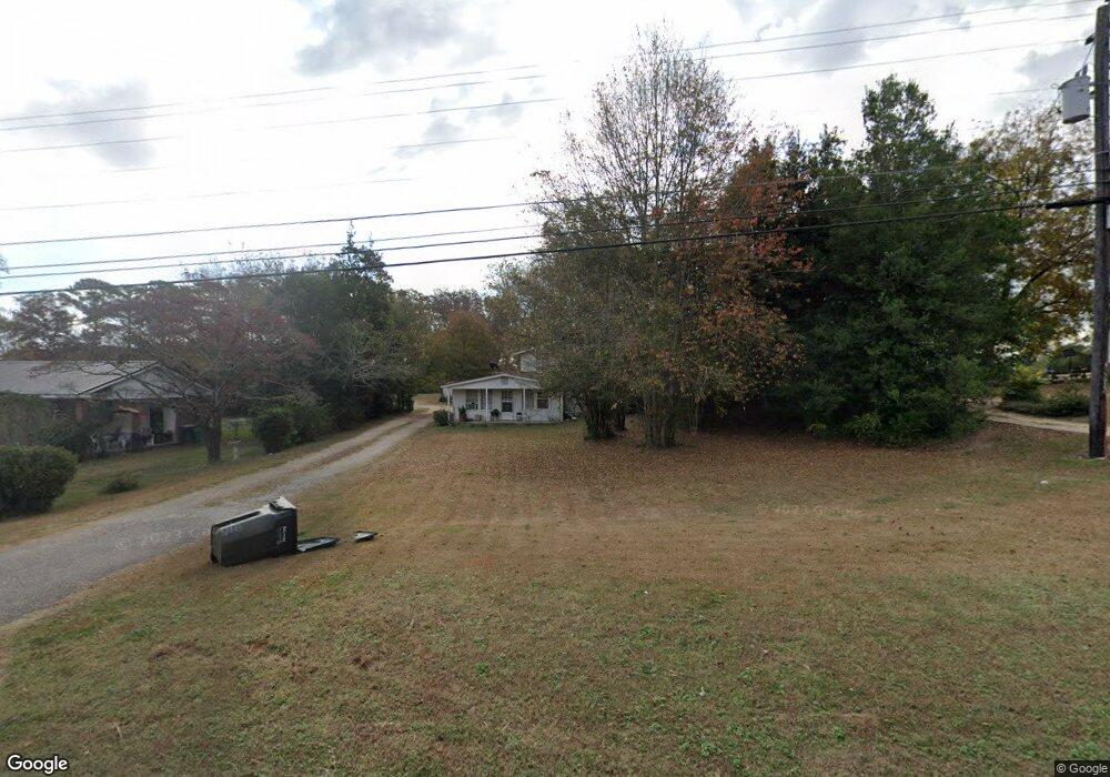
1671 E Broad St Greensboro, GA 30642
Estimated Value: $147,000 - $277,000
4
Beds
2
Baths
1,400
Sq Ft
$153/Sq Ft
Est. Value
About This Home
This home is located at 1671 E Broad St, Greensboro, GA 30642 and is currently estimated at $213,866, approximately $152 per square foot. 1671 E Broad St is a home located in Greene County with nearby schools including Greene County High School.
Ownership History
Date
Name
Owned For
Owner Type
Purchase Details
Closed on
Oct 29, 2015
Sold by
Sisson William S
Bought by
Billtown Llc
Current Estimated Value
Purchase Details
Closed on
Aug 25, 2010
Sold by
Boswell Ralph H
Bought by
Sisson William S
Home Financials for this Owner
Home Financials are based on the most recent Mortgage that was taken out on this home.
Original Mortgage
$44,000
Interest Rate
4.61%
Mortgage Type
Future Advance Clause Open End Mortgage
Purchase Details
Closed on
Jun 17, 2004
Sold by
Broman Marcia H and Broman Harper M
Bought by
Boswell Ralph H
Purchase Details
Closed on
Jun 16, 2004
Sold by
Harper Sarah Lee P
Bought by
Broman Marcia H and Broman Harper M
Purchase Details
Closed on
Jan 8, 1990
Sold by
Harper Woodrow
Bought by
Harper Sarah Lee P
Purchase Details
Closed on
Jan 1, 1946
Bought by
Harper Woodrow
Create a Home Valuation Report for This Property
The Home Valuation Report is an in-depth analysis detailing your home's value as well as a comparison with similar homes in the area
Home Values in the Area
Average Home Value in this Area
Purchase History
| Date | Buyer | Sale Price | Title Company |
|---|---|---|---|
| Billtown Llc | -- | -- | |
| Sisson William S | $43,000 | -- | |
| Boswell Ralph H | $55,000 | -- | |
| Broman Marcia H | -- | -- | |
| Harper Sarah Lee P | -- | -- | |
| Harper Woodrow | -- | -- |
Source: Public Records
Mortgage History
| Date | Status | Borrower | Loan Amount |
|---|---|---|---|
| Previous Owner | Sisson William S | $44,000 |
Source: Public Records
Tax History Compared to Growth
Tax History
| Year | Tax Paid | Tax Assessment Tax Assessment Total Assessment is a certain percentage of the fair market value that is determined by local assessors to be the total taxable value of land and additions on the property. | Land | Improvement |
|---|---|---|---|---|
| 2024 | $838 | $28,880 | $8,635 | $20,245 |
| 2023 | $628 | $30,400 | $9,520 | $20,880 |
| 2022 | $592 | $24,400 | $5,600 | $18,800 |
| 2021 | $577 | $22,440 | $5,600 | $16,840 |
| 2020 | $490 | $16,160 | $7,480 | $8,680 |
| 2019 | $504 | $16,160 | $7,480 | $8,680 |
| 2018 | $482 | $16,160 | $7,480 | $8,680 |
| 2017 | $460 | $16,170 | $7,480 | $8,690 |
| 2016 | $466 | $16,506 | $7,480 | $9,026 |
| 2015 | $434 | $16,506 | $7,480 | $9,026 |
| 2014 | $450 | $16,890 | $7,480 | $9,410 |
Source: Public Records
Map
Nearby Homes
- 1531 E Broad St
- LOT 1 Penfield
- 0 Railroad St Unit 218854
- 0 Railroad St Unit 10578007
- 0 Railroad St Unit 531919
- 1131 Planing Mill Rd
- 1141 Planing Mill Rd
- 1020 Horton Dr
- 1060 Twin Pines Cir
- 301 N East St
- 504 Martin Luther King Junior Dr
- 15 South St Unit Siloam Road
- 0 Canaan St
- 109 Reynolds Dr
- 314 W South St
- 105 Wilson St
- 805 S West St
- 0 Maple Cir
- 1141 Armour Cir
- 1311 Lighthouse Cir
- 1681 E Broad St
- 1661 E Broad St
- 1691 E Broad St
- 0 E Broad St Unit 7597228
- 0 E Broad St
- 1670 E Broad St
- 1660 E Broad St
- 1641 E Broad St
- 1711 E Broad St
- 1621 E Broad St
- 1720 E Broad St
- 1721 E Broad St
- 1630 E Broad St
- 1011 Webb Ln
- 1070 Webb Ln
- 1040 Webb Ln
- 1610 E Broad St
- 1301 Webb Lake Dr
- 1740 E Broad St
- 1070 Heritage Dr