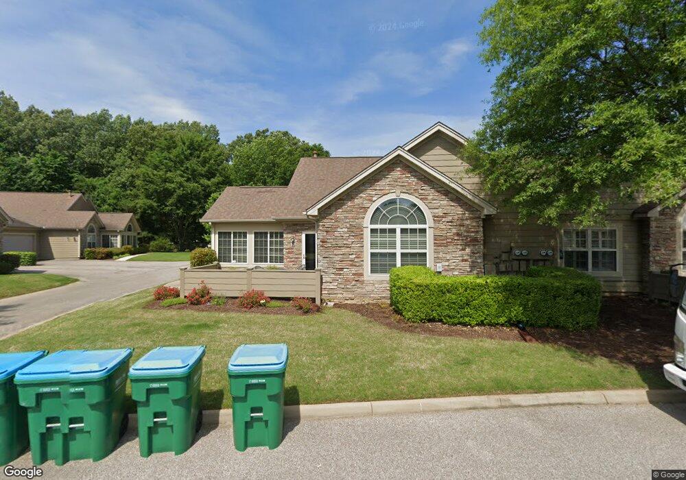
1671 W Southfield Cir Unit 25 Cordova, TN 38016
Cordova NeighborhoodEstimated Value: $248,318 - $277,000
2
Beds
2
Baths
1,605
Sq Ft
$165/Sq Ft
Est. Value
About This Home
This home is located at 1671 W Southfield Cir Unit 25, Cordova, TN 38016 and is currently estimated at $265,330, approximately $165 per square foot. 1671 W Southfield Cir Unit 25 is a home located in Shelby County with nearby schools including Riverwood Elementary School, Cordova High School, and Cordova Middle School.
Ownership History
Date
Name
Owned For
Owner Type
Purchase Details
Closed on
Oct 14, 2016
Sold by
Chapell Elizabertth M
Bought by
Nestler Sandra
Current Estimated Value
Home Financials for this Owner
Home Financials are based on the most recent Mortgage that was taken out on this home.
Original Mortgage
$60,000
Outstanding Balance
$38,259
Interest Rate
3.46%
Mortgage Type
New Conventional
Estimated Equity
$227,071
Purchase Details
Closed on
Oct 24, 2014
Sold by
Chapell Elizabeth M
Bought by
Chapell Elizabeth M and Elizabeth M Chapell Living Trust
Purchase Details
Closed on
Jan 10, 2014
Sold by
Jones Maudie
Bought by
Chapell Wayman G and Chapell Elizabeth M
Purchase Details
Closed on
May 16, 2008
Sold by
Jones Thomas N
Bought by
Jones Maudie
Purchase Details
Closed on
Oct 9, 2007
Sold by
Kemmons Wilson Inc
Bought by
Jones Robert and Jones Maudie
Create a Home Valuation Report for This Property
The Home Valuation Report is an in-depth analysis detailing your home's value as well as a comparison with similar homes in the area
Home Values in the Area
Average Home Value in this Area
Purchase History
| Date | Buyer | Sale Price | Title Company |
|---|---|---|---|
| Nestler Sandra | $145,000 | Regency Title & Escrow Llc | |
| Chapell Elizabeth M | -- | None Available | |
| Chapell Wayman G | $136,000 | Realty Title & Escrow Co Inc | |
| Jones Maudie | -- | None Available | |
| Jones Robert | $182,900 | None Available |
Source: Public Records
Mortgage History
| Date | Status | Borrower | Loan Amount |
|---|---|---|---|
| Open | Nestler Sandra | $60,000 |
Source: Public Records
Tax History Compared to Growth
Tax History
| Year | Tax Paid | Tax Assessment Tax Assessment Total Assessment is a certain percentage of the fair market value that is determined by local assessors to be the total taxable value of land and additions on the property. | Land | Improvement |
|---|---|---|---|---|
| 2025 | $1,297 | $66,900 | $5,075 | $61,825 |
| 2024 | $1,297 | $51,000 | $5,075 | $45,925 |
| 2023 | $3,107 | $51,000 | $5,075 | $45,925 |
| 2022 | $3,107 | $51,000 | $5,075 | $45,925 |
| 2021 | $3,143 | $51,000 | $5,075 | $45,925 |
| 2020 | $3,032 | $41,850 | $5,075 | $36,775 |
| 2019 | $3,032 | $41,850 | $5,075 | $36,775 |
| 2018 | $3,032 | $41,850 | $5,075 | $36,775 |
| 2017 | $1,720 | $41,850 | $5,075 | $36,775 |
| 2016 | $1,639 | $37,500 | $0 | $0 |
| 2014 | $1,639 | $37,500 | $0 | $0 |
Source: Public Records
Map
Nearby Homes
- 1655 W Southfield Cir Unit C
- 1618 E Southfield Cir
- 1593 Lacewing Trace Ln
- 7835 Teal Lake Cove
- 1811 Wood Oak Dr
- 1475 Killdeer Cove
- 7779 Killdeer Ln
- 1466 Fox Trace Dr
- 1648 Dexter Woods Dr
- 7695 Chapel Ridge Dr
- 1895 Wood Oak Dr
- 7730 Ivy Mist Cove W
- 1620 S Ryamar Cove
- 1655 S Ryamar Cove
- 1882 Pheasant Acre Ln E
- 2288 Germantown Dr
- 1888 Pheasant Acre Ln E
- 1905 Pheasant Acre Ln E
- 7598 Fairway Forest Dr N
- 1916 Pheasant Acre Ln E
- 1671 W Southfield Cir Unit A
- 1659 W Southfield Cir Unit C
- 1675 W Southfield Cir Unit 22
- 1675 W Southfield Cir Unit C
- 1663 W Southfield Cir Unit 25
- 1663 W Southfield Cir Unit A
- 1679 W Southfield Cir Unit 21
- 1679 W Southfield Cir Unit A
- 1651 W Southfield Cir Unit 28
- 1687 W Southfield Cir Unit 19
- 1687 W Southfield Cir Unit CH
- 1655 W Southfield Cir Unit 27
- 1668 W Southfield Cir
- 1683 W Southfield Cir Unit 20
- 1683 W Southfield Cir Unit V
- 1691 W Southfield Cir Unit V
- 1643 W Southfield Cir
- 1643 W Southfield Cir Unit 34
- 1647 W Southfield Cir
- 1647 W Southfield Cir Unit 33