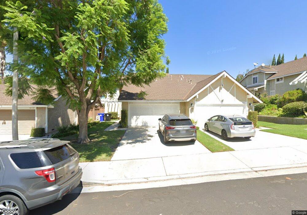
16713 Minter Ct Canyon Country, CA 91387
Estimated Value: $637,000 - $682,466
3
Beds
3
Baths
1,693
Sq Ft
$390/Sq Ft
Est. Value
About This Home
This home is located at 16713 Minter Ct, Canyon Country, CA 91387 and is currently estimated at $660,117, approximately $389 per square foot. 16713 Minter Ct is a home located in Los Angeles County with nearby schools including Mitchell Community Elementary School, Sierra Vista Junior High School, and Canyon High School.
Ownership History
Date
Name
Owned For
Owner Type
Purchase Details
Closed on
Jul 29, 2020
Sold by
Strowbridge Raymond and Strowbridge Sabrina
Bought by
Strowbridge Raymond and Strowbridge Sabrina Rachelle
Current Estimated Value
Purchase Details
Closed on
Nov 3, 2015
Sold by
Strowbridge Raymond L
Bought by
The Strowbridge Family Trust
Home Financials for this Owner
Home Financials are based on the most recent Mortgage that was taken out on this home.
Original Mortgage
$262,000
Outstanding Balance
$206,216
Interest Rate
3.81%
Mortgage Type
New Conventional
Estimated Equity
$453,901
Purchase Details
Closed on
Nov 10, 2012
Sold by
Strowbridge Raymond
Bought by
Strowbridge Raymond and Strowbridge Sabrina
Purchase Details
Closed on
Apr 21, 2008
Sold by
Fridlund David
Bought by
Strowbridge Raymond and Strowbridge Sabrina
Home Financials for this Owner
Home Financials are based on the most recent Mortgage that was taken out on this home.
Original Mortgage
$287,752
Interest Rate
6%
Mortgage Type
FHA
Purchase Details
Closed on
Jun 2, 2005
Sold by
Beechey Thomas W
Bought by
Fridlund David and Fridlund Robynn
Home Financials for this Owner
Home Financials are based on the most recent Mortgage that was taken out on this home.
Original Mortgage
$334,080
Interest Rate
7.85%
Mortgage Type
Purchase Money Mortgage
Purchase Details
Closed on
Nov 29, 2004
Sold by
Baker Deborah Lee
Bought by
Beechey Thomas W and Baker Deborah Lee
Home Financials for this Owner
Home Financials are based on the most recent Mortgage that was taken out on this home.
Original Mortgage
$127,000
Interest Rate
5.25%
Mortgage Type
New Conventional
Purchase Details
Closed on
Jul 30, 1998
Sold by
Sulett Debra L
Bought by
Baker Deborah Lee
Home Financials for this Owner
Home Financials are based on the most recent Mortgage that was taken out on this home.
Original Mortgage
$135,000
Interest Rate
6.91%
Mortgage Type
Balloon
Purchase Details
Closed on
May 11, 1994
Sold by
Pool Keith B
Bought by
Sulett Debra L
Home Financials for this Owner
Home Financials are based on the most recent Mortgage that was taken out on this home.
Original Mortgage
$142,100
Interest Rate
5.5%
Create a Home Valuation Report for This Property
The Home Valuation Report is an in-depth analysis detailing your home's value as well as a comparison with similar homes in the area
Home Values in the Area
Average Home Value in this Area
Purchase History
| Date | Buyer | Sale Price | Title Company |
|---|---|---|---|
| Strowbridge Raymond | -- | Accommodation | |
| Strowbridge Raymond | -- | Equity Title Company | |
| The Strowbridge Family Trust | -- | Accommodation | |
| Strowbridge Raymond L | -- | Lawyers Title Sd | |
| Strowbridge Raymond | -- | None Available | |
| Strowbridge Raymond | $315,000 | Lawyers Title | |
| Fridlund David | $418,000 | First American Title Company | |
| Beechey Thomas W | -- | North American Title Company | |
| Baker Deborah Lee | $150,000 | Investors Title Company | |
| Sulett Debra L | $158,000 | Old Republic Title Company |
Source: Public Records
Mortgage History
| Date | Status | Borrower | Loan Amount |
|---|---|---|---|
| Open | Strowbridge Raymond L | $262,000 | |
| Previous Owner | Strowbridge Raymond | $287,752 | |
| Previous Owner | Fridlund David | $334,080 | |
| Previous Owner | Beechey Thomas W | $127,000 | |
| Previous Owner | Baker Deborah Lee | $135,000 | |
| Previous Owner | Sulett Debra L | $142,100 | |
| Closed | Fridlund David | $83,520 |
Source: Public Records
Tax History Compared to Growth
Tax History
| Year | Tax Paid | Tax Assessment Tax Assessment Total Assessment is a certain percentage of the fair market value that is determined by local assessors to be the total taxable value of land and additions on the property. | Land | Improvement |
|---|---|---|---|---|
| 2025 | $5,638 | $413,738 | $158,532 | $255,206 |
| 2024 | $5,638 | $405,626 | $155,424 | $250,202 |
| 2023 | $5,489 | $397,674 | $152,377 | $245,297 |
| 2022 | $5,394 | $389,878 | $149,390 | $240,488 |
| 2021 | $5,298 | $382,234 | $146,461 | $235,773 |
| 2019 | $5,085 | $370,899 | $142,118 | $228,781 |
| 2018 | $4,991 | $363,628 | $139,332 | $224,296 |
| 2016 | $4,695 | $349,510 | $133,922 | $215,588 |
| 2015 | $4,817 | $344,261 | $131,911 | $212,350 |
| 2014 | $4,744 | $337,519 | $129,328 | $208,191 |
Source: Public Records
Map
Nearby Homes
- 16606 Shinedale Dr
- 16610 Shinedale Dr
- 16804 La Veda Ave
- 28414 Winterdale Dr
- 28606 Solon Ave
- 16905 Shinedale Dr
- 28367 Sand Canyon Rd Unit 14
- 28309 Winterdale Dr
- 28816 Kenroy Ave
- 17004 Crest Heights Dr
- 28110 La Veda Ave
- 28111 Eagle Peak Ave
- 28521 Meadow Heights Ct
- 17025 Zion Dr
- 17028 Zion Dr
- 28001 Deep Creek Dr
- 17047 Zion Dr
- 17037 Provo Ln
- 28346 Linda Vista St
- 17038 Mitchell Dr
- 16711 Minter Ct
- 16719 Minter Ct Unit 106
- 16719 Minter Ct
- 16724 Highfalls St Unit 90
- 16703 Minter Ct
- 16721 Minter Ct Unit 105
- 16705 Minter Ct
- 28348 Connie Ct
- 16752 Highfalls St
- 16750 Highfalls St
- 16722 Highfalls St
- 16710 Highfalls St
- 16708 Highfalls St
- 16702 Highfalls St
- 28403 La Veda Ave
- 16723 Minter Ct
- 16718 Highfalls St
- 16716 Highfalls St
- 16725 Minter Ct
- 16714 Minter Ct