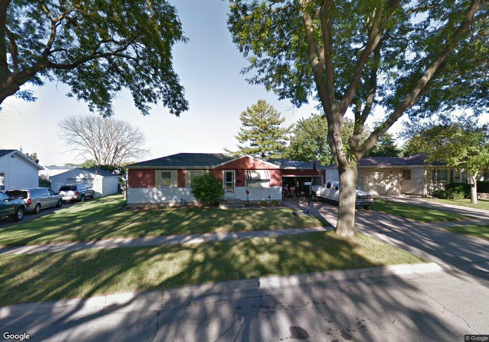
1672 Boland Rd Green Bay, WI 54303
Westside NeighborhoodEstimated Value: $231,099 - $266,000
--
Bed
--
Bath
--
Sq Ft
10,498
Sq Ft Lot
About This Home
This home is located at 1672 Boland Rd, Green Bay, WI 54303 and is currently estimated at $244,525. 1672 Boland Rd is a home located in Brown County with nearby schools including Keller Elementary School, Lombardi Middle School, and Southwest High School.
Ownership History
Date
Name
Owned For
Owner Type
Purchase Details
Closed on
Dec 23, 2003
Sold by
Duchateau Travis P and Duchateau Stephanie L
Bought by
Duchateau Travis P and Duchateau Stephanie L
Current Estimated Value
Home Financials for this Owner
Home Financials are based on the most recent Mortgage that was taken out on this home.
Original Mortgage
$99,000
Interest Rate
5.91%
Mortgage Type
New Conventional
Create a Home Valuation Report for This Property
The Home Valuation Report is an in-depth analysis detailing your home's value as well as a comparison with similar homes in the area
Home Values in the Area
Average Home Value in this Area
Purchase History
| Date | Buyer | Sale Price | Title Company |
|---|---|---|---|
| Duchateau Travis P | -- | -- |
Source: Public Records
Mortgage History
| Date | Status | Borrower | Loan Amount |
|---|---|---|---|
| Closed | Duchateau Travis P | $99,000 |
Source: Public Records
Tax History Compared to Growth
Tax History
| Year | Tax Paid | Tax Assessment Tax Assessment Total Assessment is a certain percentage of the fair market value that is determined by local assessors to be the total taxable value of land and additions on the property. | Land | Improvement |
|---|---|---|---|---|
| 2024 | $2,627 | $146,600 | $28,800 | $117,800 |
| 2023 | $2,484 | $146,600 | $28,800 | $117,800 |
| 2022 | $2,447 | $146,600 | $28,800 | $117,800 |
| 2021 | $2,671 | $120,100 | $26,000 | $94,100 |
| 2020 | $2,718 | $120,100 | $26,000 | $94,100 |
| 2019 | $2,624 | $120,100 | $26,000 | $94,100 |
| 2018 | $2,568 | $120,100 | $26,000 | $94,100 |
| 2017 | $2,548 | $120,100 | $26,000 | $94,100 |
| 2016 | $2,505 | $120,100 | $26,000 | $94,100 |
| 2015 | $2,611 | $120,100 | $26,000 | $94,100 |
| 2014 | $2,669 | $120,100 | $26,000 | $94,100 |
| 2013 | $2,669 | $120,100 | $26,000 | $94,100 |
Source: Public Records
Map
Nearby Homes
- 1773 Bond St
- 1825 Parkland Way
- 429 Manchester Dr
- 504 N Taylor St
- 1004 Moraine Way Unit 2
- 412 Saratoga St
- 120 Reinhard Ct
- 1687 Badger St
- 709 N Locust St
- 1767 Badger St
- 1013 N Locust St
- 819 N Platten St
- 820 N Platten St
- 1753 Western Ave
- 1751 Lenwood Ave
- 1034 N Platten St
- 710 Royal Blvd
- 717 Park St
- 418 S Fisk St
- 1037 Park St