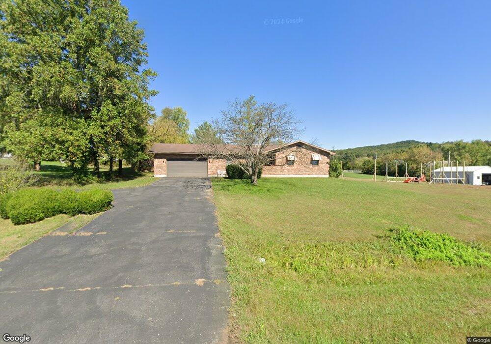
16720 State Route 125 West Union, OH 45693
Estimated Value: $195,000 - $496,473
3
Beds
2
Baths
787
Sq Ft
$439/Sq Ft
Est. Value
About This Home
This home is located at 16720 State Route 125, West Union, OH 45693 and is currently estimated at $345,737, approximately $439 per square foot. 16720 State Route 125 is a home located in Adams County with nearby schools including West Union Elementary School and West Union High School.
Ownership History
Date
Name
Owned For
Owner Type
Purchase Details
Closed on
Feb 21, 1992
Bought by
Allen Harold
Current Estimated Value
Create a Home Valuation Report for This Property
The Home Valuation Report is an in-depth analysis detailing your home's value as well as a comparison with similar homes in the area
Purchase History
| Date | Buyer | Sale Price | Title Company |
|---|---|---|---|
| Allen Harold | -- | -- |
Source: Public Records
Tax History
| Year | Tax Paid | Tax Assessment Tax Assessment Total Assessment is a certain percentage of the fair market value that is determined by local assessors to be the total taxable value of land and additions on the property. | Land | Improvement |
|---|---|---|---|---|
| 2025 | $3,042 | $143,820 | $62,580 | $81,240 |
| 2024 | $3,042 | $143,820 | $62,580 | $81,240 |
| 2023 | $3,038 | $143,820 | $62,580 | $81,240 |
| 2022 | $3,038 | $122,260 | $49,810 | $72,450 |
| 2021 | $3,032 | $122,260 | $49,810 | $72,450 |
| 2020 | $3,101 | $122,260 | $49,810 | $72,450 |
| 2019 | $3,101 | $122,260 | $49,810 | $72,450 |
| 2018 | $2,879 | $105,210 | $42,210 | $63,000 |
| 2017 | $2,832 | $105,210 | $42,210 | $63,000 |
| 2016 | $2,827 | $105,210 | $42,210 | $63,000 |
| 2015 | $2,834 | $100,880 | $38,050 | $62,830 |
| 2014 | $2,835 | $100,880 | $38,050 | $62,830 |
Source: Public Records
Map
Nearby Homes
- 500 Ernie Rd
- 1186 Tulip Rd
- 598 Ohio 348
- 1996 Randalls Run Rd
- 2603 Cassel Run Rd
- 1805 Waggoner Riffle Rd
- 117 L F Clock Dr
- 4702 Brush Creek Rd
- 4050 Poplar Ridge Rd
- 467 Waggoner Riffle Rd
- 0 Blue Creek Rd
- 2260 Germany Hill Rd
- 2030 Cedar Mills Rd
- 1478 Robinson Hollow Rd
- 526 Brush Creek Rd
- 9727 Ohio 125
- 16033 U S Route 52
- 353 Chestnut Ridge Rd
- 216 Kurt St
- 215 Chesley St
- 16720 State Route 125
- 16760 State Route 125
- 393 Lynx Dr
- 380 Lynx Dr
- 16725 State Route 125
- 16725 State Route 125
- 414 Lynx Dr
- 414 Lynx Dr
- 303 Lynx Dr
- 16655 State Route 125
- 445 Lynx Dr
- 440 Lynx Dr
- 16825 State Route 125
- 505 Lynx Dr
- 219 Lynx Dr
- 39.7ac Mahogany Rd
- 324 Lynx Dr
- 525 Lynx Dr
- 138 Shivener Rd
- 16890 State Route 125
Your Personal Tour Guide
Ask me questions while you tour the home.