Estimated Value: $187,000 - $226,767
3
Beds
2
Baths
1,539
Sq Ft
$133/Sq Ft
Est. Value
About This Home
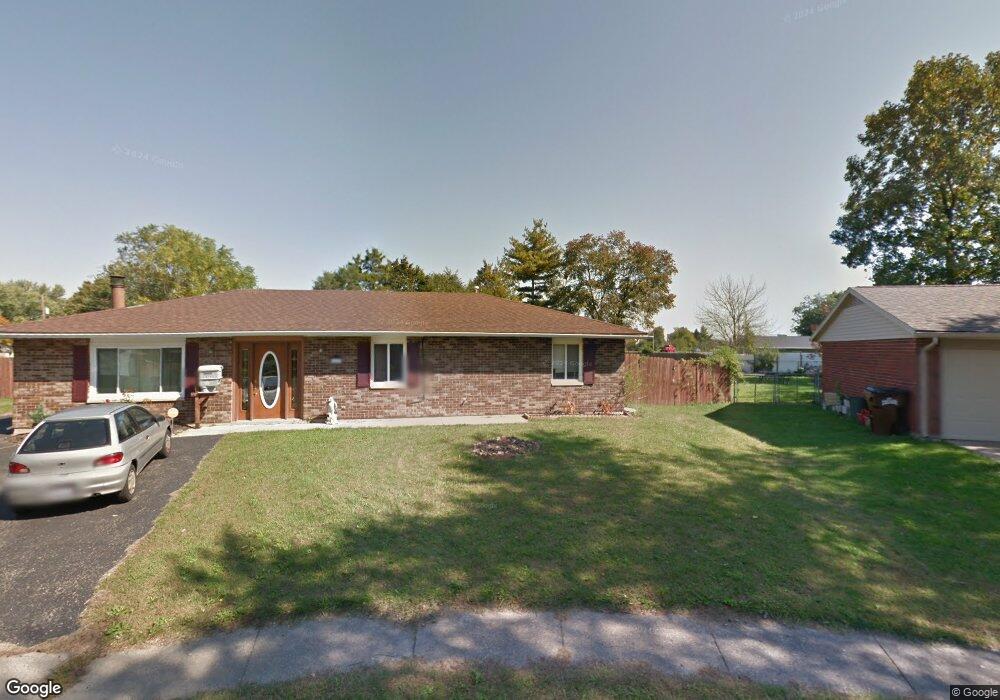
This home is located at 1673 Arizona Ct, Xenia, OH 45385 and is currently estimated at $204,442, approximately $132 per square foot. 1673 Arizona Ct is a home located in Greene County with nearby schools including Xenia High School and Summit Academy Community School for Alternative Learners - Xenia.
Ownership History
Date
Name
Owned For
Owner Type
Purchase Details
Closed on
Oct 8, 2020
Sold by
Henshaw Robin D and Henshaw Kristin
Bought by
Lendus Llc and Murphy
Current Estimated Value
Home Financials for this Owner
Home Financials are based on the most recent Mortgage that was taken out on this home.
Original Mortgage
$118,845
Outstanding Balance
$105,514
Interest Rate
2.8%
Mortgage Type
New Conventional
Estimated Equity
$98,928
Purchase Details
Closed on
Apr 4, 2016
Sold by
Henshaw Robin D
Bought by
Henshaw Robin D and Henshaw Kristen
Purchase Details
Closed on
May 23, 2008
Sold by
Hale William C and Hale Diana L
Bought by
Henshaw Robin D
Home Financials for this Owner
Home Financials are based on the most recent Mortgage that was taken out on this home.
Original Mortgage
$122,580
Interest Rate
6.01%
Mortgage Type
VA
Create a Home Valuation Report for This Property
The Home Valuation Report is an in-depth analysis detailing your home's value as well as a comparison with similar homes in the area
Home Values in the Area
Average Home Value in this Area
Purchase History
| Date | Buyer | Sale Price | Title Company |
|---|---|---|---|
| Lendus Llc | -- | None Listed On Document | |
| Henshaw Robin D | -- | None Available | |
| Henshaw Robin D | $120,000 | Attorney |
Source: Public Records
Mortgage History
| Date | Status | Borrower | Loan Amount |
|---|---|---|---|
| Open | Lendus Llc | $118,845 | |
| Previous Owner | Henshaw Robin D | $122,580 |
Source: Public Records
Tax History Compared to Growth
Tax History
| Year | Tax Paid | Tax Assessment Tax Assessment Total Assessment is a certain percentage of the fair market value that is determined by local assessors to be the total taxable value of land and additions on the property. | Land | Improvement |
|---|---|---|---|---|
| 2024 | $2,359 | $55,120 | $13,160 | $41,960 |
| 2023 | $2,359 | $55,120 | $13,160 | $41,960 |
| 2022 | $1,976 | $39,380 | $7,740 | $31,640 |
| 2021 | $2,002 | $39,380 | $7,740 | $31,640 |
| 2020 | $1,868 | $39,380 | $7,740 | $31,640 |
| 2019 | $1,636 | $32,470 | $7,620 | $24,850 |
| 2018 | $1,643 | $32,470 | $7,620 | $24,850 |
| 2017 | $1,595 | $32,470 | $7,620 | $24,850 |
| 2016 | $1,548 | $29,250 | $7,620 | $21,630 |
| 2015 | $1,553 | $29,250 | $7,620 | $21,630 |
| 2014 | $1,487 | $29,250 | $7,620 | $21,630 |
Source: Public Records
Map
Nearby Homes
- 1403 Texas Dr
- 1778 Arapaho Dr
- 1769 Gayhart Dr
- 1829 Gayhart Dr
- 1866 Roxbury Dr
- 1653 Seneca Dr
- 1618 Navajo Dr
- 1908 Whitt St
- 1255 Colorado Dr
- 1107 Arkansas Dr
- 1272 Bellbrook Ave
- 1208 Bellbrook Ave
- 2142 Michigan Dr
- 1568 Cheyenne Dr
- 2257 Maryland Dr
- 2758 Wyoming Dr
- 1144 Rockwell Dr
- 414 Whisper Ln
- 2499 Jenny Marie Dr
- 2545 Harmony Dr
- 1683 Arizona Ct
- 1708 Utah Ct
- 1697 Arizona Ct
- 1700 Utah Ct
- 1711 Arizona Ct
- 1672 Arizona Ct
- 1682 Arizona Ct
- 1696 Arizona Ct
- 15329 Texas Dr
- 1710 Arizona Ct
- 1408 Texas Dr
- 1408 Texas Dr Unit 1409
- 1422 Texas Dr
- 1394 Texas Dr
- 1707 Utah Ct
- 1875 Arapaho Dr
- 1566 Texas Dr
- 1556 Texas Dr
- 1580 N Texas Ct
- 1594 Texas Ct