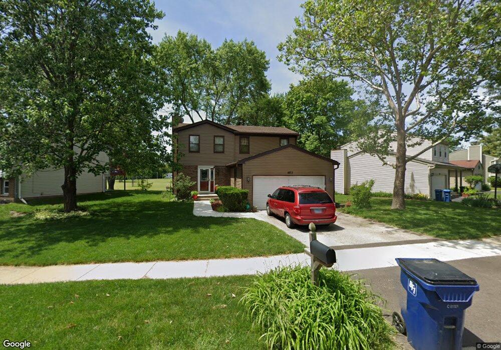
1673 Cumberland Rd Unit 8A Aurora, IL 60504
South East Village NeighborhoodEstimated Value: $284,000 - $384,000
3
Beds
2
Baths
1,564
Sq Ft
$219/Sq Ft
Est. Value
About This Home
This home is located at 1673 Cumberland Rd Unit 8A, Aurora, IL 60504 and is currently estimated at $343,139, approximately $219 per square foot. 1673 Cumberland Rd Unit 8A is a home located in DuPage County with nearby schools including Gombert Elementary School, Fischer Middle School, and Waubonsie Valley High School.
Ownership History
Date
Name
Owned For
Owner Type
Purchase Details
Closed on
Jul 13, 2001
Sold by
Parks Ruth Green
Bought by
Green Lashaunna
Current Estimated Value
Home Financials for this Owner
Home Financials are based on the most recent Mortgage that was taken out on this home.
Original Mortgage
$22,600
Outstanding Balance
$8,716
Interest Rate
7.15%
Mortgage Type
Credit Line Revolving
Estimated Equity
$334,423
Purchase Details
Closed on
Jul 23, 1999
Sold by
Crittenden Robert C and Crittenden Mary K
Bought by
Green Lashaunna T and Green Parks Ruth
Home Financials for this Owner
Home Financials are based on the most recent Mortgage that was taken out on this home.
Original Mortgage
$139,520
Outstanding Balance
$39,730
Interest Rate
7.77%
Mortgage Type
FHA
Estimated Equity
$303,409
Create a Home Valuation Report for This Property
The Home Valuation Report is an in-depth analysis detailing your home's value as well as a comparison with similar homes in the area
Home Values in the Area
Average Home Value in this Area
Purchase History
| Date | Buyer | Sale Price | Title Company |
|---|---|---|---|
| Green Lashaunna | -- | -- | |
| Green Lashaunna T | $140,500 | Law Title |
Source: Public Records
Mortgage History
| Date | Status | Borrower | Loan Amount |
|---|---|---|---|
| Open | Green Lashaunna | $22,600 | |
| Open | Green Lashaunna T | $139,520 |
Source: Public Records
Tax History
| Year | Tax Paid | Tax Assessment Tax Assessment Total Assessment is a certain percentage of the fair market value that is determined by local assessors to be the total taxable value of land and additions on the property. | Land | Improvement |
|---|---|---|---|---|
| 2024 | $6,814 | $97,612 | $26,420 | $71,192 |
| 2023 | $6,478 | $87,710 | $23,740 | $63,970 |
| 2022 | $6,046 | $78,100 | $20,970 | $57,130 |
| 2021 | $5,880 | $75,310 | $20,220 | $55,090 |
| 2020 | $5,952 | $75,310 | $20,220 | $55,090 |
| 2019 | $5,733 | $71,630 | $19,230 | $52,400 |
| 2018 | $5,201 | $64,890 | $17,050 | $47,840 |
| 2017 | $5,108 | $62,690 | $16,470 | $46,220 |
| 2016 | $5,009 | $60,170 | $15,810 | $44,360 |
| 2015 | $4,946 | $57,130 | $15,010 | $42,120 |
| 2014 | $4,966 | $55,840 | $14,560 | $41,280 |
| 2013 | $4,916 | $56,230 | $14,660 | $41,570 |
Source: Public Records
Map
Nearby Homes
- 1655 Trafalgar Ln
- 1740 Cumberland Rd Unit 8B
- 2490 Ridge Ave
- 1782 Montrose Dr
- 2509 Brook Ln
- 2509 Rosehall Ln
- 2632 Emma Cir
- 1875 Keating Dr
- 1874 Keating Dr
- 1871 Keating Dr
- 1868 Keating Dr
- 1859 Keating Dr
- 1855 Keating Dr
- 1966 Congrove Dr
- 2297 Lakeside Dr Unit 10
- 2484 Warwick Ct
- 1830 Canyon Creek Dr
- 2730 Dorothy Dr Unit 1
- 1734 Baler Ave
- 1737 Stable Ln
- 1675 Cumberland Rd
- 1671 Cumberland Rd
- 1679 Cumberland Rd Unit 8A
- 1667 Cumberland Rd Unit 8A
- 1683 Cumberland Rd
- 1680 Cumberland Rd Unit 8A
- 1676 Cumberland Rd Unit 8A
- 1674 Cumberland Rd
- 1678 Cumberland Rd
- 1685 Cumberland Rd Unit 8A
- 1682 Cumberland Rd
- 1666 Cumberland Rd
- 1668 Cumberland Rd
- 1664 Cumberland Rd
- 1672 Cumberland Rd Unit 8A
- 1684 Cumberland Rd
- 1687 Cumberland Rd Unit 8A
- 1670 Cumberland Rd
- 1660 Cumberland Rd
- 1686 Cumberland Rd Unit 8A
Your Personal Tour Guide
Ask me questions while you tour the home.