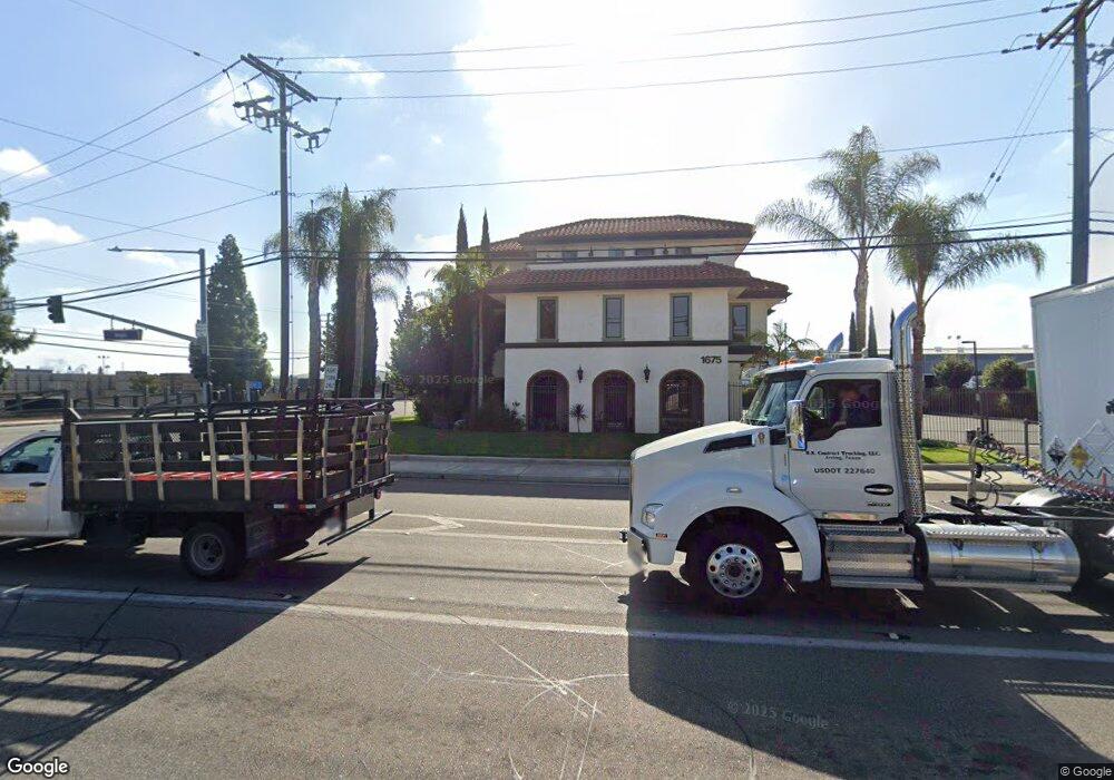
1675 N Main St Orange, CA 92865
Estimated Value: $3,216,715
--
Bed
--
Bath
9,055
Sq Ft
$355/Sq Ft
Est. Value
About This Home
This home is located at 1675 N Main St, Orange, CA 92865 and is currently estimated at $3,216,715, approximately $355 per square foot. 1675 N Main St is a home located in Orange County with nearby schools including Fletcher Mandarin Language & Gate Academy, Cerro Villa Middle School, and Villa Park High School.
Ownership History
Date
Name
Owned For
Owner Type
Purchase Details
Closed on
Mar 3, 2021
Sold by
Hill Brothers Chemical Company Inc
Bought by
A H O Associates Llc
Current Estimated Value
Purchase Details
Closed on
Jul 24, 2013
Sold by
Wells Fargo Bank Na
Bought by
Hill Brothers Chemical Company Inc
Home Financials for this Owner
Home Financials are based on the most recent Mortgage that was taken out on this home.
Original Mortgage
$1,590,000
Interest Rate
3.98%
Mortgage Type
Commercial
Purchase Details
Closed on
Jul 11, 2012
Sold by
Hill Ronald R and James Thomas
Bought by
Wells Fargo Bank Na
Create a Home Valuation Report for This Property
The Home Valuation Report is an in-depth analysis detailing your home's value as well as a comparison with similar homes in the area
Home Values in the Area
Average Home Value in this Area
Purchase History
| Date | Buyer | Sale Price | Title Company |
|---|---|---|---|
| A H O Associates Llc | $2,275,000 | First Amer Ttl Co Res Div | |
| Hill Brothers Chemical Company Inc | -- | Stewart Title Of California | |
| Wells Fargo Bank Na | -- | None Available |
Source: Public Records
Mortgage History
| Date | Status | Borrower | Loan Amount |
|---|---|---|---|
| Previous Owner | Hill Brothers Chemical Company Inc | $1,590,000 |
Source: Public Records
Tax History Compared to Growth
Tax History
| Year | Tax Paid | Tax Assessment Tax Assessment Total Assessment is a certain percentage of the fair market value that is determined by local assessors to be the total taxable value of land and additions on the property. | Land | Improvement |
|---|---|---|---|---|
| 2025 | $26,933 | $2,462,532 | $1,469,740 | $992,792 |
| 2024 | $26,933 | $2,414,248 | $1,440,922 | $973,326 |
| 2023 | $26,339 | $2,366,910 | $1,412,668 | $954,242 |
| 2022 | $25,830 | $2,320,500 | $1,384,968 | $935,532 |
| 2021 | $26,561 | $2,413,722 | $1,268,410 | $1,145,312 |
| 2020 | $26,317 | $2,388,973 | $1,255,404 | $1,133,569 |
| 2019 | $25,984 | $2,342,131 | $1,230,788 | $1,111,343 |
| 2018 | $25,589 | $2,296,207 | $1,206,655 | $1,089,552 |
| 2017 | $24,523 | $2,251,184 | $1,182,995 | $1,068,189 |
| 2016 | $24,049 | $2,207,044 | $1,159,799 | $1,047,245 |
| 2015 | $23,700 | $2,173,893 | $1,142,378 | $1,031,515 |
| 2014 | $23,197 | $2,131,310 | $1,120,000 | $1,011,310 |
Source: Public Records
Map
Nearby Homes
- 1400 S Sunkist St Unit 214
- 1400 S Sunkist St Unit 82
- 1400 S Sunkist St Unit 173
- 1400 S Sunkist St Unit 170
- 1400 S Sunkist St Unit 80
- 2586 E Riles Cir
- 2641 E Paladin Ave
- 218 W Wilson Ave
- 2810 E Burntwood Ave
- 336 E Briardale Ave Unit 3
- 123 E Wilson Ave
- 201 W Collins Ave Unit 55
- 201 W Collins Ave Unit 40
- 201 W Collins Ave Unit 73
- 201 W Collins Ave Unit 118
- 1631 N Shaffer St
- 2144 E Almont Ave
- 2117 N Orange Olive Rd
- 626 E Palmdale Ave
- 636 S Lakeshore Dr
- 1637 N Brian St
- 1594 N Main St
- 1572 N Main St
- 1594 N Batavia St
- 1592 N Batavia St Unit C16
- 1590 N Batavia St Unit C14
- 1590 N Batavia St Unit C13
- 1590 N Batavia St Unit C12
- 1588 N Batavia St
- 1576 N Batavia St Unit C08
- 1574 N Batavia St Unit C06
- 1574 N Batavia St Unit C05
- 1574 N Batavia St Unit C04
- 1572 N Batavia St Unit C02
- 1590 N Batavia St Unit C15
- 1574 N Batavia St Unit C07
- 1572 N Batavia St Unit 1C
- 1576 N Batavia St
- 1592 N Batavia St
- 1588 N Batavia St Unit C11