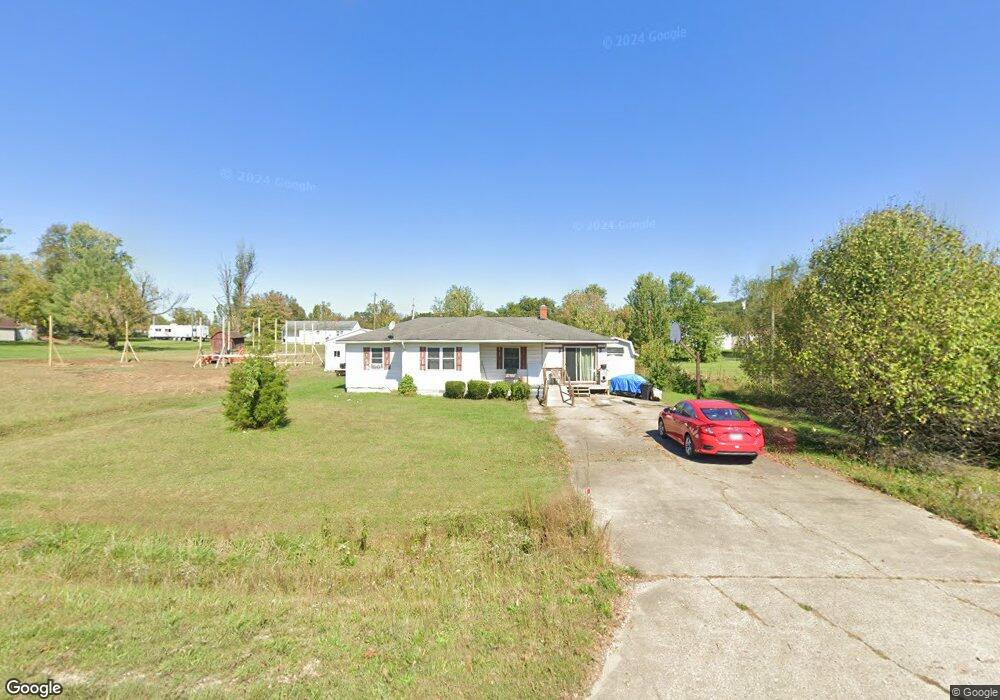
16760 State Route 125 West Union, OH 45693
Estimated Value: $126,719 - $197,000
3
Beds
1
Bath
1,246
Sq Ft
$125/Sq Ft
Est. Value
About This Home
This home is located at 16760 State Route 125, West Union, OH 45693 and is currently estimated at $155,930, approximately $125 per square foot. 16760 State Route 125 is a home located in Adams County with nearby schools including West Union Elementary School and West Union High School.
Ownership History
Date
Name
Owned For
Owner Type
Purchase Details
Closed on
Feb 28, 2007
Sold by
Smith Robert H and Smith Linda J
Bought by
Griffith Roger D and Griffith Eunice H
Current Estimated Value
Home Financials for this Owner
Home Financials are based on the most recent Mortgage that was taken out on this home.
Original Mortgage
$72,526
Outstanding Balance
$43,947
Interest Rate
6.28%
Mortgage Type
VA
Estimated Equity
$111,983
Purchase Details
Closed on
Nov 26, 2002
Sold by
Taylor Chad E
Bought by
Smith Robert H
Purchase Details
Closed on
May 17, 1996
Bought by
Taylor Chad E
Create a Home Valuation Report for This Property
The Home Valuation Report is an in-depth analysis detailing your home's value as well as a comparison with similar homes in the area
Home Values in the Area
Average Home Value in this Area
Purchase History
| Date | Buyer | Sale Price | Title Company |
|---|---|---|---|
| Griffith Roger D | $71,000 | None Available | |
| Smith Robert H | $63,500 | -- | |
| Taylor Chad E | $50,000 | -- |
Source: Public Records
Mortgage History
| Date | Status | Borrower | Loan Amount |
|---|---|---|---|
| Open | Griffith Roger D | $72,526 |
Source: Public Records
Tax History Compared to Growth
Tax History
| Year | Tax Paid | Tax Assessment Tax Assessment Total Assessment is a certain percentage of the fair market value that is determined by local assessors to be the total taxable value of land and additions on the property. | Land | Improvement |
|---|---|---|---|---|
| 2024 | $875 | $25,970 | $2,660 | $23,310 |
| 2023 | $874 | $25,970 | $2,660 | $23,310 |
| 2022 | $792 | $21,700 | $1,960 | $19,740 |
| 2021 | $792 | $21,700 | $1,960 | $19,740 |
| 2020 | $810 | $21,700 | $1,960 | $19,740 |
| 2019 | $810 | $21,700 | $1,960 | $19,740 |
| 2018 | $674 | $18,410 | $1,960 | $16,450 |
| 2017 | $663 | $18,410 | $1,960 | $16,450 |
| 2016 | $662 | $18,410 | $1,960 | $16,450 |
| 2015 | $650 | $18,690 | $2,030 | $16,660 |
| 2014 | $650 | $18,690 | $2,030 | $16,660 |
Source: Public Records
Map
Nearby Homes
- 1186 Tulip Rd
- 1460 Hamilton Rd
- 598 Ohio 348
- 189 Hamilton Rd
- 858 Randalls Run Rd
- 1011 Hafer Rd
- 1064 Hafer Rd
- 2603 Cassel Run Rd
- 1805 Waggoner Riffle Rd
- 467 Waggoner Riffle Rd
- 4702 Ohio Brush Creek Rd
- 4702 Brush Creek Rd
- 0 Blue Creek Rd
- 3380 Blue Creek Rd
- 7851 Ohio 348
- 2030 Cedar Mills Rd
- 0 Coon Hollow Rd Unit 947967
- 410 Owens Rd
- 2316 White Oak Rd
- 108 Chirsdon Ln
- 16720 State Route 125
- 16720 State Route 125
- 393 Lynx Dr
- 414 Lynx Dr
- 414 Lynx Dr
- 445 Lynx Dr
- 16725 State Route 125
- 16725 State Route 125
- 16825 State Route 125
- 380 Lynx Dr
- 440 Lynx Dr
- 505 Lynx Dr
- 303 Lynx Dr
- 16655 State Route 125
- 525 Lynx Dr
- 16890 State Route 125
- 16897 State Route 125
- 138 Shivener Rd
- 219 Lynx Dr
- 3151 Tulip Rd