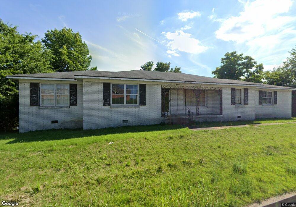
16767 W College St Pulaski, TN 38478
Estimated Value: $288,000 - $312,031
--
Bed
2
Baths
1,624
Sq Ft
$185/Sq Ft
Est. Value
About This Home
This home is located at 16767 W College St, Pulaski, TN 38478 and is currently estimated at $300,016, approximately $184 per square foot. 16767 W College St is a home located in Giles County with nearby schools including Pulaski Elementary School, Southside Elementary School, and Bridgeforth Middle School.
Ownership History
Date
Name
Owned For
Owner Type
Purchase Details
Closed on
Dec 11, 2024
Sold by
Braly Mahlon Ray
Bought by
Braly Judith Ann
Current Estimated Value
Purchase Details
Closed on
Jan 5, 1999
Sold by
Braly Mahlon Ray
Bought by
Tennessee Dept Of Transpor
Purchase Details
Closed on
Feb 2, 1993
Bought by
Braly Mahlon Ray
Purchase Details
Closed on
Jan 28, 1993
Bought by
Braly Mahlon Ray
Purchase Details
Closed on
Dec 23, 1992
Bought by
Braly Mahlon Ray
Purchase Details
Closed on
Apr 7, 1978
Bought by
Harwell Lorene B
Create a Home Valuation Report for This Property
The Home Valuation Report is an in-depth analysis detailing your home's value as well as a comparison with similar homes in the area
Home Values in the Area
Average Home Value in this Area
Purchase History
| Date | Buyer | Sale Price | Title Company |
|---|---|---|---|
| Braly Judith Ann | -- | None Listed On Document | |
| Braly Judith Ann | -- | None Listed On Document | |
| Tennessee Dept Of Transpor | $4,000 | -- | |
| Braly Mahlon Ray | -- | -- | |
| Braly Mahlon Ray | $12,800 | -- | |
| Braly Mahlon Ray | $12,800 | -- | |
| Harwell Lorene B | -- | -- |
Source: Public Records
Tax History Compared to Growth
Tax History
| Year | Tax Paid | Tax Assessment Tax Assessment Total Assessment is a certain percentage of the fair market value that is determined by local assessors to be the total taxable value of land and additions on the property. | Land | Improvement |
|---|---|---|---|---|
| 2024 | $925 | $46,550 | $13,325 | $33,225 |
| 2023 | $925 | $46,550 | $13,325 | $33,225 |
| 2022 | $925 | $46,550 | $13,325 | $33,225 |
| 2021 | $901 | $31,900 | $9,450 | $22,450 |
| 2020 | $901 | $31,900 | $9,450 | $22,450 |
| 2019 | $901 | $31,900 | $9,450 | $22,450 |
| 2018 | $901 | $31,900 | $9,450 | $22,450 |
| 2017 | $901 | $31,900 | $9,450 | $22,450 |
| 2016 | $953 | $32,075 | $8,975 | $23,100 |
| 2015 | $889 | $32,075 | $8,975 | $23,100 |
| 2014 | $889 | $32,068 | $0 | $0 |
Source: Public Records
Map
Nearby Homes
- 132 Stonecreek Dr
- 0 Industrial Loop Rd
- 1660 Vales Mill Rd
- 133 Sunset Dr
- 1814 Vales Mill Rd
- 118 Sunset Dr
- 125 Chicken Creek Rd
- 271 Chicken Creek Rd
- 1 Chicken Creek Rd
- 2400 Chicken Creek Rd
- 1336 Charlotte Ct
- 1041 Jackson Dr
- 1205 Beverly Dr
- 720 W Madison St
- 1202 Parker Dr
- 210 S 6th St
- 1200 Mill St
- 1021 Mill St
- 420 Fort Hill Dr
- 803 Nichols St
- 16682 W College St
- 16880 W College St
- 16616 W College St
- 16946 W College St
- 16972 W College St
- 245 Robin Hood Rd
- 421 Westgate Dr
- 417 Westgate Dr
- 237 Robinhood Rd
- 425 Westgate Dr
- 415 Westgate Dr
- 235 Robin Hood Rd Unit 237
- 429 Westgate Dr
- 413 Westgate Dr
- 229 Robin Hood Rd
- 16988 W College St
- 16988 W College St
- 0 U S Highway 64
- 221 Robin Hood Rd
- 416 Westgate Dr