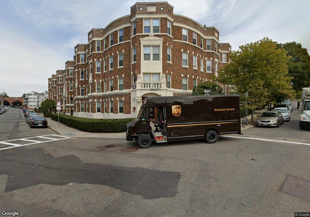
1677 Commonwealth Ave Unit 1 Brighton, MA 02135
Saint Elizabeths NeighborhoodEstimated Value: $472,000 - $513,000
2
Beds
1
Bath
738
Sq Ft
$668/Sq Ft
Est. Value
About This Home
This home is located at 1677 Commonwealth Ave Unit 1, Brighton, MA 02135 and is currently estimated at $493,050, approximately $668 per square foot. 1677 Commonwealth Ave Unit 1 is a home located in Suffolk County with nearby schools including Boston Green Academy Horace Mann Charter School, Torah Academy, and Shaloh House Jewish Day School.
Ownership History
Date
Name
Owned For
Owner Type
Purchase Details
Closed on
Jul 30, 2024
Sold by
Liu Sen and Liu Dan
Bought by
Zhang Ft and Zhang
Current Estimated Value
Purchase Details
Closed on
Oct 7, 2019
Sold by
Harringan Rachel Est
Bought by
Roberts Jeffrey D
Purchase Details
Closed on
Jun 1, 2004
Sold by
Loon Nt
Bought by
Taggart Brian S
Home Financials for this Owner
Home Financials are based on the most recent Mortgage that was taken out on this home.
Original Mortgage
$177,000
Interest Rate
5.88%
Mortgage Type
Purchase Money Mortgage
Create a Home Valuation Report for This Property
The Home Valuation Report is an in-depth analysis detailing your home's value as well as a comparison with similar homes in the area
Home Values in the Area
Average Home Value in this Area
Purchase History
| Date | Buyer | Sale Price | Title Company |
|---|---|---|---|
| Zhang Ft | $525,000 | None Available | |
| Zhang Ft | $525,000 | None Available | |
| Roberts Jeffrey D | -- | -- | |
| Taggart Brian S | $236,000 | -- | |
| Taggart Brian S | $236,000 | -- |
Source: Public Records
Mortgage History
| Date | Status | Borrower | Loan Amount |
|---|---|---|---|
| Previous Owner | Taggart Brian S | $177,000 |
Source: Public Records
Tax History Compared to Growth
Tax History
| Year | Tax Paid | Tax Assessment Tax Assessment Total Assessment is a certain percentage of the fair market value that is determined by local assessors to be the total taxable value of land and additions on the property. | Land | Improvement |
|---|---|---|---|---|
| 2025 | $4,623 | $399,200 | $0 | $399,200 |
| 2024 | $4,146 | $380,400 | $0 | $380,400 |
| 2023 | $4,085 | $380,400 | $0 | $380,400 |
| 2022 | $3,904 | $358,800 | $0 | $358,800 |
| 2021 | $3,907 | $366,200 | $0 | $366,200 |
| 2020 | $3,620 | $342,800 | $0 | $342,800 |
| 2019 | $3,544 | $336,200 | $0 | $336,200 |
| 2018 | $3,294 | $314,300 | $0 | $314,300 |
| 2017 | $3,082 | $291,000 | $0 | $291,000 |
| 2016 | $2,937 | $267,000 | $0 | $267,000 |
| 2015 | $2,757 | $227,700 | $0 | $227,700 |
| 2014 | $2,740 | $217,800 | $0 | $217,800 |
Source: Public Records
Map
Nearby Homes
- 1669 Commonwealth Ave Unit 3
- 38 Ransom Rd Unit 12
- 38 Ransom Rd Unit 3
- 1691 Commonwealth Ave Unit 31
- 1691 Commonwealth Ave Unit 32
- 1666 Commonwealth Ave Unit 24
- 1641 Commonwealth Ave Unit 20
- 1662 Commonwealth Ave Unit 52
- 36 Colborne Rd
- 1650 Commonwealth Ave Unit 304
- 28 Ransom Rd Unit 11
- 1710 Commonwealth Ave Unit 3
- 1633 Commonwealth Ave Unit 6
- 36 Cummings Rd Unit 1
- 53 Colborne Rd Unit B1
- 65 Lanark Rd Unit 2
- 78 Kilsyth Rd Unit 3
- 130 Sutherland Rd Unit 1
- 126 Kilsyth Rd Unit 1
- 100 Lanark Rd Unit A
- 1677 Commonwealth Ave Unit 21
- 1677 Commonwealth Ave Unit 20
- 1677 Commonwealth Ave Unit 19
- 1677 Commonwealth Ave Unit 18
- 1677 Commonwealth Ave Unit 17
- 1677 Commonwealth Ave Unit 16
- 1677 Commonwealth Ave Unit 15
- 1677 Commonwealth Ave Unit 14
- 1677 Commonwealth Ave Unit 12A
- 1677 Commonwealth Ave Unit 12
- 1677 Commonwealth Ave Unit 11
- 1677 Commonwealth Ave Unit 10
- 1677 Commonwealth Ave Unit 9
- 1677 Commonwealth Ave Unit 8
- 1677 Commonwealth Ave Unit 7
- 1677 Commonwealth Ave Unit 6
- 1677 Commonwealth Ave Unit 5
- 1677 Commonwealth Ave Unit 4
- 1677 Commonwealth Ave Unit 3
- 1677 Commonwealth Ave Unit 2