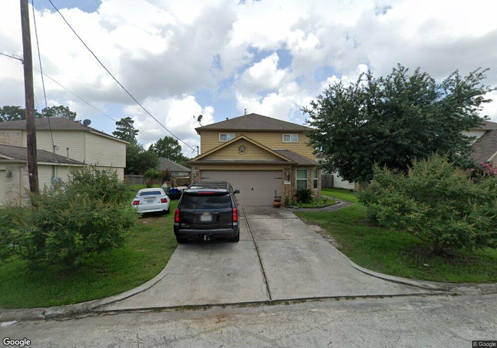
16774 N Blue Jay Dr Conroe, TX 77385
Estimated Value: $254,379 - $280,000
--
Bed
1
Bath
2,119
Sq Ft
$127/Sq Ft
Est. Value
About This Home
This home is located at 16774 N Blue Jay Dr, Conroe, TX 77385 and is currently estimated at $268,595, approximately $126 per square foot. 16774 N Blue Jay Dr is a home with nearby schools including Oak Ridge Elementary School, Irons J High School, and Vogel Intermediate School.
Ownership History
Date
Name
Owned For
Owner Type
Purchase Details
Closed on
Mar 21, 2012
Sold by
Long Lake Ltd
Bought by
Adams Justin D
Current Estimated Value
Home Financials for this Owner
Home Financials are based on the most recent Mortgage that was taken out on this home.
Original Mortgage
$98,288
Outstanding Balance
$68,080
Interest Rate
3.97%
Mortgage Type
Stand Alone Second
Estimated Equity
$200,515
Purchase Details
Closed on
Oct 17, 2011
Sold by
Long Lake Ltd
Bought by
Adams Justin D
Create a Home Valuation Report for This Property
The Home Valuation Report is an in-depth analysis detailing your home's value as well as a comparison with similar homes in the area
Home Values in the Area
Average Home Value in this Area
Purchase History
| Date | Buyer | Sale Price | Title Company |
|---|---|---|---|
| Adams Justin D | -- | South Land Title Llc | |
| Adams Justin D | -- | -- |
Source: Public Records
Mortgage History
| Date | Status | Borrower | Loan Amount |
|---|---|---|---|
| Open | Adams Justin D | $98,288 | |
| Closed | Adams Justin D | $98,288 |
Source: Public Records
Tax History Compared to Growth
Tax History
| Year | Tax Paid | Tax Assessment Tax Assessment Total Assessment is a certain percentage of the fair market value that is determined by local assessors to be the total taxable value of land and additions on the property. | Land | Improvement |
|---|---|---|---|---|
| 2025 | $2,670 | $288,209 | -- | -- |
| 2024 | $2,670 | $262,008 | -- | -- |
| 2023 | $3,807 | $238,190 | $23,100 | $265,620 |
| 2022 | $4,442 | $216,540 | $23,100 | $0 |
| 2021 | $5,135 | $196,850 | $23,100 | $173,750 |
| 2020 | $5,114 | $185,420 | $23,100 | $162,320 |
| 2019 | $5,256 | $182,230 | $16,700 | $165,530 |
| 2018 | $4,034 | $167,340 | $16,700 | $150,640 |
| 2017 | $4,516 | $153,690 | $16,700 | $150,670 |
| 2016 | $4,106 | $139,720 | $10,020 | $148,320 |
| 2015 | $3,251 | $127,020 | $10,020 | $148,320 |
| 2014 | $3,251 | $115,470 | $10,020 | $119,160 |
Source: Public Records
Map
Nearby Homes
- 16771 N Rail Dr
- 16778 N Gull Dr
- 9877 Lace Flower Way
- 16751 N Rail Dr
- 9838 Bobolink Dr
- 16774 Fallen Timbers Dr
- 9921 Kingfisher Dr
- 16731 Foursquare Dr
- 16859 Blackberry Lily Ln
- 10003 S Whimbrel Cir
- 3420 Chestnut Colony Ct
- 9807 Toucan Ln
- 16916 Tableland Trail
- 10311 Woodhollow Dr
- 9977 Western Ridge Way
- 9972 Western Ridge Way
- 9881 Youpon Ridge Way
- 74 Wimberly Way
- 9903 Valance Way
- 16937 Larkspur
- 16770 N Blue Jay Dr
- 16778 N Blue Jay Dr
- 16782 Blue Jay St
- 16775 N Bob White Dr
- 16771 N Bob White Dr
- 16779 N Bob White Dr
- 16762 N Blue Jay Dr
- 16775 N Blue Jay Dr
- 16767 N Bob White Dr
- 16779 Blue Jay St
- 16771 N Blue Jay Dr
- 16783 N Bob White Dr
- 16786 N Blue Jay Dr
- 16767 N Blue Jay Dr
- 16783 N Blue Jay Dr
- 16763 N Bob White Dr
- 16758 N Blue Jay Dr
- 16763 N Blue Jay Dr
- 16787 N Bob White Dr
- 16759 N Bob White Dr