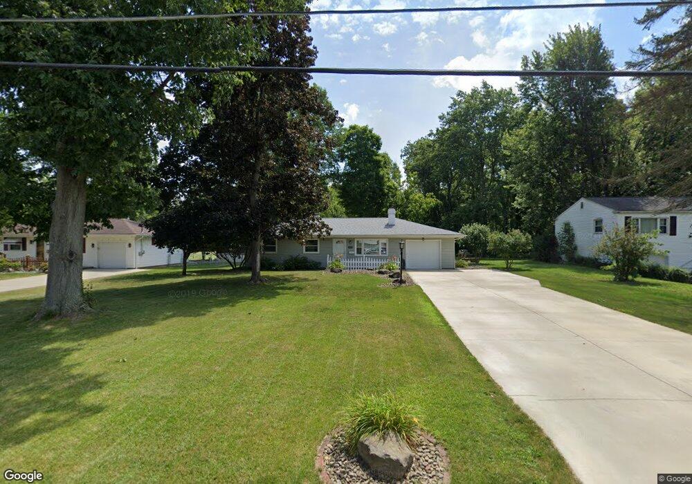
1679 Lancaster Dr Youngstown, OH 44511
Austintown NeighborhoodEstimated Value: $147,000 - $183,000
About This Home
This home is located at 1679 Lancaster Dr, Youngstown, OH 44511 and is currently estimated at $159,498, approximately $161 per square foot. 1679 Lancaster Dr is a home located in Mahoning County with nearby schools including Austintown Elementary School, Austintown Intermediate School, and Austintown Middle School.
Ownership History
We collect this data history from publicly available records. To have your information removed, we recommend requesting removal directly through your county’s website.
Purchase Details
Home Financials for this Owner
Home Financials are based on the most recent Mortgage that was taken out on this home.Purchase Details
Purchase Details
Purchase Details
Purchase Details
Home Values in the Area
Average Home Value in this Area
Purchase History
We collect this data history from publicly available records. To have your information removed, we recommend requesting removal directly through your county’s website.
| Date | Buyer | Sale Price | Title Company |
|---|---|---|---|
| $58,000 | None Available | ||
| -- | -- | ||
| -- | -- | ||
| -- | -- | ||
| -- | -- |
Mortgage History
We collect this data history from publicly available records. To have your information removed, we recommend requesting removal directly through your county’s website.
| Date | Status | Borrower | Loan Amount |
|---|---|---|---|
| Open | $56,949 |
Tax History
We collect this data history from publicly available records. To have your information removed, we recommend requesting removal directly through your county’s website.
| Year | Tax Paid | Tax Assessment Tax Assessment Total Assessment is a certain percentage of the fair market value that is determined by local assessors to be the total taxable value of land and additions on the property. | Land | Improvement |
|---|---|---|---|---|
| 2025 | $1,326 | $37,460 | $8,330 | $29,130 |
| 2024 | $1,732 | $37,460 | $8,330 | $29,130 |
| 2023 | $1,701 | $37,460 | $8,330 | $29,130 |
| 2022 | $1,339 | $23,610 | $7,130 | $16,480 |
| 2021 | $1,340 | $23,610 | $7,130 | $16,480 |
| 2020 | $1,345 | $23,610 | $7,130 | $16,480 |
| 2019 | $1,329 | $21,070 | $6,360 | $14,710 |
| 2018 | $1,279 | $21,070 | $6,360 | $14,710 |
| 2017 | $1,266 | $21,070 | $6,360 | $14,710 |
| 2016 | $1,303 | $21,470 | $6,670 | $14,800 |
| 2015 | $1,264 | $21,470 | $6,670 | $14,800 |
| 2014 | $1,269 | $21,470 | $6,670 | $14,800 |
| 2013 | $1,255 | $21,470 | $6,670 | $14,800 |
Map
- 4259 Carlisle Ave
- 4265 Carlisle Ave
- 4260 Wedgewood Dr
- 4257 Selkirk Ave
- 3902 Ayrshire Dr
- 4238 Claridge Dr
- 4285 Kerrybrook Dr
- 3898 New Rd
- 4025 Nottingham Ave
- 3930 Cannon Rd
- 3898 Bryant Dr
- 3894 Cannon Rd
- 3955 Dunbar St
- 3786 Bryant Dr
- 3904 Dunbar St
- 3980 Lake Rd
- 1627 Yolanda Dr
- 4138 Burkey Rd
- 4174 Burkey Rd
- 3730 Ayrshire Dr
- 1685 Lancaster Dr
- 1673 Lancaster Dr
- 1703 Lancaster Dr
- 1684 Lancaster Dr
- 1678 Lancaster Dr
- 1667 Lancaster Dr
- 1709 Lancaster Dr
- 1672 Lancaster Dr
- 1702 Lancaster Dr
- 1666 Lancaster Dr
- 1661 Lancaster Dr
- 1715 Lancaster Dr
- 1708 Lancaster Dr
- 4216 Carlisle Ave
- 1660 Lancaster Dr
- 1714 Lancaster Dr
- 4209 Patricia Ave
- 1721 Lancaster Dr
- 4215 Carlisle Ave
- 1655 Lancaster Dr
Ask me questions while you tour the home.