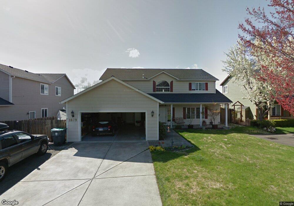
1679 Rolling Meadows Ln Medford, OR 97504
Estimated Value: $610,000 - $658,192
4
Beds
3
Baths
2,898
Sq Ft
$222/Sq Ft
Est. Value
About This Home
This home is located at 1679 Rolling Meadows Ln, Medford, OR 97504 and is currently estimated at $642,298, approximately $221 per square foot. 1679 Rolling Meadows Ln is a home located in Jackson County with nearby schools including Lone Pine Elementary School, Hedrick Middle School, and North Medford High School.
Ownership History
Date
Name
Owned For
Owner Type
Purchase Details
Closed on
Sep 21, 2016
Sold by
Hart Paul D and Hart Danette E
Bought by
Hart Paul D and Hart Danette E
Current Estimated Value
Home Financials for this Owner
Home Financials are based on the most recent Mortgage that was taken out on this home.
Original Mortgage
$280,000
Outstanding Balance
$223,797
Interest Rate
3.45%
Mortgage Type
New Conventional
Estimated Equity
$418,501
Purchase Details
Closed on
Jan 18, 2013
Sold by
Hart Paul D and Dunn Danette E
Bought by
Hart Paul D and Dunn Danette E
Home Financials for this Owner
Home Financials are based on the most recent Mortgage that was taken out on this home.
Original Mortgage
$236,500
Interest Rate
3.28%
Mortgage Type
New Conventional
Purchase Details
Closed on
Apr 8, 2011
Sold by
Federal National Mortgage Association
Bought by
Hart Paul D and Dunn Danette E
Home Financials for this Owner
Home Financials are based on the most recent Mortgage that was taken out on this home.
Original Mortgage
$233,818
Interest Rate
4.9%
Mortgage Type
FHA
Purchase Details
Closed on
May 24, 2010
Sold by
Spence Michael P and Spence Jeanne L
Bought by
Federal National Mortgage Association
Purchase Details
Closed on
Nov 5, 2009
Sold by
Spence Michael P
Bought by
Spence Jeanne L
Purchase Details
Closed on
Jun 6, 2001
Sold by
Cathcart Robert D and Cathcart Paula
Bought by
Spence Michael P and Spence Jeanne L
Home Financials for this Owner
Home Financials are based on the most recent Mortgage that was taken out on this home.
Original Mortgage
$265,050
Interest Rate
7.14%
Purchase Details
Closed on
Aug 6, 1998
Sold by
Jolly Edward A and Jolly Carin D
Bought by
Cathcart Robert D and Cathcart Paula
Home Financials for this Owner
Home Financials are based on the most recent Mortgage that was taken out on this home.
Original Mortgage
$221,700
Interest Rate
6.93%
Create a Home Valuation Report for This Property
The Home Valuation Report is an in-depth analysis detailing your home's value as well as a comparison with similar homes in the area
Home Values in the Area
Average Home Value in this Area
Purchase History
| Date | Buyer | Sale Price | Title Company |
|---|---|---|---|
| Hart Paul D | -- | First American | |
| Hart Paul D | -- | First American | |
| Hart Paul D | $239,900 | Ticor Title Company Oregon | |
| Federal National Mortgage Association | $354,943 | Fa | |
| Spence Jeanne L | -- | None Available | |
| Spence Michael P | $279,000 | Lawyers Title Insurance Corp | |
| Cathcart Robert D | $233,400 | Amerititle |
Source: Public Records
Mortgage History
| Date | Status | Borrower | Loan Amount |
|---|---|---|---|
| Open | Hart Paul D | $280,000 | |
| Closed | Hart Paul D | $236,500 | |
| Closed | Hart Paul D | $233,818 | |
| Previous Owner | Spence Michael P | $265,050 | |
| Previous Owner | Cathcart Robert D | $221,700 |
Source: Public Records
Tax History Compared to Growth
Tax History
| Year | Tax Paid | Tax Assessment Tax Assessment Total Assessment is a certain percentage of the fair market value that is determined by local assessors to be the total taxable value of land and additions on the property. | Land | Improvement |
|---|---|---|---|---|
| 2025 | $6,093 | $420,110 | $63,010 | $357,100 |
| 2024 | $6,093 | $407,880 | $61,170 | $346,710 |
| 2023 | $5,906 | $396,000 | $59,390 | $336,610 |
| 2022 | $5,762 | $396,000 | $59,390 | $336,610 |
| 2021 | $5,613 | $384,470 | $57,670 | $326,800 |
| 2020 | $5,494 | $373,280 | $55,990 | $317,290 |
| 2019 | $5,365 | $351,860 | $52,770 | $299,090 |
| 2018 | $5,227 | $341,620 | $51,240 | $290,380 |
| 2017 | $5,133 | $341,620 | $51,240 | $290,380 |
| 2016 | $5,166 | $322,010 | $48,300 | $273,710 |
| 2015 | $4,966 | $322,010 | $48,300 | $273,710 |
| 2014 | $4,878 | $303,540 | $45,540 | $258,000 |
Source: Public Records
Map
Nearby Homes
- 1876 Inglewood Dr
- 1460 Brookdale Ave
- 3317 Tree Top Dr
- 2752 Pronghorn Ln
- 2675 Kerrisdale Ridge Dr
- 1501 Brookdale Ave
- 3079 Sycamore Way
- 3073 Ruby Dr
- 3203 Broken Top Way
- 3268 Sky Way
- 3290 Sky Way
- 3303 Sky Way
- 2802 High Cedars Ln
- 1137 Riverrock Way
- 523 W La Strada Cir
- 2857 Caldera Ln
- 1277 Gardendale Ave
- 2410 N Foothill Rd
- 2777 Roberts Rd
- 1089 Brookdale Ave
- 1683 Rolling Meadows Ln
- 1675 Rolling Meadows Ln
- 1674 Rolling Meadows Ln
- 3322 Lone Pine Rd
- 3330 Lone Pine Rd
- 1677 Thrasher Ln
- 1687 Thrasher Ln
- 3360 Lone Pine Rd
- 1671 Thrasher Ln
- 3268 Lone Pine Rd
- 0 Lone Pine Rd Unit 100974371
- 0 Lone Pine Rd Unit 100202491
- 0 Lone Pine Rd Unit 220176014
- 0 Lone Pine Rd Unit 220160343
- 0 Lone Pine Rd Unit 102927690
- 0 Lone Pine Rd Unit 102935814
- 0 Lone Pine Rd Unit 102943613
- 0 Lone Pine Rd Unit 102944004
- 0 Lone Pine Rd Unit 102953963
- 0 Lone Pine Rd Unit 102953964