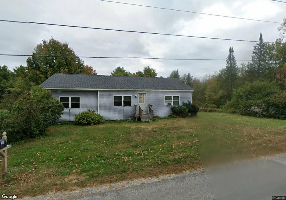
168 Auburn Pownal Rd Durham, ME 04222
Estimated Value: $264,427 - $438,000
3
Beds
1
Bath
1,152
Sq Ft
$320/Sq Ft
Est. Value
About This Home
This home is located at 168 Auburn Pownal Rd, Durham, ME 04222 and is currently estimated at $368,357, approximately $319 per square foot. 168 Auburn Pownal Rd is a home located in Androscoggin County with nearby schools including Durham Community School and Freeport High School.
Ownership History
Date
Name
Owned For
Owner Type
Purchase Details
Closed on
Nov 20, 2012
Sold by
New England Const Co Llc
Bought by
Fochler Nichole
Current Estimated Value
Home Financials for this Owner
Home Financials are based on the most recent Mortgage that was taken out on this home.
Original Mortgage
$122,346
Interest Rate
3.39%
Mortgage Type
Purchase Money Mortgage
Purchase Details
Closed on
Nov 18, 2011
Sold by
Us Bank Na Tr
Bought by
Us Bank Na Tr
Create a Home Valuation Report for This Property
The Home Valuation Report is an in-depth analysis detailing your home's value as well as a comparison with similar homes in the area
Home Values in the Area
Average Home Value in this Area
Purchase History
| Date | Buyer | Sale Price | Title Company |
|---|---|---|---|
| Fochler Nichole | -- | -- | |
| Us Bank Na Tr | -- | -- |
Source: Public Records
Mortgage History
| Date | Status | Borrower | Loan Amount |
|---|---|---|---|
| Closed | Fochler Nichole | $122,346 |
Source: Public Records
Tax History Compared to Growth
Tax History
| Year | Tax Paid | Tax Assessment Tax Assessment Total Assessment is a certain percentage of the fair market value that is determined by local assessors to be the total taxable value of land and additions on the property. | Land | Improvement |
|---|---|---|---|---|
| 2024 | $2,553 | $117,400 | $60,000 | $57,400 |
| 2023 | $2,506 | $117,400 | $60,000 | $57,400 |
| 2022 | $2,430 | $117,400 | $60,000 | $57,400 |
| 2021 | $2,430 | $117,400 | $60,000 | $57,400 |
| 2020 | $2,377 | $117,400 | $60,000 | $57,400 |
| 2019 | $2,377 | $117,400 | $60,000 | $57,400 |
| 2018 | $2,313 | $117,400 | $60,000 | $57,400 |
| 2016 | $2,207 | $117,400 | $60,000 | $57,400 |
| 2015 | $2,043 | $117,400 | $60,000 | $57,400 |
| 2014 | $1,955 | $117,400 | $60,000 | $57,400 |
| 2013 | $1,755 | $117,400 | $60,000 | $57,400 |
Source: Public Records
Map
Nearby Homes
- 1 Mattie Ln
- 99 Rangdale Rd
- 200 Woodman Rd
- 850 Lawrence Rd
- 059-007 Soper's Mill Rd
- 206 Davis Rd
- 10 Cobbs Bridge Rd
- 164 Intervale Rd
- 1032 Ferry Rd
- 284 Allen Rd
- 160 Gloucester Hill Rd
- 11 Pinewoods Rd
- 890 Elmwood Rd
- 244 Allen Rd
- 155 & 151 Gloucester Hill Rd
- 0018-C Gloucester Hill Rd
- 12 Country Charm Ln
- 16 Harlie Woods Rd
- 10-56 C&E Bowdoin Way
- 026-01 Dow Ln
- 161 Auburn Pownal Rd
- 184 Auburn Pownal Rd
- 151 Auburn Pownal Rd
- 189 Auburn Pownal Rd
- 201 Auburn Pownal Rd
- 26 Victory Ln
- 222 Auburn Pownal Rd
- 852 Stackpole Rd
- 221 Parcel B Auburn Pownal Rd
- 221 Auburn Pownal Rd
- 221 Auburn Pownal Rd
- 15 Victory Ln
- 836 Stackpole Rd
- 839 Stackpole Rd
- 15 New Gloucester Rd
- 817 Stackpole Rd
- 7 New Gloucester Rd
- 240 Auburn Pownal Rd
- 37 New Gloucester Rd
- 27 New Gloucester Rd