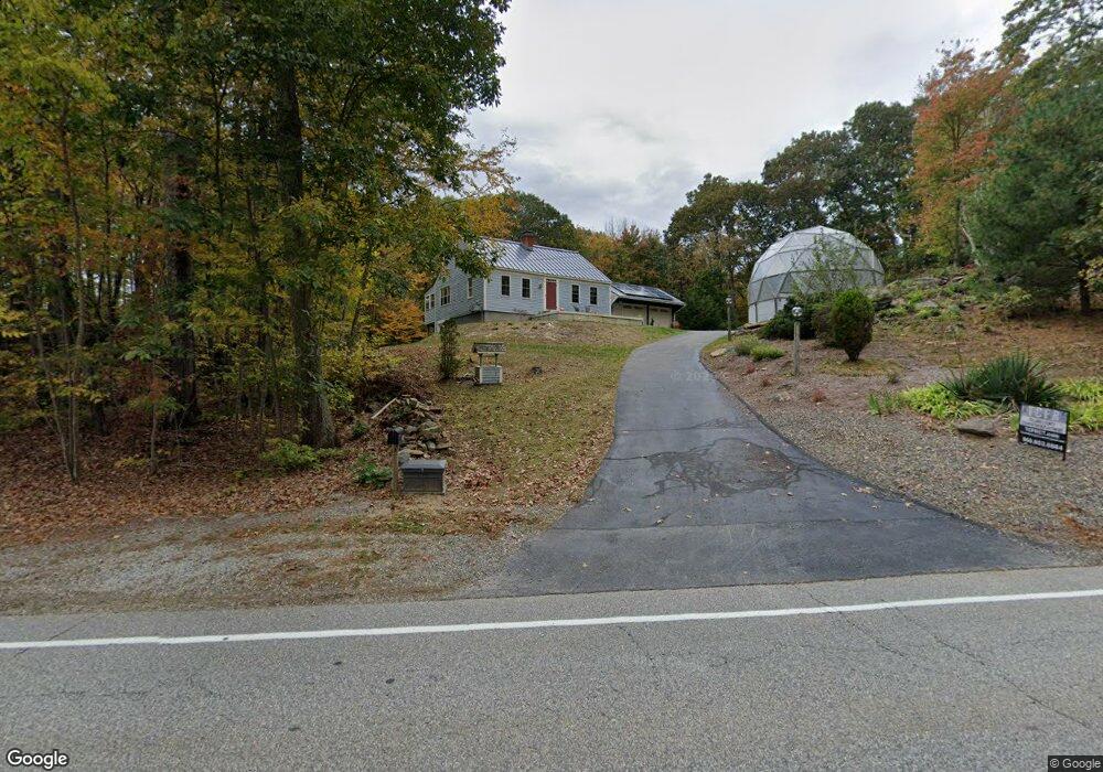
168 Buckley Hwy Stafford Springs, CT 06076
Stafford NeighborhoodEstimated Value: $340,000 - $455,000
3
Beds
2
Baths
1,764
Sq Ft
$220/Sq Ft
Est. Value
About This Home
This home is located at 168 Buckley Hwy, Stafford Springs, CT 06076 and is currently estimated at $387,935, approximately $219 per square foot. 168 Buckley Hwy is a home located in Tolland County with nearby schools including Stafford Elementary School, Stafford Middle School, and Stafford High School.
Ownership History
Date
Name
Owned For
Owner Type
Purchase Details
Closed on
Nov 27, 2012
Sold by
Bouley Renee
Bought by
Bouley Daniel B
Current Estimated Value
Purchase Details
Closed on
May 4, 2010
Sold by
Kukucka Drew
Bought by
Bouley Daniel and Bouley Renee
Home Financials for this Owner
Home Financials are based on the most recent Mortgage that was taken out on this home.
Original Mortgage
$192,000
Interest Rate
4.99%
Purchase Details
Closed on
Aug 24, 1998
Sold by
Jellen Barbara A
Bought by
Duthie Evelyn
Create a Home Valuation Report for This Property
The Home Valuation Report is an in-depth analysis detailing your home's value as well as a comparison with similar homes in the area
Home Values in the Area
Average Home Value in this Area
Purchase History
| Date | Buyer | Sale Price | Title Company |
|---|---|---|---|
| Bouley Daniel B | -- | -- | |
| Bouley Daniel | $240,000 | -- | |
| Duthie Evelyn | $142,500 | -- |
Source: Public Records
Mortgage History
| Date | Status | Borrower | Loan Amount |
|---|---|---|---|
| Previous Owner | Duthie Evelyn | $192,000 | |
| Previous Owner | Duthie Evelyn | $188,000 | |
| Previous Owner | Duthie Evelyn | $17,000 |
Source: Public Records
Tax History Compared to Growth
Tax History
| Year | Tax Paid | Tax Assessment Tax Assessment Total Assessment is a certain percentage of the fair market value that is determined by local assessors to be the total taxable value of land and additions on the property. | Land | Improvement |
|---|---|---|---|---|
| 2025 | $8,925 | $152,390 | $35,840 | $116,550 |
| 2024 | $5,881 | $152,390 | $35,840 | $116,550 |
| 2023 | $3,353 | $91,210 | $35,840 | $55,370 |
| 2022 | $3,263 | $91,210 | $35,840 | $55,370 |
| 2021 | $3,186 | $91,210 | $35,840 | $55,370 |
| 2020 | $3,259 | $93,310 | $41,650 | $51,660 |
| 2019 | $5,223 | $149,520 | $41,650 | $107,870 |
| 2018 | $5,123 | $149,520 | $41,650 | $107,870 |
| 2017 | $5,073 | $149,520 | $41,650 | $107,870 |
| 2016 | $5,010 | $149,520 | $41,650 | $107,870 |
| 2015 | $5,057 | $151,550 | $41,650 | $109,900 |
| 2014 | $5,006 | $151,550 | $41,650 | $109,900 |
Source: Public Records
Map
Nearby Homes
- 74 Crooked S Rd
- 23 East St
- 8 South Rd Unit W86
- 8 South Rd Unit WW4
- 8 South Rd Unit R80
- 8 South Rd Unit R29
- 28 Cemetery Rd
- 13 Goodell Rd
- 61 Lohse Rd
- 57 Lohse Rd
- 20 Grant Ave
- 336 East St
- 21 Ashley Ln
- 30 Edgewood St
- 92 Furnace Ave Unit 68
- 3 Hemlock Cir
- 4 Clinton St
- 28 Fluery Dr
- 52 High St
- 0 Lohse Rd Unit map 42 block 21
- 164 Buckley Hwy
- 172 Buckley Hwy
- 160 Buckley Hwy
- 175 Buckley Hwy
- 156 Buckley Hwy
- 177 Buckley Hwy
- 176 Buckley Hwy
- 128 Buckley Hwy
- 152 Buckley Hwy
- 186 Buckley Hwy
- 148 Buckley Hwy
- 188 Buckley Hwy
- 140 Buckley Hwy
- 132 Buckley Hwy
- 124 Buckley Hwy
- 141 Buckley Hwy
- 197 Buckley Hwy
- 131 Buckley Hwy
- 23 Clearview Dr
- 25 Clearview Dr