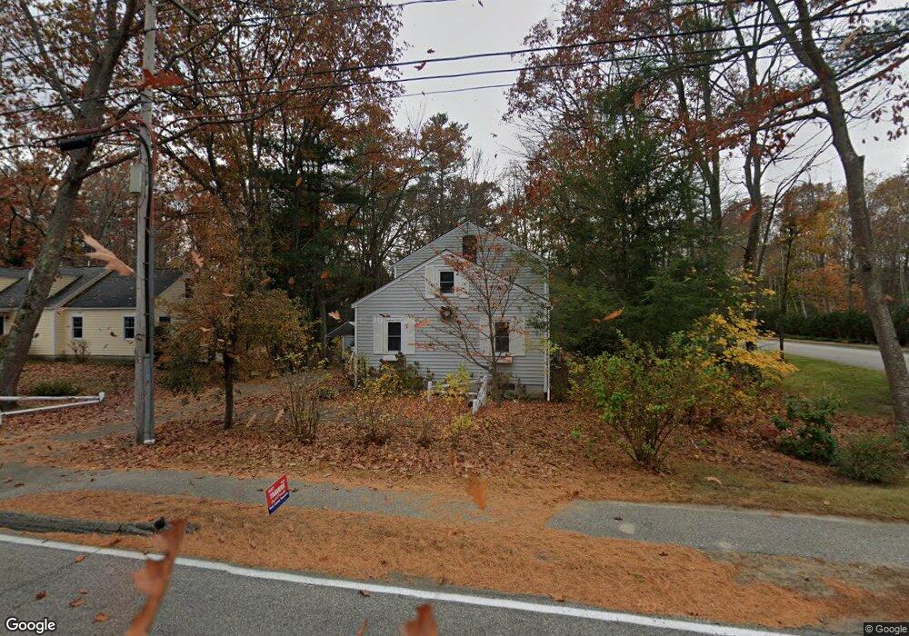
168 Cat Mousam Rd Kennebunk, ME 04043
Estimated Value: $434,103 - $518,000
2
Beds
2
Baths
1,207
Sq Ft
$388/Sq Ft
Est. Value
About This Home
This home is located at 168 Cat Mousam Rd, Kennebunk, ME 04043 and is currently estimated at $468,776, approximately $388 per square foot. 168 Cat Mousam Rd is a home located in York County with nearby schools including Kennebunk High School and The New School.
Ownership History
Date
Name
Owned For
Owner Type
Purchase Details
Closed on
May 2, 2007
Sold by
Grip Robyn H and Grip Kenneth C
Bought by
Siefker James D
Current Estimated Value
Home Financials for this Owner
Home Financials are based on the most recent Mortgage that was taken out on this home.
Original Mortgage
$44,000
Outstanding Balance
$26,850
Interest Rate
6.14%
Mortgage Type
Adjustable Rate Mortgage/ARM
Estimated Equity
$441,926
Purchase Details
Closed on
Feb 5, 2007
Sold by
Grip Robyn H and Grip Kenneth C
Bought by
Siefker James D
Home Financials for this Owner
Home Financials are based on the most recent Mortgage that was taken out on this home.
Original Mortgage
$176,000
Interest Rate
6.13%
Mortgage Type
Adjustable Rate Mortgage/ARM
Purchase Details
Closed on
Feb 8, 2005
Sold by
Graybeal H M
Bought by
Grip Robyn H and Grip Kenneth C
Create a Home Valuation Report for This Property
The Home Valuation Report is an in-depth analysis detailing your home's value as well as a comparison with similar homes in the area
Home Values in the Area
Average Home Value in this Area
Purchase History
| Date | Buyer | Sale Price | Title Company |
|---|---|---|---|
| Siefker James D | -- | -- | |
| Siefker James D | -- | -- | |
| Grip Robyn H | -- | -- |
Source: Public Records
Mortgage History
| Date | Status | Borrower | Loan Amount |
|---|---|---|---|
| Open | Siefker James D | $44,000 | |
| Open | Siefker James D | $176,000 | |
| Closed | Siefker James D | $44,000 | |
| Previous Owner | Siefker James D | $176,000 |
Source: Public Records
Tax History Compared to Growth
Tax History
| Year | Tax Paid | Tax Assessment Tax Assessment Total Assessment is a certain percentage of the fair market value that is determined by local assessors to be the total taxable value of land and additions on the property. | Land | Improvement |
|---|---|---|---|---|
| 2024 | $3,334 | $196,700 | $70,300 | $126,400 |
| 2023 | $3,157 | $196,700 | $70,300 | $126,400 |
| 2022 | $2,872 | $196,700 | $70,300 | $126,400 |
| 2021 | $2,803 | $196,700 | $70,300 | $126,400 |
| 2020 | $2,783 | $196,700 | $70,300 | $126,400 |
| 2019 | $2,705 | $196,700 | $70,300 | $126,400 |
| 2018 | $2,581 | $147,500 | $52,700 | $94,800 |
| 2017 | $2,441 | $147,500 | $52,700 | $94,800 |
| 2016 | $2,345 | $147,500 | $52,700 | $94,800 |
| 2015 | $2,257 | $147,500 | $52,700 | $94,800 |
| 2014 | $2,198 | $147,500 | $52,700 | $94,800 |
Source: Public Records
Map
Nearby Homes
- 59 Plymouth Grove Unit 11
- 3 Kensington Dr
- 108 Hampton Glen Dr Unit 108
- 22 Winchester Ct
- 25 Cambridge Ct
- 14 Hampton Glen Dr Unit 51
- 6 Dunnhill Dr Unit 28
- 9 Hampton Glen Dr Unit 3
- 17 Hampton Glen Dr Unit 5
- 3 Nichols Ln
- 056 Cat Mousam Rd
- 29 Bentley Place Unit 50
- 23 Lilac Ln
- 15 Casey Ln
- 3 Hardwood Dr
- 61 Fletcher St
- 5 Wiggins Pond Ln
- 19 Old Alewive Rd
- 16 Oakwood Ln Unit 16
- 2 Cross St
- 166 Cat Mousam Rd
- 169 Cat Mousam Rd
- 163 Cat Mousam Rd
- 176 Cat Mousam Rd
- 164 Cat Mousam Rd
- 175 Cat Mousam Rd
- 157 Cat Mousam Rd
- 180 Cat Mousam Rd
- 158 Cat Mousam Rd
- 1 Plymouth Grove
- 179 Cat Mousam Rd
- 15 Plymouth Grove Dr
- 15 Plymouth Grove Dr Unit 15
- 15 Plymouth Grove Dr Unit 1
- 17 Plymouth Grove Dr
- 184 Cat Mousam Rd
- 21 Plymouth Grove Dr
- 21 Plymouth Grove Dr Unit 21
- 21 Plymouth Grove Dr Unit 3
- 152 Cat Mousam Rd