Estimated Value: $199,000 - $212,000
3
Beds
2
Baths
1,230
Sq Ft
$167/Sq Ft
Est. Value
About This Home
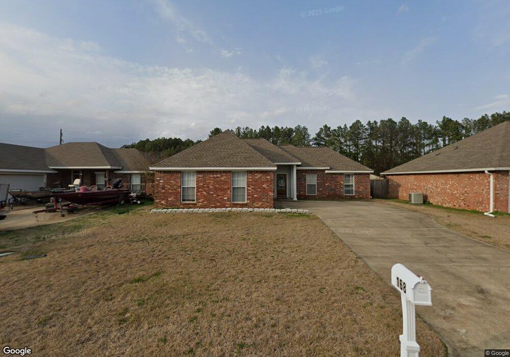
This home is located at 168 Cedar Spring Cir Unit (LOT 45), Pearl, MS 39208 and is currently estimated at $204,979, approximately $166 per square foot. 168 Cedar Spring Cir Unit (LOT 45) is a home located in Rankin County with nearby schools including McLaurin Elementary School.
Ownership History
Date
Name
Owned For
Owner Type
Purchase Details
Closed on
Apr 5, 2022
Sold by
Ohair Michael A
Bought by
Sanders Melissa
Current Estimated Value
Purchase Details
Closed on
Feb 17, 2015
Sold by
Secretary Of Veterans Affairs
Bought by
Ohair Michael Anthony and Ohair Jillian Brooke
Home Financials for this Owner
Home Financials are based on the most recent Mortgage that was taken out on this home.
Original Mortgage
$100,642
Interest Rate
3.74%
Mortgage Type
Purchase Money Mortgage
Purchase Details
Closed on
Jun 4, 2014
Bought by
The Secretary Of Veterans Affairs
Create a Home Valuation Report for This Property
The Home Valuation Report is an in-depth analysis detailing your home's value as well as a comparison with similar homes in the area
Home Values in the Area
Average Home Value in this Area
Purchase History
| Date | Buyer | Sale Price | Title Company |
|---|---|---|---|
| Sanders Melissa | -- | New Title Company Name | |
| Ohair Michael Anthony | $100,900 | None Available | |
| The Secretary Of Veterans Affairs | -- | -- |
Source: Public Records
Mortgage History
| Date | Status | Borrower | Loan Amount |
|---|---|---|---|
| Previous Owner | Ohair Michael Anthony | $100,642 |
Source: Public Records
Tax History Compared to Growth
Tax History
| Year | Tax Paid | Tax Assessment Tax Assessment Total Assessment is a certain percentage of the fair market value that is determined by local assessors to be the total taxable value of land and additions on the property. | Land | Improvement |
|---|---|---|---|---|
| 2024 | $1,844 | $18,683 | $0 | $0 |
| 2023 | $1,833 | $18,564 | $0 | $0 |
| 2022 | $1,805 | $18,564 | $0 | $0 |
| 2021 | $1,805 | $18,564 | $0 | $0 |
| 2020 | $1,805 | $18,564 | $0 | $0 |
| 2019 | $1,665 | $16,653 | $0 | $0 |
| 2018 | $1,632 | $16,653 | $0 | $0 |
| 2017 | $1,632 | $16,653 | $0 | $0 |
| 2016 | $1,501 | $16,137 | $0 | $0 |
| 2015 | $1,501 | $16,137 | $0 | $0 |
| 2014 | $1,466 | $16,137 | $0 | $0 |
| 2013 | -- | $16,137 | $0 | $0 |
Source: Public Records
Map
Nearby Homes
- 605 Cedar Hill Dr
- 606 Cedar Hill Dr
- 406 Cedar Hill Dr
- Aldridge Plan at Cedar Lane
- Freeport Plan at Cedar Lane
- 103 Cedar Ridge Blvd
- 305 Cedar Crest Dr
- 304 Cedar Hill Dr
- 308 London Way
- 307 Cedar Crest Dr
- 508 Ridgecrest Dr
- 00 Whitfield Rd
- 606 Cedar Place
- 607 Cedar Place
- 320 Cedar Hill Dr
- 603 Cedar Place
- 605 Cedar Place
- 241 Trace Dr
- 243 Trace Dr
- 505 Arden Dr
- 168 Cedar Spring Cir
- 166 Cedar Springs Cir
- 170 Cedar Spring Cir
- 170 Cedar Spring Cir Unit (Lot 44)
- 172 Cedar Spring Cir
- 164 Cedar Springs Cir
- 164 Cedar Spring Cir
- 164 Cedar Spring Cir Unit CIR
- 169 Cedar Springs Cir
- 169 Cedar Spring Cir
- 169 Cedar Spring Cir Unit (LOT 34 )
- 169 Cedar Spring Cir Unit CIR
- 171 Cedar Spring Cir
- 171 Cedar Spring Cir Unit (LOT 35)
- 162 Cedar Spring Cir
- 167 Cedar Spring Cir
- 167 Cedar Spring Cir Unit (LOT 33)
- 173 Cedar Spring Cir
- 174 Cedar Spring Cir
- 153 Cedar Spring Cir