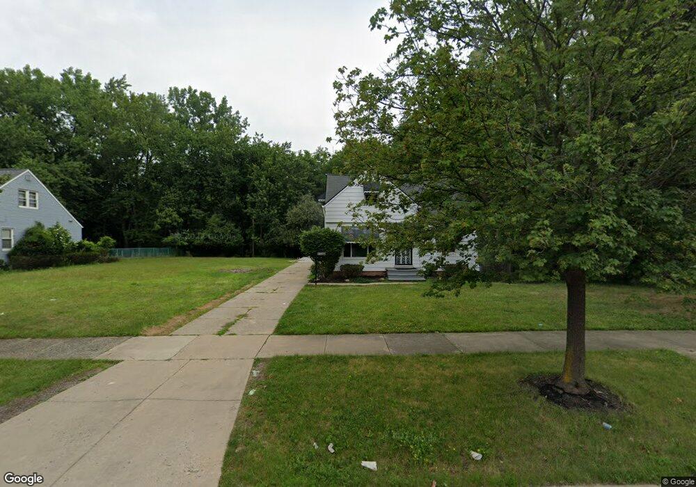
16801 Raymond St Maple Heights, OH 44137
Estimated Value: $20,000 - $381,000
2
Beds
1
Bath
1,257
Sq Ft
$160/Sq Ft
Est. Value
About This Home
This home is located at 16801 Raymond St, Maple Heights, OH 44137 and is currently estimated at $200,500, approximately $159 per square foot. 16801 Raymond St is a home located in Cuyahoga County with nearby schools including Abraham Lincoln Elementary School, Rockside/ J.F. Kennedy School, and Italy High School.
Ownership History
Date
Name
Owned For
Owner Type
Purchase Details
Closed on
Oct 30, 2025
Sold by
Vc Housing
Bought by
Patricks Enterprises Llc
Current Estimated Value
Purchase Details
Closed on
Jan 28, 2021
Sold by
Jordan Charles and County Of Cuyahoga
Bought by
Vc Housing
Purchase Details
Closed on
Jul 27, 2010
Sold by
Cuyahoga County Land Reutilization Corpo
Bought by
Jordan Charles E
Purchase Details
Closed on
Jun 29, 2010
Sold by
Stevens Julio
Bought by
Cuyahoga County Land Reutilization Corpo
Purchase Details
Closed on
Feb 11, 2010
Sold by
Flagstar Bank Fsb
Bought by
Stevens Julio
Purchase Details
Closed on
Oct 27, 2008
Sold by
Cottingham Daniel and Cottingham Dawn
Bought by
Flagstar Bank Fsb
Purchase Details
Closed on
May 7, 1993
Sold by
Prosser Carmen Marie
Bought by
Sec. Of H.U.D.
Purchase Details
Closed on
May 14, 1990
Sold by
Prosser Gordon C
Bought by
Prosser Carmen Marie
Purchase Details
Closed on
Nov 25, 1986
Sold by
Difranco Santina
Bought by
Prosser Gordon C
Purchase Details
Closed on
Jan 1, 1975
Bought by
Difranco John and Difranco Santina
Create a Home Valuation Report for This Property
The Home Valuation Report is an in-depth analysis detailing your home's value as well as a comparison with similar homes in the area
Home Values in the Area
Average Home Value in this Area
Purchase History
| Date | Buyer | Sale Price | Title Company |
|---|---|---|---|
| Patricks Enterprises Llc | $8,820 | None Listed On Document | |
| Vc Housing | $10,700 | None Available | |
| Jordan Charles E | -- | Public | |
| Cuyahoga County Land Reutilization Corpo | -- | Attorney | |
| Stevens Julio | $1,000 | None Available | |
| Flagstar Bank Fsb | $16,667 | None Available | |
| Sec. Of H.U.D. | -- | -- | |
| Prosser Carmen Marie | -- | -- | |
| Prosser Gordon C | $24,500 | -- | |
| Difranco Santina | $24,500 | -- | |
| Difranco John | -- | -- |
Source: Public Records
Tax History Compared to Growth
Tax History
| Year | Tax Paid | Tax Assessment Tax Assessment Total Assessment is a certain percentage of the fair market value that is determined by local assessors to be the total taxable value of land and additions on the property. | Land | Improvement |
|---|---|---|---|---|
| 2024 | $600 | $5,145 | $5,145 | -- |
| 2023 | $642 | $5,150 | $5,150 | $0 |
| 2022 | $640 | $5,145 | $5,145 | $0 |
| 2021 | $677 | $5,150 | $5,150 | $0 |
| 2020 | $424 | $3,890 | $3,890 | $0 |
| 2019 | $451 | $11,100 | $11,100 | $0 |
| 2018 | $450 | $3,890 | $3,890 | $0 |
| 2017 | $341 | $1,790 | $1,790 | $0 |
| 2016 | $749 | $1,790 | $1,790 | $0 |
| 2015 | $481 | $1,790 | $1,790 | $0 |
| 2014 | $481 | $1,960 | $1,960 | $0 |
Source: Public Records
Map
Nearby Homes
- 5210 Theodore St
- 16712 Kollin Ave
- 16241 Glenburn Ave
- 5208 Clement Ave
- 5185 Clement Ave
- 5082 Philip Ave
- 5110 Philip Ave
- 5061 Philip Ave
- 5212 Catherine St
- 5247 Henry St
- 5231 Philip Ave
- 15911 Friend Ave
- 5320 Clement Ave
- 5257 Philip Ave
- 5031 Cato St
- 16312 Sunny Glenn Ave
- 16216 Sunny Glenn Ave
- 5199 Arch St
- 5205 Stanley Ave
- 5239 Arch St
- 16713 Raymond St
- 16805 Raymond St
- 16705 Raymond St
- 16895 Raymond St
- 16800 Raymond St
- 16716 Raymond St
- 5101 Theodore St
- 16617 Raymond St
- 16804 Raymond St
- 16901 Raymond St
- 16808 Raymond St
- 5107 Theodore St
- 16613 Raymond St
- 16812 Raymond St
- 16911 Raymond St
- 16816 Raymond St
- 5109 Theodore St
- 16650 Anthony St
- 16900 Raymond St
- 16605 Raymond St