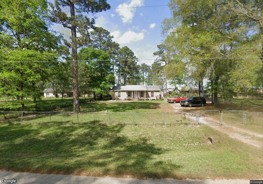
16805 Springfield Dr Conroe, TX 77302
Estimated Value: $209,680 - $302,000
Studio
1
Bath
1,274
Sq Ft
$198/Sq Ft
Est. Value
About This Home
This home is located at 16805 Springfield Dr, Conroe, TX 77302 and is currently estimated at $252,420, approximately $198 per square foot. 16805 Springfield Dr is a home located in Montgomery County with nearby schools including Grangerland Intermediate School, Moorhead Junior High School, and Caney Creek High School.
Ownership History
Date
Name
Owned For
Owner Type
Purchase Details
Closed on
Mar 24, 2025
Sold by
Brunton James Lowell and Brunton John Allen
Bought by
Campos Tammy L
Current Estimated Value
Home Financials for this Owner
Home Financials are based on the most recent Mortgage that was taken out on this home.
Original Mortgage
$143,453
Outstanding Balance
$142,722
Interest Rate
6.89%
Mortgage Type
FHA
Estimated Equity
$109,698
Purchase Details
Closed on
Apr 15, 1997
Sold by
Brunton Barbara E
Bought by
Brunton Andrew A
Purchase Details
Closed on
Aug 31, 1990
Sold by
Hensley Kenneth R and Hensley Carla J
Bought by
Brunton Andrew
Create a Home Valuation Report for This Property
The Home Valuation Report is an in-depth analysis detailing your home's value as well as a comparison with similar homes in the area
Home Values in the Area
Average Home Value in this Area
Purchase History
| Date | Buyer | Sale Price | Title Company |
|---|---|---|---|
| Campos Tammy L | -- | Stewart Title Of Montgomery Co | |
| Brunton Andrew A | -- | -- | |
| Brunton Andrew | -- | -- |
Source: Public Records
Mortgage History
| Date | Status | Borrower | Loan Amount |
|---|---|---|---|
| Open | Campos Tammy L | $143,453 |
Source: Public Records
Tax History
| Year | Tax Paid | Tax Assessment Tax Assessment Total Assessment is a certain percentage of the fair market value that is determined by local assessors to be the total taxable value of land and additions on the property. | Land | Improvement |
|---|---|---|---|---|
| 2025 | $90 | $178,624 | $57,681 | $120,943 |
| 2024 | $90 | $92,224 | -- | -- |
| 2023 | $74 | $83,840 | $57,680 | $100,060 |
| 2022 | $1,324 | $76,220 | $57,680 | $74,730 |
| 2021 | $1,281 | $69,290 | $28,840 | $49,380 |
| 2020 | $1,225 | $62,990 | $28,840 | $52,050 |
| 2019 | $1,153 | $57,260 | $4,330 | $80,970 |
| 2018 | $222 | $52,050 | $4,330 | $80,970 |
| 2017 | $956 | $47,320 | $4,330 | $80,970 |
| 2016 | $869 | $43,020 | $4,330 | $85,130 |
| 2015 | $48 | $39,110 | $4,330 | $59,270 |
| 2014 | $48 | $35,550 | $4,330 | $36,990 |
Source: Public Records
Map
Nearby Homes
- 16980 Hazelnut Dr
- 16976 Hazelnut Dr
- 16994 Hazelnut Dr
- 16889 Springfield Dr
- 17002 Hazelnut Dr
- 16981 Hazelnut Dr
- 16969 Hazelnut Dr
- 17014 Hazelnut Dr
- 14337 Ash Tree Dr
- 14325 Ash Tree Dr
- 16874 Needlepoint Dr
- 16866 Needlepoint Dr
- 14308 Ash Tree Dr
- 16858 Needlepoint Dr
- 16900 Hazelnut Dr
- 16875 Needlepoint Dr
- 14300 Ash Tree Dr
- 16891 Needlepoint Dr
- 16849 Needlepoint Dr
- 16841 Needlepoint Dr
- 16783 Springfield Dr
- 16845 Springfield Dr
- 16786 Springfield Dr
- 16723 Springfield Dr Unit 1
- 16822 Springfield Dr
- 15248 Rusty Oak Trail
- 16758 Springfield Dr
- 16885 Springfield Dr
- 15231 Rusty Oak Trail
- 16693 Springfield Dr
- 16998 Hazelnut Dr
- 16948 Hazelnut Dr
- 16956 Hazelnut Dr
- 16730 Springfield Dr
- 16949 Hazelnut Dr
- 16937 Hazelnut Dr
- 16886 Springfield Dr
- 16997 Hazelnut Dr
- 16698 Springfield Dr
- 16854 Bristle Cone Way
Your Personal Tour Guide
Ask me questions while you tour the home.