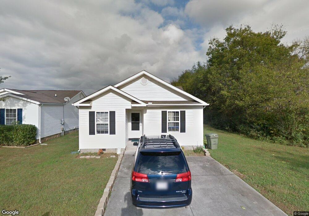
1681 Sails Way Knoxville, TN 37932
West Knoxville NeighborhoodEstimated Value: $269,000 - $309,616
3
Beds
2
Baths
1,180
Sq Ft
$247/Sq Ft
Est. Value
About This Home
This home is located at 1681 Sails Way, Knoxville, TN 37932 and is currently estimated at $291,404, approximately $246 per square foot. 1681 Sails Way is a home located in Knox County with nearby schools including Ball Camp Elementary School, Cedar Bluff Middle School, and Hardin Valley Academy.
Ownership History
Date
Name
Owned For
Owner Type
Purchase Details
Closed on
Sep 29, 2008
Sold by
Yeary Stone Leontyne and Stone David
Bought by
Sayani Jamaludin and Sayani Hamida
Current Estimated Value
Home Financials for this Owner
Home Financials are based on the most recent Mortgage that was taken out on this home.
Original Mortgage
$90,504
Outstanding Balance
$60,241
Interest Rate
6.45%
Mortgage Type
Purchase Money Mortgage
Estimated Equity
$231,163
Purchase Details
Closed on
Sep 30, 1999
Sold by
Carlton Enterprises Inc
Bought by
Yeary Leontyne
Home Financials for this Owner
Home Financials are based on the most recent Mortgage that was taken out on this home.
Original Mortgage
$85,439
Interest Rate
7.89%
Mortgage Type
FHA
Create a Home Valuation Report for This Property
The Home Valuation Report is an in-depth analysis detailing your home's value as well as a comparison with similar homes in the area
Home Values in the Area
Average Home Value in this Area
Purchase History
| Date | Buyer | Sale Price | Title Company |
|---|---|---|---|
| Sayani Jamaludin | $113,130 | Admiral Title Inc | |
| Yeary Leontyne | $85,483 | -- |
Source: Public Records
Mortgage History
| Date | Status | Borrower | Loan Amount |
|---|---|---|---|
| Open | Sayani Jamaludin | $90,504 | |
| Previous Owner | Yeary Leontyne | $85,439 |
Source: Public Records
Tax History Compared to Growth
Tax History
| Year | Tax Paid | Tax Assessment Tax Assessment Total Assessment is a certain percentage of the fair market value that is determined by local assessors to be the total taxable value of land and additions on the property. | Land | Improvement |
|---|---|---|---|---|
| 2024 | $742 | $47,725 | $0 | $0 |
| 2023 | $742 | $47,725 | $0 | $0 |
| 2022 | $742 | $47,725 | $0 | $0 |
| 2021 | $531 | $25,025 | $0 | $0 |
| 2020 | $531 | $25,025 | $0 | $0 |
| 2019 | $531 | $25,025 | $0 | $0 |
| 2018 | $531 | $25,025 | $0 | $0 |
| 2017 | $531 | $25,025 | $0 | $0 |
| 2016 | $585 | $0 | $0 | $0 |
| 2015 | $585 | $0 | $0 | $0 |
| 2014 | $585 | $0 | $0 | $0 |
Source: Public Records
Map
Nearby Homes
- 10548 Lone Star Way
- 10220 Colt Haven Dr
- 1909 Cedardale Ln
- 1714 Yearling Rd
- 1177 Hamilton Farm Ln
- 1844 Pinestraw Ln
- 1809 Plumb Branch Rd Unit I
- 1801 Plumb Branch Rd
- 10320 Boston Ln
- 10609 Sprawls Point
- 10517 Odin St
- 1145 Hamilton Farm Ln
- 1933 Plumb Creek Cir
- 1055 Blinken St
- 2013 Thompson Rd
- 10300 Mantooth Ln
- 10732 Yarnell Rd
- 10604 Alameda Dr
- 10319 Harrison Springs Ln
- 1300 Whittbier Dr
- 1681 Sails Way Unit End
- 1685 Sails Way
- 1689 Sails Way
- 1693 Sails Way
- 10556 Lone Star Way
- 1680 Sails Way
- 10552 Lone Star Way
- 1684 Sails Way
- 1671 Sails Way
- 1688 Sails Way
- 10611 Bitteroot Way
- 1692 Sails Way
- 1663 Sails Way
- 1701 Sails Way
- 10617 Bitteroot Way
- 10544 Lone Star Way
- 1701 Delmonte Way
- 10610 Lone Star Way
- 10623 Bitteroot Way
- 10540 Lone Star Way