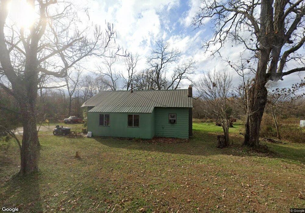
1681 State Route V Mountain View, MO 65548
Estimated Value: $55,483 - $140,000
--
Bed
--
Bath
888
Sq Ft
$129/Sq Ft
Est. Value
About This Home
This home is located at 1681 State Route V, Mountain View, MO 65548 and is currently estimated at $114,621, approximately $129 per square foot. 1681 State Route V is a home with nearby schools including Liberty Senior High School.
Ownership History
Date
Name
Owned For
Owner Type
Purchase Details
Closed on
Sep 29, 2022
Sold by
Piotrowski Phillips Kimberly Ann
Bought by
Ramey David
Current Estimated Value
Purchase Details
Closed on
Jul 7, 2021
Sold by
Phillips Billy Wayne
Bought by
Piotrowski Kimberley Ann
Purchase Details
Closed on
Jul 20, 2011
Sold by
Fellows Charles L
Bought by
Phillips Billy and Phillips Kimberly
Home Financials for this Owner
Home Financials are based on the most recent Mortgage that was taken out on this home.
Original Mortgage
$21,001
Interest Rate
4.52%
Mortgage Type
Future Advance Clause Open End Mortgage
Create a Home Valuation Report for This Property
The Home Valuation Report is an in-depth analysis detailing your home's value as well as a comparison with similar homes in the area
Home Values in the Area
Average Home Value in this Area
Purchase History
| Date | Buyer | Sale Price | Title Company |
|---|---|---|---|
| Ramey David | -- | Powell Crews Title & Escrow | |
| Piotrowski Kimberley Ann | -- | None Available | |
| Phillips Billy | -- | None Available |
Source: Public Records
Mortgage History
| Date | Status | Borrower | Loan Amount |
|---|---|---|---|
| Previous Owner | Phillips Billy | $21,001 |
Source: Public Records
Tax History Compared to Growth
Tax History
| Year | Tax Paid | Tax Assessment Tax Assessment Total Assessment is a certain percentage of the fair market value that is determined by local assessors to be the total taxable value of land and additions on the property. | Land | Improvement |
|---|---|---|---|---|
| 2025 | $272 | $7,190 | $3,490 | $3,700 |
| 2024 | $268 | $6,420 | -- | -- |
| 2023 | $268 | $6,420 | $0 | $0 |
| 2022 | $259 | $6,220 | $0 | $0 |
| 2021 | $253 | $6,220 | $0 | $0 |
| 2020 | $253 | $6,060 | $0 | $0 |
| 2019 | $253 | $6,060 | $0 | $0 |
| 2018 | $231 | $5,490 | $0 | $0 |
| 2017 | $358 | $7,940 | $0 | $0 |
| 2015 | -- | $7,940 | $0 | $0 |
| 2014 | -- | $7,940 | $0 | $0 |
| 2013 | -- | $7,940 | $0 | $0 |
Source: Public Records
Map
Nearby Homes
- 6416 U S 60
- 2191 County Road 2790
- 000 Private Road 2532
- Private Road 2532
- Private Road 2532
- 6200 County Road 3440
- 6037 Private Road 2422
- 2405 County Road 2710
- 1243 County Road 2410
- 1498 State Route Ra
- 000 County Road 2410
- 7876 County Road 3400
- 000 Private Road 3424
- 1003 County Road 3030
- Tbd Private Road 3424
- 1786 County Road 2030
- 960 County Road 3030
- 7702 County Road 2800
- 0 County Road 3200
- 000 County Road 3200
- 1639 State Route V
- 1682 State Route V
- 1684 County Road 2650
- 0 Hwy 60
- 0 Hwy 60 Unit 16049600
- 1746 State Route V
- 1644 County Road 2650
- 6735 Us Highway 60
- 1806 State Route V
- 6887 Us Highway 60
- 1543 County Road 2650
- Tbd Highway 60 & County Road 2650
- 1871 State Route V
- Tbd State Route V
- 0 State Route V
- 1876 State Route V
- 6962 U S 60
- 6962 Highway 60
- 1506 County Road 2650
- 6937 Us Highway 60
