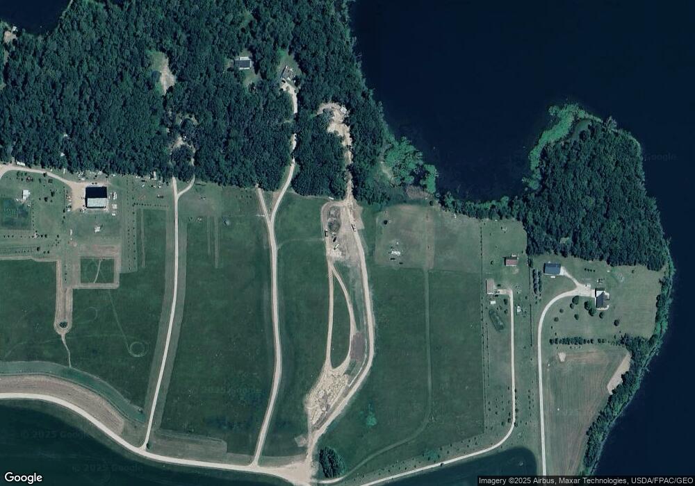
16817 472nd St Pelican Rapids, MN 56572
Estimated Value: $273,000 - $687,000
--
Bed
--
Bath
900
Sq Ft
$448/Sq Ft
Est. Value
About This Home
This home is located at 16817 472nd St, Pelican Rapids, MN 56572 and is currently estimated at $403,515, approximately $448 per square foot. 16817 472nd St is a home with nearby schools including Viking Elementary School and Pelican Rapids Secondary School.
Ownership History
Date
Name
Owned For
Owner Type
Purchase Details
Closed on
Oct 9, 2017
Sold by
Future Generations Llc
Bought by
Desouza Alexandre and Checco Desouza A
Current Estimated Value
Purchase Details
Closed on
Jun 30, 2016
Bought by
Anderson Blake and Anderson Laura
Home Financials for this Owner
Home Financials are based on the most recent Mortgage that was taken out on this home.
Original Mortgage
$13,000
Interest Rate
3.66%
Purchase Details
Closed on
Jun 10, 2016
Bought by
Anderson Blake and Anderson Laura
Home Financials for this Owner
Home Financials are based on the most recent Mortgage that was taken out on this home.
Original Mortgage
$13,000
Interest Rate
3.66%
Purchase Details
Closed on
Mar 12, 2014
Bought by
Peterson Steven and Peterson Barbara
Home Financials for this Owner
Home Financials are based on the most recent Mortgage that was taken out on this home.
Original Mortgage
$34,500
Interest Rate
4.35%
Purchase Details
Closed on
Nov 5, 2005
Sold by
Augustus Wayne Wayne
Create a Home Valuation Report for This Property
The Home Valuation Report is an in-depth analysis detailing your home's value as well as a comparison with similar homes in the area
Home Values in the Area
Average Home Value in this Area
Purchase History
| Date | Buyer | Sale Price | Title Company |
|---|---|---|---|
| Desouza Alexandre | $47,500 | Becker Cnty Title Svcs Inc | |
| Anderson Blake | $58,000 | -- | |
| Anderson Blake | $58,000 | -- | |
| Peterson Steven | $39,000 | -- | |
| -- | $66,600 | -- |
Source: Public Records
Mortgage History
| Date | Status | Borrower | Loan Amount |
|---|---|---|---|
| Previous Owner | Anderson Blake | $13,000 | |
| Previous Owner | Peterson Steven | $34,500 |
Source: Public Records
Tax History Compared to Growth
Tax History
| Year | Tax Paid | Tax Assessment Tax Assessment Total Assessment is a certain percentage of the fair market value that is determined by local assessors to be the total taxable value of land and additions on the property. | Land | Improvement |
|---|---|---|---|---|
| 2025 | $1,844 | $377,300 | $188,300 | $189,000 |
| 2024 | $830 | $288,300 | $149,900 | $138,400 |
| 2023 | $830 | $122,300 | $122,300 | $0 |
| 2022 | $636 | $83,000 | $0 | $0 |
| 2021 | $574 | $122,300 | $122,300 | $0 |
| 2020 | $592 | $71,100 | $71,100 | $0 |
| 2019 | $596 | $71,100 | $71,100 | $0 |
| 2018 | $830 | $71,100 | $71,100 | $0 |
| 2017 | $676 | $88,300 | $88,300 | $0 |
| 2016 | $1,218 | $149,400 | $149,400 | $0 |
| 2015 | $1,104 | $0 | $0 | $0 |
| 2014 | -- | $166,200 | $166,200 | $0 |
Source: Public Records
Map
Nearby Homes
- 17021 470th St
- 18766 Minnesota 34
- 48441 Pike Beach Trail
- 48987 Tamarac Dr
- TBD 147th Ave S
- TBD W Lake Olaf Rd
- 50412 Anderson Beach Trail
- 48366 County Highway 9
- 20473 Leisure Dr
- 21297 Lot 3 Broadwater Dr
- 21297 Lot 5 Broadwater Dr
- 21297 Lot 2 Broadwater Dr
- 148XX Co Hwy 30 [C]
- 149XX Co Hwy 30 [D]
- 51509 County Hwy 9
- 15544 260th St S
- 26147 154 Ave S
- 26203 154 Ave S
- 46520 Poss Beach Rd
- 26085 154 Ave S
- Tract K 165th Ave
- 16831 472nd St
- 16741 472nd St
- Tract J 165th Ave
- 16795 472nd St
- 16839 472nd St
- 16791 472nd St
- Tract G 165th Ave
- Tract F 165th Ave
- TRACT E 472nd St
- TRACT C 472nd St
- 16585 472nd St
- 16782 476th St
- 47486 165th Ave
- 16928 476th St
- 16806 476th St
- 16734 476th St
- 16658 476th St
- 476 Th St
- 0 Lot 12 476th St Unit 3547314
