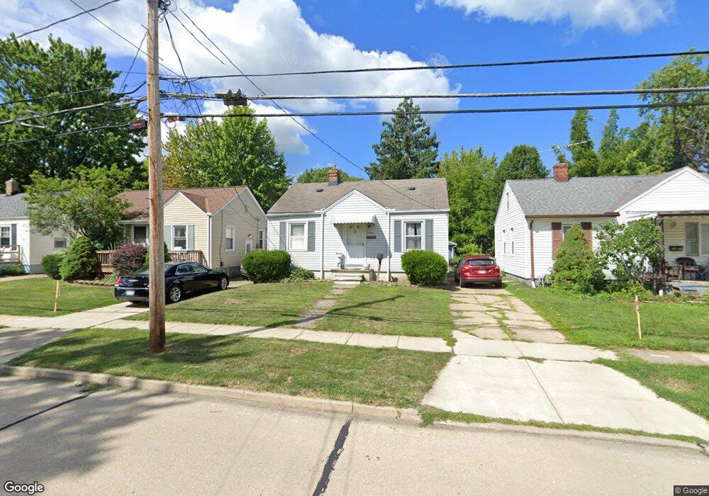
1682 Mapledale Rd Wickliffe, OH 44092
Estimated Value: $156,000 - $194,000
3
Beds
1
Bath
971
Sq Ft
$176/Sq Ft
Est. Value
About This Home
This home is located at 1682 Mapledale Rd, Wickliffe, OH 44092 and is currently estimated at $170,784, approximately $175 per square foot. 1682 Mapledale Rd is a home located in Lake County with nearby schools including Wickliffe Elementary School, Wickliffe Middle School, and Wickliffe High School.
Ownership History
Date
Name
Owned For
Owner Type
Purchase Details
Closed on
Apr 1, 2016
Sold by
Buchheit David L and Buchheit Debra C
Bought by
Buchheit David L
Current Estimated Value
Purchase Details
Closed on
Jan 14, 2002
Sold by
Buckheit David L
Bought by
Buchheit David L and Buchheit Debra C
Home Financials for this Owner
Home Financials are based on the most recent Mortgage that was taken out on this home.
Original Mortgage
$80,000
Interest Rate
6.58%
Purchase Details
Closed on
Mar 11, 1976
Bought by
Buckheit David L
Create a Home Valuation Report for This Property
The Home Valuation Report is an in-depth analysis detailing your home's value as well as a comparison with similar homes in the area
Home Values in the Area
Average Home Value in this Area
Purchase History
| Date | Buyer | Sale Price | Title Company |
|---|---|---|---|
| Buchheit David L | -- | Emerald Glen Title Agency | |
| Buchheit David L | -- | Real Estate Title | |
| Buckheit David L | -- | -- |
Source: Public Records
Mortgage History
| Date | Status | Borrower | Loan Amount |
|---|---|---|---|
| Closed | Buchheit David L | $80,000 | |
| Closed | Buchheit David L | $10,000 |
Source: Public Records
Tax History
| Year | Tax Paid | Tax Assessment Tax Assessment Total Assessment is a certain percentage of the fair market value that is determined by local assessors to be the total taxable value of land and additions on the property. | Land | Improvement |
|---|---|---|---|---|
| 2025 | -- | $49,680 | $14,050 | $35,630 |
| 2024 | -- | $49,680 | $14,050 | $35,630 |
| 2023 | $4,160 | $33,830 | $12,130 | $21,700 |
| 2022 | $2,527 | $33,830 | $12,130 | $21,700 |
| 2021 | $2,505 | $33,830 | $12,130 | $21,700 |
| 2020 | $2,295 | $27,070 | $9,710 | $17,360 |
| 2019 | $2,294 | $27,070 | $9,710 | $17,360 |
| 2018 | $1,951 | $27,270 | $9,470 | $17,800 |
| 2017 | $1,920 | $27,270 | $9,470 | $17,800 |
| 2016 | $1,911 | $27,270 | $9,470 | $17,800 |
| 2015 | $1,877 | $27,270 | $9,470 | $17,800 |
| 2014 | $1,653 | $27,270 | $9,470 | $17,800 |
| 2013 | $1,652 | $27,270 | $9,470 | $17,800 |
Source: Public Records
Map
Nearby Homes
- 1677 Mapledale Rd
- 1677 Douglas Rd
- 30530 Grant St
- 1604 Empire Rd
- 5430 Oak Ridge Dr
- 1784 Empire Rd
- 1554 Rush Rd
- 5485 Wildwood Ct Unit D
- 1522 Mapledale Rd
- 1849 Empire Rd
- 1739 Ridgeview Dr
- 5481 Millwood Ln Unit C
- 34345 Giovanni Ave
- 5463 Millwood Ln Unit 42C
- 5548 Ivy Ct Unit C
- 5121 Shepherds Glen
- 5112 Shepherds Glen
- 1842 Eldon Dr
- 5110 Shepherds Glen
- 261 Chelsea Dr
- 1678 Mapledale Rd
- 1686 Mapledale Rd
- 1674 Mapledale Rd
- 1690 Mapledale Rd
- 1887 Harding Dr
- 1883 Harding Dr
- 1670 Mapledale Rd
- 1895 Harding Dr
- 1681 Mapledale Rd
- 1685 Mapledale Rd
- 1666 Mapledale Rd
- 1698 Mapledale Rd
- 1899 Harding Dr
- 1671 Mapledale Rd
- 1689 Mapledale Rd
- 1879 Harding Dr
- 1669 Mapledale Rd
- 1693 Mapledale Rd
- 1662 Mapledale Rd
- 1702 Mapledale Rd
Your Personal Tour Guide
Ask me questions while you tour the home.