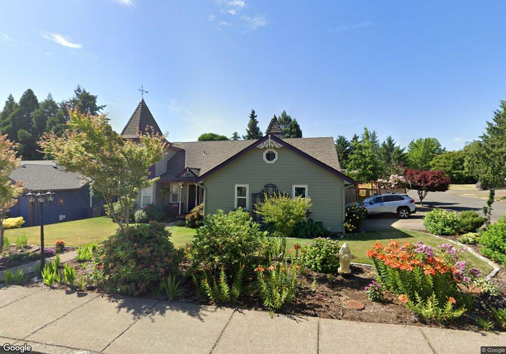
1684 Ammon St NW Salem, OR 97304
West Salem NeighborhoodEstimated Value: $557,959 - $601,000
3
Beds
3
Baths
2,586
Sq Ft
$222/Sq Ft
Est. Value
About This Home
This home is located at 1684 Ammon St NW, Salem, OR 97304 and is currently estimated at $573,490, approximately $221 per square foot. 1684 Ammon St NW is a home located in Polk County with nearby schools including Harritt Elementary School, Walker Middle School, and West Salem High School.
Ownership History
Date
Name
Owned For
Owner Type
Purchase Details
Closed on
Dec 2, 2005
Sold by
Torres Matt A and Torres Tracy L
Bought by
Bissell Lance A and Bissell Victoria A
Current Estimated Value
Home Financials for this Owner
Home Financials are based on the most recent Mortgage that was taken out on this home.
Original Mortgage
$245,955
Outstanding Balance
$136,384
Interest Rate
6.14%
Mortgage Type
Fannie Mae Freddie Mac
Estimated Equity
$437,106
Create a Home Valuation Report for This Property
The Home Valuation Report is an in-depth analysis detailing your home's value as well as a comparison with similar homes in the area
Home Values in the Area
Average Home Value in this Area
Purchase History
| Date | Buyer | Sale Price | Title Company |
|---|---|---|---|
| Bissell Lance A | $258,900 | Fidelity National Title |
Source: Public Records
Mortgage History
| Date | Status | Borrower | Loan Amount |
|---|---|---|---|
| Open | Bissell Lance A | $245,955 |
Source: Public Records
Tax History Compared to Growth
Tax History
| Year | Tax Paid | Tax Assessment Tax Assessment Total Assessment is a certain percentage of the fair market value that is determined by local assessors to be the total taxable value of land and additions on the property. | Land | Improvement |
|---|---|---|---|---|
| 2025 | $5,311 | $290,270 | $65,200 | $225,070 |
| 2024 | $5,311 | $281,820 | $63,310 | $218,510 |
| 2023 | $5,157 | $273,620 | $61,470 | $212,150 |
| 2022 | $4,992 | $265,660 | $59,680 | $205,980 |
| 2021 | $4,850 | $257,930 | $57,950 | $199,980 |
| 2020 | $4,706 | $250,420 | $56,260 | $194,160 |
| 2019 | $4,541 | $243,130 | $54,620 | $188,510 |
| 2018 | $4,466 | $236,050 | $53,030 | $183,020 |
| 2017 | $4,025 | $229,180 | $51,490 | $177,690 |
| 2016 | $3,929 | $222,510 | $49,990 | $172,520 |
| 2015 | $3,962 | $216,030 | $48,530 | $167,500 |
| 2014 | $3,780 | $209,740 | $47,120 | $162,620 |
Source: Public Records
Map
Nearby Homes
- 1553 Ammon St NW
- 2114 Mousebird Ave NW
- 2084 Mousebird Ave NW
- 1835 Wakefield Ct NW
- 1936 Orchard Heights Rd NW
- 2388 Westminster Ave NW
- 1417 Orchard Heights Rd NW
- 1375 Ranier Loop NW
- 1380 Ranier Loop NW
- 1664 Pelican Ct NW
- 2110 Woodhaven Ct NW
- 2438 Whetstone Ct NW
- 2075 Opaque Ave NW
- 1656 Ashland Ct NW
- 1842 Boulder Ridge Ct NW
- 1236 Redwood St NW
- 2367 Wilark Dr NW
- 2038 W Park Ct NW
- 1739 Gemma St NW
- 2334 Doaks Ferry Rd NW
- 1664 Ammon St NW
- 2054 Tanager Ave NW
- 1704 Ammon St NW
- 2064 Tanager Ave NW
- 1644 Ammon St NW
- 1683 Ammon St NW
- 1663 Ammon St NW
- 2043 Tanager Ave NW
- 2044 Tanager Ave NW
- 1714 Ammon St NW
- 1643 Ammon St NW
- 1624 Ammon St NW
- 2113 Tanager Ave NW
- 2144 Tanager Ave NW
- 2034 Tanager Ave NW
- 2033 Tanager Ave NW
- 2133 Tanager Ave NW
- 1623 Ammon St NW
- 1724 Ammon St NW
- 1627 Goldcrest Ave NW