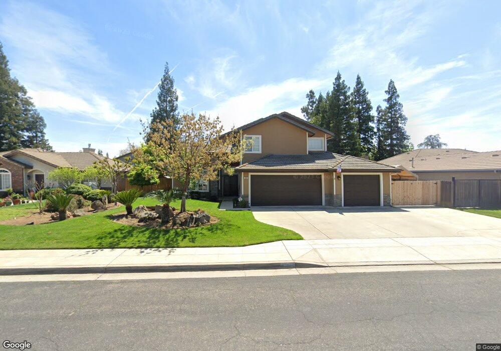
1684 Decatur Ave Clovis, CA 93611
Estimated Value: $633,000 - $674,000
5
Beds
3
Baths
2,652
Sq Ft
$244/Sq Ft
Est. Value
About This Home
This home is located at 1684 Decatur Ave, Clovis, CA 93611 and is currently estimated at $647,977, approximately $244 per square foot. 1684 Decatur Ave is a home located in Fresno County with nearby schools including Century Elementary School, Alta Sierra Intermediate School, and Buchanan High School.
Ownership History
Date
Name
Owned For
Owner Type
Purchase Details
Closed on
Oct 27, 1997
Sold by
Scott Woods
Bought by
Peters Kevin M and Peters Kimberly S
Current Estimated Value
Home Financials for this Owner
Home Financials are based on the most recent Mortgage that was taken out on this home.
Original Mortgage
$115,000
Outstanding Balance
$18,923
Interest Rate
7.31%
Estimated Equity
$629,054
Create a Home Valuation Report for This Property
The Home Valuation Report is an in-depth analysis detailing your home's value as well as a comparison with similar homes in the area
Home Values in the Area
Average Home Value in this Area
Purchase History
| Date | Buyer | Sale Price | Title Company |
|---|---|---|---|
| Peters Kevin M | $215,000 | North American Title Co |
Source: Public Records
Mortgage History
| Date | Status | Borrower | Loan Amount |
|---|---|---|---|
| Open | Peters Kevin M | $115,000 |
Source: Public Records
Tax History
| Year | Tax Paid | Tax Assessment Tax Assessment Total Assessment is a certain percentage of the fair market value that is determined by local assessors to be the total taxable value of land and additions on the property. | Land | Improvement |
|---|---|---|---|---|
| 2025 | $4,073 | $343,277 | $79,824 | $263,453 |
| 2023 | $3,919 | $329,949 | $76,725 | $253,224 |
| 2022 | $3,867 | $323,480 | $75,221 | $248,259 |
| 2021 | $3,738 | $317,139 | $73,747 | $243,392 |
| 2020 | $3,723 | $313,888 | $72,991 | $240,897 |
| 2019 | $3,651 | $307,734 | $71,560 | $236,174 |
| 2018 | $3,572 | $301,701 | $70,157 | $231,544 |
| 2017 | $3,511 | $295,786 | $68,782 | $227,004 |
| 2016 | $3,393 | $289,987 | $67,434 | $222,553 |
| 2015 | $3,341 | $285,633 | $66,422 | $219,211 |
| 2014 | $3,279 | $280,038 | $65,121 | $214,917 |
Source: Public Records
Map
Nearby Homes
- 1754 Decatur Ave
- 1977 Goshen Ave
- 878 N Ash Ave
- 2117 Goshen Ave
- 8220 N Fowler Ave
- 1323 Oak Ave
- 1303 Jordan Ave
- 971 N Filbert Ave
- 1124 Oak Ave
- 1490 Fir Ave
- 2361 Cromwell Ave
- 2089 Boccioni Ln
- 367 N Raphael Ln Unit 367
- 338 N Filbert Ave
- 2051 Los Altos Ave
- 1152 Lester Ave
- 3664 E Serena Ave
- 22 N Bliss Ave
- 2047 Menlo Ave
- 5211 E Shepherd Ave
- 1674 Decatur Ave
- 1724 Decatur Ave
- 1681 Cromwell Ave
- 1671 Cromwell Ave
- 1721 Cromwell Ave
- 1664 Decatur Ave
- 1734 Decatur Ave
- 1683 Decatur Ave
- 1673 Decatur Ave
- 1723 Decatur Ave
- 1661 Cromwell Ave
- 1731 Cromwell Ave
- 1663 Decatur Ave
- 1733 Decatur Ave
- 1654 Decatur Ave
- 1744 Decatur Ave
- 1651 Cromwell Ave
- 1741 Cromwell Ave
- 1653 Decatur Ave
- 1686 El Paso Ave
Your Personal Tour Guide
Ask me questions while you tour the home.