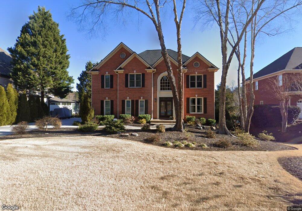
1684 Kenbrook Trace NW Unit 10 Acworth, GA 30101
Estimated Value: $680,000 - $880,000
4
Beds
4
Baths
3,629
Sq Ft
$209/Sq Ft
Est. Value
About This Home
This home is located at 1684 Kenbrook Trace NW Unit 10, Acworth, GA 30101 and is currently estimated at $759,504, approximately $209 per square foot. 1684 Kenbrook Trace NW Unit 10 is a home located in Cobb County with nearby schools including Ford Elementary School, Durham Middle School, and Harrison High School.
Ownership History
Date
Name
Owned For
Owner Type
Purchase Details
Closed on
Sep 8, 1994
Sold by
G Tech Const
Bought by
Solohub Roman T Jennifer S
Current Estimated Value
Home Financials for this Owner
Home Financials are based on the most recent Mortgage that was taken out on this home.
Original Mortgage
$235,600
Interest Rate
4.75%
Create a Home Valuation Report for This Property
The Home Valuation Report is an in-depth analysis detailing your home's value as well as a comparison with similar homes in the area
Home Values in the Area
Average Home Value in this Area
Purchase History
| Date | Buyer | Sale Price | Title Company |
|---|---|---|---|
| Solohub Roman T Jennifer S | $294,600 | -- |
Source: Public Records
Mortgage History
| Date | Status | Borrower | Loan Amount |
|---|---|---|---|
| Closed | Solohub Roman T Jennifer S | $235,600 |
Source: Public Records
Tax History Compared to Growth
Tax History
| Year | Tax Paid | Tax Assessment Tax Assessment Total Assessment is a certain percentage of the fair market value that is determined by local assessors to be the total taxable value of land and additions on the property. | Land | Improvement |
|---|---|---|---|---|
| 2025 | $1,668 | $252,212 | $33,600 | $218,612 |
| 2024 | $1,673 | $252,212 | $33,600 | $218,612 |
| 2023 | $1,467 | $252,212 | $33,600 | $218,612 |
| 2022 | $1,673 | $252,212 | $33,600 | $218,612 |
| 2021 | $1,539 | $207,576 | $33,600 | $173,976 |
| 2020 | $1,507 | $196,820 | $33,600 | $163,220 |
| 2019 | $5,038 | $196,820 | $33,600 | $163,220 |
| 2018 | $4,524 | $173,312 | $33,600 | $139,712 |
| 2017 | $4,356 | $173,312 | $33,600 | $139,712 |
| 2016 | $3,991 | $156,500 | $32,000 | $124,500 |
| 2015 | $3,827 | $145,168 | $31,200 | $113,968 |
| 2014 | $3,856 | $145,168 | $0 | $0 |
Source: Public Records
Map
Nearby Homes
- 5830 Brookstone Walk NW
- 1707 Kenbrook Ct NW
- 6065 Victoria Falls Overlook NW
- 5807 Brookstone Walk NW
- 1220 Waterfall Ln NW
- 1382 Benbrooke Ln NW
- 1401 Downington View NW
- 1391 Benbrooke Ln NW
- 1670 Knob Creek Ct NW
- 002 Knob Creek Ct NW
- 5881 Brookstone Walk NW
- 1377 Downington Ln NW
- 1134 Low Water Crossing
- 1094 Low Water Crossing
- 5893 Fords Rd
- 5573 Fallsbrook Trace NW
- 1114 Low Water Crossing
- 1106 Low Water Crossing
- 5885 Fords Rd
- 1314 Fallsbrook Terrace NW
- 1686 Kenbrook Trace NW
- 1682 Kenbrook Trace NW
- 1680 Kenbrook Trace NW
- 1683 Kenbrook Trace NW
- 6145 Kenbrook Dr NW
- 6141 Kenbrook Dr NW
- 1678 Kenbrook Trace NW
- 1679 Kenbrook Trace NW
- 6147 Kenbrook Dr NW
- 6142 Kenbrook Dr NW Unit 10
- 1676 Kenbrook Trace NW
- 6139 Kenbrook Dr NW
- 1677 Kenbrook Trace NW
- 6144 Kenbrook Dr NW Unit 10
- 1704 Kenbrook Ct NW
- 6140 Kenbrook Dr NW
- 1706 Kenbrook Ct NW
- 1712 Kenbrook Ct NW
- 1712 Kenbrook Ct NW
- 1675 Kenbrook Trace NW