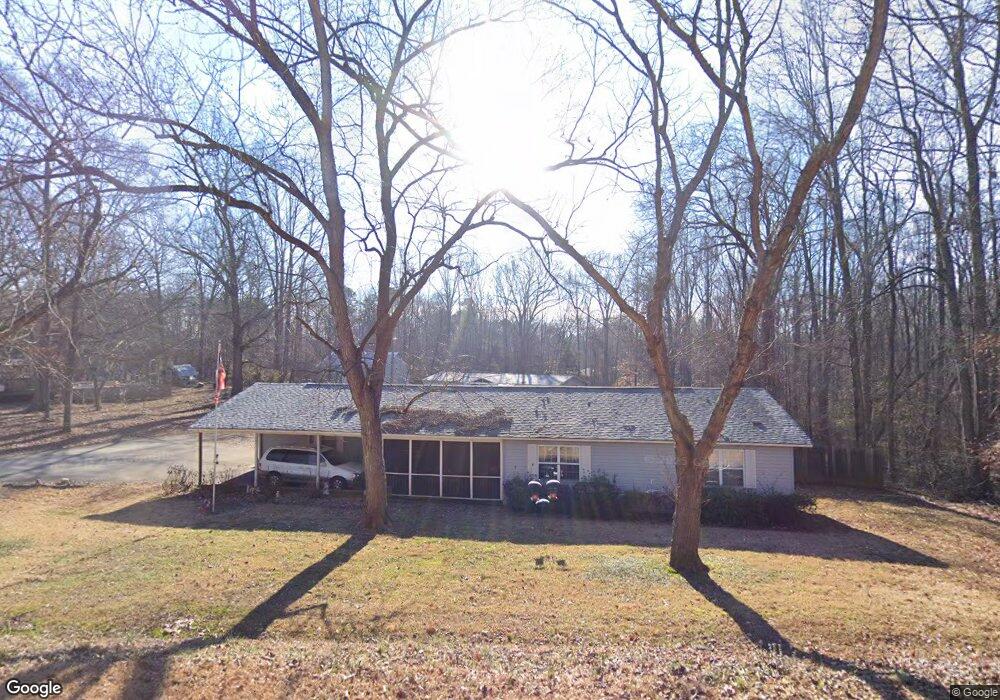
1684 Merritt Rd Fort Mill, SC 29715
Springfield NeighborhoodEstimated Value: $375,000 - $521,000
--
Bed
--
Bath
1,857
Sq Ft
$229/Sq Ft
Est. Value
About This Home
This home is located at 1684 Merritt Rd, Fort Mill, SC 29715 and is currently estimated at $424,991, approximately $228 per square foot. 1684 Merritt Rd is a home located in York County with nearby schools including Fort Mill Elementary School, Fort Mill Middle School, and Nation Ford High School.
Ownership History
Date
Name
Owned For
Owner Type
Purchase Details
Closed on
Apr 12, 2018
Sold by
Broome Matthew W and Broome Tonya H
Bought by
Broome Matthew W and Broome Tonya H
Current Estimated Value
Home Financials for this Owner
Home Financials are based on the most recent Mortgage that was taken out on this home.
Original Mortgage
$144,000
Outstanding Balance
$123,479
Interest Rate
4.5%
Mortgage Type
Adjustable Rate Mortgage/ARM
Estimated Equity
$301,512
Purchase Details
Closed on
Feb 21, 2018
Sold by
Broome Matthew W and Broome Tonya H
Bought by
Hutto Glene E and Hutto Linda A
Home Financials for this Owner
Home Financials are based on the most recent Mortgage that was taken out on this home.
Original Mortgage
$144,000
Outstanding Balance
$123,479
Interest Rate
4.5%
Mortgage Type
Adjustable Rate Mortgage/ARM
Estimated Equity
$301,512
Create a Home Valuation Report for This Property
The Home Valuation Report is an in-depth analysis detailing your home's value as well as a comparison with similar homes in the area
Home Values in the Area
Average Home Value in this Area
Purchase History
| Date | Buyer | Sale Price | Title Company |
|---|---|---|---|
| Broome Matthew W | -- | None Available | |
| Hutto Glene E | -- | None Available | |
| Broome Matthew W | $4,500 | None Available |
Source: Public Records
Mortgage History
| Date | Status | Borrower | Loan Amount |
|---|---|---|---|
| Open | Broome Matthew W | $144,000 |
Source: Public Records
Tax History Compared to Growth
Tax History
| Year | Tax Paid | Tax Assessment Tax Assessment Total Assessment is a certain percentage of the fair market value that is determined by local assessors to be the total taxable value of land and additions on the property. | Land | Improvement |
|---|---|---|---|---|
| 2024 | $991 | $5,612 | $1,205 | $4,407 |
| 2023 | $960 | $5,612 | $1,205 | $4,407 |
| 2022 | $952 | $5,612 | $1,205 | $4,407 |
| 2021 | -- | $5,612 | $1,205 | $4,407 |
| 2020 | $1,022 | $5,612 | $0 | $0 |
| 2019 | $1,020 | $6,780 | $0 | $0 |
| 2018 | $1,078 | $4,880 | $0 | $0 |
| 2017 | $1,017 | $4,880 | $0 | $0 |
| 2016 | $1,004 | $4,880 | $0 | $0 |
| 2014 | $784 | $4,880 | $1,400 | $3,480 |
| 2013 | $784 | $5,500 | $1,400 | $4,100 |
Source: Public Records
Map
Nearby Homes
- 002 Roanoke Dr
- 001 Roanoke Dr
- 000 Roanoke Dr
- 105 Redcoat Dr
- 121 Pelham Ln
- 118 Brookside Dr
- 323 Swamp Fox Dr
- 1565 Kennel Rd
- 4649 Cava Ct
- 1364 Regions Blvd
- 4049 Wild Turkey Ln
- 9848 Verdun Ct
- 1224 Regions Blvd
- 3942 Kestrel Ln
- 1185 Regions Blvd
- 3954 Kestrel Ln
- 3175 Montreaux Valley Dr
- 521 Vine St
- 9792 Verdun Ct
- 219 Maple St Unit 26
- 1680 Merritt Rd
- 1690 Merritt Rd
- 1695 Merritt Rd
- 1710 Merritt Rd
- 1685 Merritt Rd
- 568 Roanoke Dr
- 1720 Merritt Rd
- 1660 Merritt Rd
- 1645 Merritt Rd
- 1650 Merritt Rd
- 1730 Merritt Rd
- 1627 Merritt Rd
- 114 Fox Run Dr
- 559 Roanoke Dr
- 116 Fox Run Dr
- 110 Fox Run Dr
- 112 Fox Run Dr
- 1651 Merritt Rd
- 1636 Merritt Rd
- 118 Fox Run Dr