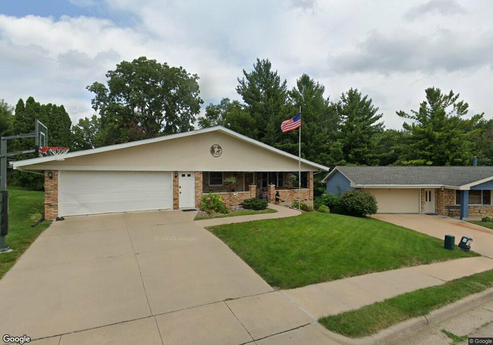
1685 Lori Ct Dubuque, IA 52001
Estimated Value: $258,000 - $319,000
3
Beds
2
Baths
1,276
Sq Ft
$231/Sq Ft
Est. Value
About This Home
This home is located at 1685 Lori Ct, Dubuque, IA 52001 and is currently estimated at $294,324, approximately $230 per square foot. 1685 Lori Ct is a home located in Dubuque County with nearby schools including Eisenhower Elementary School, Eleanor Roosevelt Middle School, and Dubuque Senior High School.
Ownership History
Date
Name
Owned For
Owner Type
Purchase Details
Closed on
May 30, 2019
Sold by
Beresford Terence H and Beresford Donna M
Bought by
Noel Regina R
Current Estimated Value
Home Financials for this Owner
Home Financials are based on the most recent Mortgage that was taken out on this home.
Original Mortgage
$172,000
Outstanding Balance
$150,916
Interest Rate
4.1%
Mortgage Type
New Conventional
Estimated Equity
$143,408
Create a Home Valuation Report for This Property
The Home Valuation Report is an in-depth analysis detailing your home's value as well as a comparison with similar homes in the area
Purchase History
| Date | Buyer | Sale Price | Title Company |
|---|---|---|---|
| Noel Regina R | $215,000 | Dalco Abstract Title Co |
Source: Public Records
Mortgage History
| Date | Status | Borrower | Loan Amount |
|---|---|---|---|
| Open | Noel Regina R | $172,000 |
Source: Public Records
Tax History
| Year | Tax Paid | Tax Assessment Tax Assessment Total Assessment is a certain percentage of the fair market value that is determined by local assessors to be the total taxable value of land and additions on the property. | Land | Improvement |
|---|---|---|---|---|
| 2025 | $3,744 | $290,200 | $37,900 | $252,300 |
| 2024 | $3,744 | $270,600 | $34,500 | $236,100 |
| 2023 | $3,632 | $270,600 | $34,500 | $236,100 |
| 2022 | $3,526 | $222,130 | $31,010 | $191,120 |
| 2021 | $3,526 | $222,130 | $31,010 | $191,120 |
| 2020 | $3,380 | $198,870 | $29,280 | $169,590 |
| 2019 | $3,576 | $198,870 | $29,280 | $169,590 |
| 2018 | $3,522 | $192,360 | $27,560 | $164,800 |
| 2017 | $3,150 | $192,360 | $27,560 | $164,800 |
| 2016 | $3,080 | $174,880 | $27,560 | $147,320 |
| 2015 | $3,080 | $174,880 | $27,560 | $147,320 |
| 2014 | $2,944 | $171,990 | $27,560 | $144,430 |
Source: Public Records
Map
Nearby Homes
- 1600 Lori St
- 1610 Kane St
- 2685 Renaissance Dr
- 2739 Balboa Dr
- 2930 Kane #1 St
- 2815 Wildwood Ct
- 3085 Kaufmann Ave
- 3085 Lindale St
- 610 Kurt Ct
- 2995 Asbury Rd
- 2185 Broadlawn Rd
- 2778 Oak Crest Dr
- 2548 Marywood Dr
- 847 Spires Dr
- 2290 Theda Dr
- 2665 Marywood Dr
- 2035 Broadlawn Rd
- 959 Clarke Dr
- 3163 Killarney Ct
- 2540 Clarke Crest Dr
- 1695 Lori Ct
- 1675 Lori Ct
- 1700 Scenic View Dr
- 1705 Lori St
- 1690 Lori Ct
- 1710 Scenic View Dr
- 1696 Scenic View Dr
- 1667 Lori Ct
- 1710 Sarah St
- 1725 Lori St
- 1650 Lori St
- 1720 Scenic View Dr
- 2605 Mesa Dr
- 1650 Lori Ct
- 1716 Sarah St
- 1665 Lori Ct
- 1690 Scenic View Dr
- 1733 Lori St
- 1730 Scenic View Dr
- 1705 Scenic View Dr
Your Personal Tour Guide
Ask me questions while you tour the home.