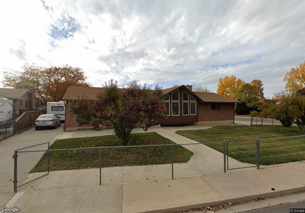
1685 N 680 W Orem, UT 84057
Aspen NeighborhoodEstimated Value: $526,000 - $572,000
3
Beds
2
Baths
2,698
Sq Ft
$202/Sq Ft
Est. Value
About This Home
This home is located at 1685 N 680 W, Orem, UT 84057 and is currently estimated at $545,451, approximately $202 per square foot. 1685 N 680 W is a home located in Utah County with nearby schools including Aspen Elementary School, Oak Canyon Junior High School, and Timpanogos High School.
Ownership History
Date
Name
Owned For
Owner Type
Purchase Details
Closed on
Jun 1, 2012
Sold by
Shurrleff Elaine A and Shurrleff Philip S
Bought by
Shurtleff Philip Sherrill and Shurtleff Elaine Aston
Current Estimated Value
Purchase Details
Closed on
Oct 10, 2001
Sold by
Beus Steven and Estate Of Dean Carter Mann
Bought by
Shurtleff Philip S and Shurtleff Elaine A
Home Financials for this Owner
Home Financials are based on the most recent Mortgage that was taken out on this home.
Original Mortgage
$90,000
Outstanding Balance
$35,281
Interest Rate
6.91%
Estimated Equity
$510,170
Create a Home Valuation Report for This Property
The Home Valuation Report is an in-depth analysis detailing your home's value as well as a comparison with similar homes in the area
Home Values in the Area
Average Home Value in this Area
Purchase History
| Date | Buyer | Sale Price | Title Company |
|---|---|---|---|
| Shurtleff Philip Sherrill | -- | None Available | |
| Shurtleff Philip S | -- | First American Title Co |
Source: Public Records
Mortgage History
| Date | Status | Borrower | Loan Amount |
|---|---|---|---|
| Open | Shurtleff Philip S | $90,000 |
Source: Public Records
Tax History
| Year | Tax Paid | Tax Assessment Tax Assessment Total Assessment is a certain percentage of the fair market value that is determined by local assessors to be the total taxable value of land and additions on the property. | Land | Improvement |
|---|---|---|---|---|
| 2025 | $2,006 | $258,665 | -- | -- |
| 2024 | $2,006 | $245,245 | $0 | $0 |
| 2023 | $1,849 | $243,045 | $0 | $0 |
| 2022 | $1,965 | $250,140 | $0 | $0 |
| 2021 | $1,830 | $352,900 | $155,800 | $197,100 |
| 2020 | $1,677 | $317,800 | $124,600 | $193,200 |
| 2019 | $1,516 | $298,700 | $124,600 | $174,100 |
| 2018 | $1,462 | $275,400 | $113,900 | $161,500 |
| 2017 | $1,383 | $139,535 | $0 | $0 |
| 2016 | $1,436 | $133,540 | $0 | $0 |
| 2015 | $1,323 | $116,380 | $0 | $0 |
| 2014 | $1,275 | $111,650 | $0 | $0 |
Source: Public Records
Map
Nearby Homes
- 1552 N 740 W
- 1545 N State St Unit 1
- 967 W 1630 N
- 1405 N 770 W
- 1663 N 980 W
- 1917 N 860 W
- 527 W 1450 N
- 512 W 1450 N
- 1948 N 520 W
- 1916 N 430 W
- 582 W 1300 N
- 1461 N Amiron Way Unit B
- 1547 N 275 West St Unit 5
- 1566 N 275 West St Unit 1
- 1548 N 275 West St Unit 2
- 1744 N 280 W
- 332 W Amiron Way Unit D
- 1244 N 580 W
- 1230 N 685 W
- 90 S 200 E
Your Personal Tour Guide
Ask me questions while you tour the home.