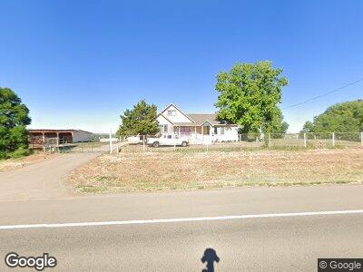
16885 Highway 491 Cortez, CO 81321
Estimated Value: $346,000 - $608,151
--
Bed
--
Bath
2,372
Sq Ft
$210/Sq Ft
Est. Value
About This Home
This home is located at 16885 Highway 491, Cortez, CO 81321 and is currently estimated at $499,050, approximately $210 per square foot. 16885 Highway 491 is a home with nearby schools including Montezuma-Cortez High School.
Ownership History
Date
Name
Owned For
Owner Type
Purchase Details
Closed on
Feb 9, 2024
Sold by
Duran Candace M
Bought by
Duran Candace M and Duran Victor D
Current Estimated Value
Purchase Details
Closed on
Sep 7, 2004
Sold by
Oasis Trust
Bought by
Arana Humberto J and Arana Georgina
Purchase Details
Closed on
Sep 11, 2002
Sold by
Johnston Beth
Bought by
Oasis Trust
Purchase Details
Closed on
Mar 21, 2002
Sold by
Oasis Trust The
Bought by
Johnston Beth
Create a Home Valuation Report for This Property
The Home Valuation Report is an in-depth analysis detailing your home's value as well as a comparison with similar homes in the area
Home Values in the Area
Average Home Value in this Area
Purchase History
| Date | Buyer | Sale Price | Title Company |
|---|---|---|---|
| Duran Candace M | -- | None Listed On Document | |
| Arana Humberto J | $241,500 | -- | |
| The Oasis Trust | -- | -- | |
| -- | -- | -- | |
| Oasis Trust | -- | -- | |
| Johnston Beth | -- | -- |
Source: Public Records
Mortgage History
| Date | Status | Borrower | Loan Amount |
|---|---|---|---|
| Previous Owner | Arana Humberto J | $232,213 | |
| Previous Owner | Arana Humberto J | $283,977 | |
| Previous Owner | Arana Humberto J | $254,300 | |
| Previous Owner | Arana Humberto J | $262,000 | |
| Previous Owner | Arana Humberto J | $230,000 | |
| Previous Owner | Arana Humberto J | $50,000 |
Source: Public Records
Tax History Compared to Growth
Tax History
| Year | Tax Paid | Tax Assessment Tax Assessment Total Assessment is a certain percentage of the fair market value that is determined by local assessors to be the total taxable value of land and additions on the property. | Land | Improvement |
|---|---|---|---|---|
| 2024 | $1,128 | $32,267 | $8,255 | $24,012 |
| 2023 | $1,128 | $36,644 | $9,374 | $27,270 |
| 2022 | $1,133 | $26,217 | $7,883 | $18,334 |
| 2021 | $1,153 | $26,217 | $7,883 | $18,334 |
| 2020 | $1,036 | $24,558 | $8,250 | $16,308 |
| 2019 | $1,035 | $24,558 | $8,250 | $16,308 |
| 2018 | $1,197 | $24,470 | $7,460 | $17,010 |
| 2017 | $1,146 | $24,470 | $7,460 | $17,010 |
| 2016 | $1,094 | $23,650 | $8,250 | $15,400 |
| 2015 | $719 | $344,470 | $0 | $0 |
| 2014 | $1,060 | $23,650 | $0 | $0 |
Source: Public Records
Map
Nearby Homes
- 16885 Highway 491
- 16909 Hwy 491
- 16909 Highway 491
- 16787 Highway 491
- 16914 Highway 491
- 16931 Highway 491
- 16722 Highway 491
- 16718 Highway 491
- TBD Road 22 Rd
- 17001 Highway 491
- Lot 2 Road 22
- TBD Hwy 491 Lot 2 Rd
- TBD Road 22 Lot 2 Rd
- Lot 1 Road 22
- TBD Road 22 Lot 1 Rd
- 16715 Road 22
- 16733 Road 22
- 16695 Road 22
- 16615 Road 22
- 16738 Road 22