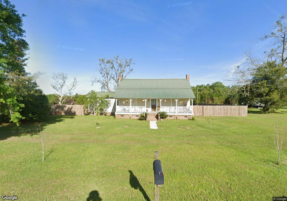
1689 Peacock Rd Quitman, GA 31643
Estimated Value: $440,000
--
Bed
1
Bath
1,556
Sq Ft
$283/Sq Ft
Est. Value
About This Home
This home is located at 1689 Peacock Rd, Quitman, GA 31643 and is currently priced at $440,000, approximately $282 per square foot. 1689 Peacock Rd is a home located in Brooks County with nearby schools including North Brooks Elementary School.
Ownership History
Date
Name
Owned For
Owner Type
Purchase Details
Closed on
Sep 13, 2016
Sold by
Margie G
Bought by
Turner Gregory M and Turner Charlotte
Current Estimated Value
Purchase Details
Closed on
May 10, 2012
Sold by
Vining Margie G
Bought by
Conservation Use Covenant Recording
Purchase Details
Closed on
Dec 1, 2003
Sold by
Green Tree Servicing Llc
Bought by
Vinning Margie
Purchase Details
Closed on
Oct 23, 2003
Sold by
Moore James D and Moore Jamie D
Bought by
Green Tree Servicing Llc
Purchase Details
Closed on
Nov 23, 1998
Sold by
Johnson David R
Bought by
Moore James D and Moore Jamie D
Purchase Details
Closed on
Jun 10, 1998
Sold by
Griner Virgil V
Bought by
Johnson David R
Create a Home Valuation Report for This Property
The Home Valuation Report is an in-depth analysis detailing your home's value as well as a comparison with similar homes in the area
Home Values in the Area
Average Home Value in this Area
Purchase History
| Date | Buyer | Sale Price | Title Company |
|---|---|---|---|
| Turner Gregory M | -- | -- | |
| Conservation Use Covenant Recording | -- | -- | |
| Vinning Margie | $40,000 | -- | |
| Green Tree Servicing Llc | -- | -- | |
| Moore James D | $68,100 | -- | |
| Johnson David R | $18,000 | -- |
Source: Public Records
Tax History Compared to Growth
Tax History
| Year | Tax Paid | Tax Assessment Tax Assessment Total Assessment is a certain percentage of the fair market value that is determined by local assessors to be the total taxable value of land and additions on the property. | Land | Improvement |
|---|---|---|---|---|
| 2024 | $1,082 | $222,544 | $221,800 | $744 |
| 2023 | $1,053 | $198,224 | $197,480 | $744 |
| 2022 | $1,120 | $188,824 | $188,080 | $744 |
| 2021 | $1,100 | $161,424 | $160,680 | $744 |
| 2020 | $4,483 | $161,424 | $160,680 | $744 |
| 2019 | $1,029 | $137,344 | $136,600 | $744 |
| 2018 | $4,092 | $140,104 | $139,360 | $744 |
| 2017 | $1,002 | $140,104 | $139,360 | $744 |
| 2016 | $1,962 | $181,112 | $163,160 | $17,952 |
| 2015 | -- | $180,952 | $163,160 | $17,792 |
| 2014 | -- | $180,952 | $163,160 | $17,792 |
| 2013 | -- | $180,952 | $163,160 | $17,792 |
Source: Public Records
Map
Nearby Homes
- 237 Turkey Ridge Ln
- 4386 Studstill Rd
- 471 Jamar Trail
- 288 Jamar Trail
- 295 Sunflower
- 270 Jamar Trail
- 248 Jamar Trail
- 61 Trail of Hawk Rd
- 17 Green Lake Cir
- 51 Green Lake Cir
- 6818 Troupeville Rd
- 85 Hitch St
- 16000 Valdosta Hwy
- 8262 Troupeville Rd
- 11439 Adel Hwy
- 6211 Hardee Dr
- 168 Azalea St
- 302 Waterside Dr
- 802 Morris Ave
- 804 Morris Ave