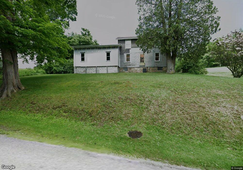
169 Lessig Rd Leechburg, PA 15656
South Armstrong County NeighborhoodEstimated Value: $159,672 - $273,000
3
Beds
2
Baths
1,600
Sq Ft
$137/Sq Ft
Est. Value
About This Home
This home is located at 169 Lessig Rd, Leechburg, PA 15656 and is currently estimated at $218,918, approximately $136 per square foot. 169 Lessig Rd is a home located in Armstrong County.
Ownership History
Date
Name
Owned For
Owner Type
Purchase Details
Closed on
Mar 22, 2001
Bought by
Vakulick Dean A
Current Estimated Value
Purchase Details
Closed on
Jun 30, 1992
Create a Home Valuation Report for This Property
The Home Valuation Report is an in-depth analysis detailing your home's value as well as a comparison with similar homes in the area
Home Values in the Area
Average Home Value in this Area
Purchase History
| Date | Buyer | Sale Price | Title Company |
|---|---|---|---|
| Vakulick Dean A | -- | -- | |
| -- | -- | -- |
Source: Public Records
Tax History Compared to Growth
Tax History
| Year | Tax Paid | Tax Assessment Tax Assessment Total Assessment is a certain percentage of the fair market value that is determined by local assessors to be the total taxable value of land and additions on the property. | Land | Improvement |
|---|---|---|---|---|
| 2025 | $2,600 | $25,130 | $15,960 | $9,170 |
| 2024 | $2,551 | $25,130 | $15,960 | $9,170 |
| 2023 | $2,352 | $25,130 | $15,960 | $9,170 |
| 2022 | $2,352 | $25,130 | $15,960 | $9,170 |
| 2021 | $1,879 | $18,780 | $12,780 | $6,000 |
| 2020 | $1,846 | $18,780 | $12,780 | $6,000 |
| 2019 | $1,844 | $18,780 | $12,780 | $6,000 |
| 2018 | $1,875 | $18,255 | $9,690 | $8,565 |
| 2017 | $1,831 | $18,780 | $12,780 | $6,000 |
| 2016 | $1,780 | $18,780 | $12,780 | $6,000 |
| 2015 | $1,334 | $18,780 | $12,780 | $6,000 |
| 2014 | $1,334 | $18,780 | $12,780 | $6,000 |
Source: Public Records
Map
Nearby Homes
- 171 Hillview Manor Rd
- 767 Evergreen Rd
- 0 Ritter Ln
- 0 Jack Rd
- Lot 4 Sober Rd
- Lot 1 Sober Rd
- Lot 3 Sober Rd
- Lot 2 Sober Rd
- 0000 Sr-2060
- 153 Shuster Hollow Rd
- 109 1st Ave
- 309 State Route 66
- 0 Sportsman Rd Unit 1719147
- 34 & 38 Earhart St
- 503 Main St
- 118 Lehigh Dr
- 124 Giron St
- 272 Ford City Rd
- 505 Locust St
- 129 Lincoln Ave