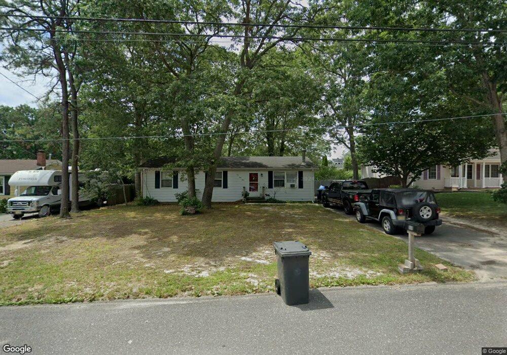
169 Sextant Rd Manahawkin, NJ 08050
Stafford NeighborhoodEstimated Value: $311,720 - $427,000
3
Beds
1
Bath
1,056
Sq Ft
$362/Sq Ft
Est. Value
About This Home
This home is located at 169 Sextant Rd, Manahawkin, NJ 08050 and is currently estimated at $382,430, approximately $362 per square foot. 169 Sextant Rd is a home located in Ocean County with nearby schools including Ocean Acres Elementary School, Oxycocus Elementary School, and McKinley Avenue Elementary School.
Ownership History
Date
Name
Owned For
Owner Type
Purchase Details
Closed on
Feb 6, 1998
Sold by
Parks James and Parks Theresa
Bought by
Liberty Custom Builders Inc
Current Estimated Value
Purchase Details
Closed on
Jun 22, 1995
Sold by
Futyma Janet Lynch
Bought by
Fishman Eric and Fishman Landa
Purchase Details
Closed on
Jul 14, 1994
Sold by
Lynch Joseph
Bought by
Futyna Janet Lynch
Create a Home Valuation Report for This Property
The Home Valuation Report is an in-depth analysis detailing your home's value as well as a comparison with similar homes in the area
Home Values in the Area
Average Home Value in this Area
Purchase History
| Date | Buyer | Sale Price | Title Company |
|---|---|---|---|
| Liberty Custom Builders Inc | $26,000 | Freedom Title & Abstract | |
| Fishman Eric | $69,484 | -- | |
| Futyna Janet Lynch | $70,108 | -- |
Source: Public Records
Tax History Compared to Growth
Tax History
| Year | Tax Paid | Tax Assessment Tax Assessment Total Assessment is a certain percentage of the fair market value that is determined by local assessors to be the total taxable value of land and additions on the property. | Land | Improvement |
|---|---|---|---|---|
| 2025 | $3,809 | $153,400 | $61,600 | $91,800 |
| 2024 | $3,772 | $153,400 | $61,600 | $91,800 |
| 2023 | $3,611 | $153,400 | $61,600 | $91,800 |
| 2022 | $3,611 | $153,400 | $61,600 | $91,800 |
| 2021 | $3,562 | $153,400 | $61,600 | $91,800 |
| 2020 | $3,567 | $153,400 | $61,600 | $91,800 |
| 2019 | $3,516 | $153,400 | $61,600 | $91,800 |
| 2018 | $3,494 | $153,400 | $61,600 | $91,800 |
| 2017 | $3,353 | $142,500 | $61,600 | $80,900 |
| 2016 | $3,319 | $142,500 | $61,600 | $80,900 |
| 2015 | $3,202 | $142,500 | $61,600 | $80,900 |
| 2014 | $3,162 | $139,000 | $60,800 | $78,200 |
Source: Public Records
Map
Nearby Homes
- 309 Neptune Dr
- 296 Neptune Dr
- 117 Topside Rd
- 137 Skipper Rd
- 181 Bowline Rd
- 100 Leeward Rd
- 225 Yeoman Rd
- 182 Atlantis Ave
- 113 Toggle Rd
- 246 Atlantis Ave
- 2010 Breakers Dr
- 2018 Breakers Dr
- 2012 Breakers Dr
- 2014 Breakers Dr
- 2008 Breakers Dr
- 2016 Breakers Dr
- 433 Mermaid Dr
- 107 Deerfield Dr
- 100 Deerfield Dr
- 96 Deerfield Dr