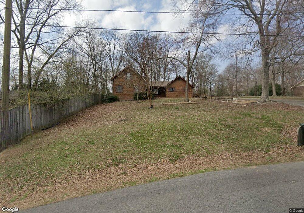
169 Stackstone Dr Dalton, GA 30721
Estimated Value: $288,000 - $335,000
Studio
3
Baths
2,103
Sq Ft
$147/Sq Ft
Est. Value
About This Home
This home is located at 169 Stackstone Dr, Dalton, GA 30721 and is currently estimated at $310,048, approximately $147 per square foot. 169 Stackstone Dr is a home located in Whitfield County with nearby schools including Pleasant Grove Elementary School, New Hope Middle School, and Northwest Whitfield County High School.
Ownership History
Date
Name
Owned For
Owner Type
Purchase Details
Closed on
Dec 20, 2005
Sold by
Fiest Jack R
Bought by
Dempsey Paul A
Current Estimated Value
Home Financials for this Owner
Home Financials are based on the most recent Mortgage that was taken out on this home.
Original Mortgage
$152,500
Outstanding Balance
$82,820
Interest Rate
6.19%
Mortgage Type
New Conventional
Estimated Equity
$227,228
Purchase Details
Closed on
Sep 1, 1997
Bought by
Fiest Jack R and Fiest Kathleen C
Create a Home Valuation Report for This Property
The Home Valuation Report is an in-depth analysis detailing your home's value as well as a comparison with similar homes in the area
Purchase History
| Date | Buyer | Sale Price | Title Company |
|---|---|---|---|
| Dempsey Paul A | $163,000 | -- | |
| Fiest Jack R | -- | -- |
Source: Public Records
Mortgage History
| Date | Status | Borrower | Loan Amount |
|---|---|---|---|
| Open | Dempsey Paul A | $152,500 |
Source: Public Records
Tax History
| Year | Tax Paid | Tax Assessment Tax Assessment Total Assessment is a certain percentage of the fair market value that is determined by local assessors to be the total taxable value of land and additions on the property. | Land | Improvement |
|---|---|---|---|---|
| 2025 | $2,642 | $125,074 | $15,600 | $109,474 |
| 2024 | $2,642 | $125,074 | $15,600 | $109,474 |
| 2023 | $2,373 | $86,032 | $10,600 | $75,432 |
| 2022 | $1,538 | $60,706 | $10,600 | $50,106 |
| 2021 | $1,395 | $55,853 | $10,600 | $45,253 |
| 2020 | $1,431 | $55,853 | $10,600 | $45,253 |
| 2019 | $1,449 | $55,853 | $10,600 | $45,253 |
| 2018 | $1,332 | $51,576 | $10,600 | $40,976 |
| 2017 | $1,333 | $51,576 | $10,600 | $40,976 |
| 2016 | $1,238 | $49,698 | $9,030 | $40,668 |
| 2014 | $1,139 | $49,698 | $9,030 | $40,668 |
| 2013 | -- | $52,725 | $9,030 | $43,695 |
Source: Public Records
Map
Nearby Homes
- 107 Driftwood Ln
- 503 Moore Dr
- 101 Forrest Park Rd
- 522 Westbrook Rd
- 629 Mahogany Ln NW
- 1903 Summit View Dr Unit 188
- 2502 E Hillview Dr
- 1903 Middle Summit Dr
- 1899 N Summit Dr Unit 66
- 112 Albertson Dr
- 0 Battle Way
- 1709 Willow Oak Ln Unit 53
- 1706 Chestnut Oak Dr Unit 91
- 2256 Waring Rd NW
- 132 Andros Loop
- 1702 Chestnut Oak Dr Unit 81
- 1702 Chestnut Oak Dr Unit 83
- 1702 Chestnut Oak Dr
- 150 W Acklin Ln
- 140 Andros Dr
- 201 Stackstone Dr
- 149 Stackstone Dr
- 225 Stackstone Dr
- 141 Stackstone Dr
- 214 Stackstone Dr
- 128 Stackstone Dr
- 600 Royal Oak Dr
- 231 Stackstone Dr
- 502 Royal Oak Dr
- 218 Stackstone Dr
- 602 Royal Oak Dr
- 104 Azalea Cir
- 100 Azalea Cir
- 500 Royal Oak Dr
- 276 Stackstone Dr
- 102 Azalea Cir
- 255 Stackstone Dr
- 605 Royal Oak Dr
- 601 Royal Oak Dr
- 120 Briarcliff Dr
Your Personal Tour Guide
Ask me questions while you tour the home.