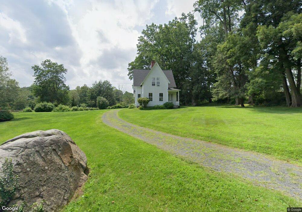
169 Umpawaug Rd Redding, CT 06896
Estimated Value: $543,394 - $688,000
3
Beds
2
Baths
1,335
Sq Ft
$469/Sq Ft
Est. Value
About This Home
This home is located at 169 Umpawaug Rd, Redding, CT 06896 and is currently estimated at $626,349, approximately $469 per square foot. 169 Umpawaug Rd is a home located in Fairfield County with nearby schools including Redding Elementary School, John Read Middle School, and Joel Barlow High School.
Ownership History
Date
Name
Owned For
Owner Type
Purchase Details
Closed on
Aug 4, 1982
Bought by
Kennedy Arthur J and Kennedy Margaret M
Current Estimated Value
Create a Home Valuation Report for This Property
The Home Valuation Report is an in-depth analysis detailing your home's value as well as a comparison with similar homes in the area
Home Values in the Area
Average Home Value in this Area
Purchase History
| Date | Buyer | Sale Price | Title Company |
|---|---|---|---|
| Kennedy Arthur J | -- | -- |
Source: Public Records
Mortgage History
| Date | Status | Borrower | Loan Amount |
|---|---|---|---|
| Closed | Kennedy Arthur J | $115,000 | |
| Closed | Kennedy Arthur J | $15,000 | |
| Closed | Kennedy Arthur J | $107,100 | |
| Closed | Kennedy Arthur J | $110,000 |
Source: Public Records
Tax History
| Year | Tax Paid | Tax Assessment Tax Assessment Total Assessment is a certain percentage of the fair market value that is determined by local assessors to be the total taxable value of land and additions on the property. | Land | Improvement |
|---|---|---|---|---|
| 2025 | $8,806 | $298,100 | $149,400 | $148,700 |
| 2024 | $8,561 | $298,100 | $149,400 | $148,700 |
| 2023 | $8,254 | $298,100 | $149,400 | $148,700 |
| 2022 | $8,562 | $256,800 | $166,200 | $90,600 |
| 2021 | $7,481 | $256,800 | $166,200 | $90,600 |
| 2020 | $8,433 | $256,800 | $166,200 | $90,600 |
| 2019 | $8,433 | $256,800 | $166,200 | $90,600 |
| 2018 | $16,332 | $256,800 | $166,200 | $90,600 |
| 2017 | $8,679 | $293,000 | $197,800 | $95,200 |
| 2016 | $8,567 | $293,000 | $197,800 | $95,200 |
| 2015 | $8,471 | $293,000 | $197,800 | $95,200 |
| 2014 | $8,471 | $293,000 | $197,800 | $95,200 |
Source: Public Records
Map
Nearby Homes
- 229 Umpawaug Rd
- 36 Fox Run Rd
- 74 Seventy Acre Rd
- 2 Brick School Dr
- 123A Peaceable St
- 299 Redding Rd
- 45 Great Pasture Rd
- 24 Costa Ln
- 22 Ledgewood Rd
- 41 Deer Hill Rd
- 15 Laurel Hill Rd
- 2 Longwood Dr
- 12 Werf Dr
- 176 Picketts Ridge Rd
- 64 Portland Ave
- 8 Cornerstone Ct
- 26 Wilridge Rd
- 71 Picketts Ridge Rd
- 9 Chuck Wagon Ln
- 21 Wicks Manor Dr
- 237 Umpawaug Rd
- 183 Old Redding Rd
- 163 Umpawaug Rd
- 175 Umpawaug Rd
- 170 Umpawaug Rd
- 190 Old Redding Rd
- 164 Umpawaug Rd
- 172 Umpawaug Rd
- 185 Umpawaug Rd
- 159 Umpawaug Rd
- 162 Umpawaug Rd
- 160 Umpawaug Rd
- 161 Umpawaug Rd
- 15 Granite Ridge Rd
- 17 Granite Ridge Rd
- 27 Granite Ridge Rd
- 155 Umpawaug Rd
- 7 Granite Ridge Rd
- 28 Granite Ridge Rd
- 187 Umpawaug Rd
Your Personal Tour Guide
Ask me questions while you tour the home.