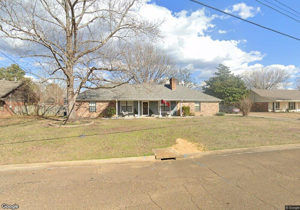
169 W Swoope Dr Columbus, MS 39702
Estimated Value: $227,008 - $257,000
--
Bed
--
Bath
2,104
Sq Ft
$117/Sq Ft
Est. Value
About This Home
This home is located at 169 W Swoope Dr, Columbus, MS 39702 and is currently estimated at $245,502, approximately $116 per square foot. 169 W Swoope Dr is a home.
Ownership History
Date
Name
Owned For
Owner Type
Purchase Details
Closed on
Aug 31, 2017
Sold by
Mcanally Andrew Deaton and Mcanally Amber Stegall
Bought by
Gregory Garrett D
Current Estimated Value
Home Financials for this Owner
Home Financials are based on the most recent Mortgage that was taken out on this home.
Original Mortgage
$161,515
Outstanding Balance
$134,663
Interest Rate
3.93%
Mortgage Type
New Conventional
Estimated Equity
$110,839
Purchase Details
Closed on
Sep 12, 2012
Sold by
Profitt Campbell
Bought by
Mcannally Andrew Deaton
Create a Home Valuation Report for This Property
The Home Valuation Report is an in-depth analysis detailing your home's value as well as a comparison with similar homes in the area
Home Values in the Area
Average Home Value in this Area
Purchase History
| Date | Buyer | Sale Price | Title Company |
|---|---|---|---|
| Gregory Garrett D | -- | None Available | |
| Mcannally Andrew Deaton | -- | -- |
Source: Public Records
Mortgage History
| Date | Status | Borrower | Loan Amount |
|---|---|---|---|
| Open | Gregory Garrett D | $161,515 |
Source: Public Records
Tax History Compared to Growth
Tax History
| Year | Tax Paid | Tax Assessment Tax Assessment Total Assessment is a certain percentage of the fair market value that is determined by local assessors to be the total taxable value of land and additions on the property. | Land | Improvement |
|---|---|---|---|---|
| 2025 | $1,017 | $13,462 | $0 | $0 |
| 2024 | $1,006 | $13,462 | $0 | $0 |
| 2023 | $846 | $11,860 | $0 | $0 |
| 2022 | $847 | $11,860 | $0 | $0 |
| 2021 | $805 | $11,860 | $0 | $0 |
| 2020 | $744 | $11,860 | $0 | $0 |
| 2019 | $1,556 | $11,893 | $0 | $0 |
| 2018 | $1,556 | $17,156 | $0 | $0 |
| 2017 | $692 | $17,156 | $0 | $0 |
| 2016 | $692 | $11,437 | $0 | $0 |
| 2015 | $723 | $11,795 | $0 | $0 |
| 2014 | $723 | $11,795 | $0 | $0 |
Source: Public Records
Map
Nearby Homes
- 187 Jones Dr
- 17 Paige Cove
- 669 Jones Dr
- 524 Jones Dr
- 358 Rogers Way
- 338 Rogers Way
- 836 Oswalt Rd
- 102 Livingston Ln
- 2654 Yorkville Rd E
- 49 Freeman Dr
- 4 Stringer Ln
- 364 Pinewood Dr
- 40 Angela Dr
- 186 Wind Chase Dr
- 262 Center Rd
- 11 Mckay Dr
- 0 Mckay Dr
- 0 New Hope Rd Unit 25-2493
- 9 Monticello Cir
- 0 0 Hwy 69 S
- 131 W Swoope Dr
- 175 W Swoope Dr
- 156 W Swoope Dr
- 192 W Swoope Dr
- 109 E Swoope Dr
- 109 W Swoope Dr
- 101 Loftis Cove
- 77 Loftis Cove
- 122 W Swoope Dr
- 197 W Swoope Dr
- 61 Loftis Cove
- 214 W Swoope Dr
- 47 Loftis Cove
- 106 W Swoope Dr
- 50 Powers Place
- 47 Powers Place
- 101 W Swoope Dr
- 110 Loftis Cove
- 235 W Swoope Dr
- 186 Jones Dr