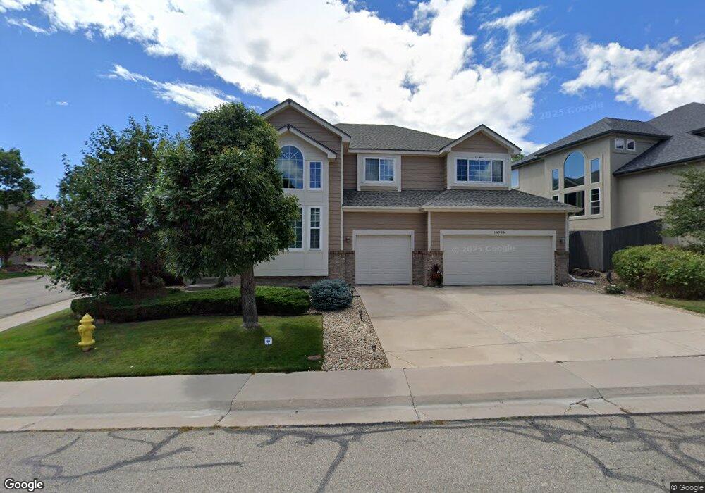
16906 W 71st Place Arvada, CO 80007
Meadows at Westwoods NeighborhoodEstimated Value: $942,129 - $1,160,000
3
Beds
5
Baths
2,909
Sq Ft
$366/Sq Ft
Est. Value
About This Home
This home is located at 16906 W 71st Place, Arvada, CO 80007 and is currently estimated at $1,064,532, approximately $365 per square foot. 16906 W 71st Place is a home located in Jefferson County with nearby schools including West Woods Elementary School, Drake Junior High School, and Ralston Valley Senior High School.
Ownership History
Date
Name
Owned For
Owner Type
Purchase Details
Closed on
Sep 15, 2003
Sold by
Ferrera David Anthony and Ferrera Mary Carol
Bought by
Ferrera David A and Ferrera Mary C
Current Estimated Value
Home Financials for this Owner
Home Financials are based on the most recent Mortgage that was taken out on this home.
Original Mortgage
$218,200
Interest Rate
6.31%
Mortgage Type
Purchase Money Mortgage
Purchase Details
Closed on
Nov 19, 1998
Sold by
The Genesee Company
Bought by
Ferrera David Anthony and Ferrera Mary Carol
Home Financials for this Owner
Home Financials are based on the most recent Mortgage that was taken out on this home.
Original Mortgage
$227,000
Interest Rate
6.9%
Create a Home Valuation Report for This Property
The Home Valuation Report is an in-depth analysis detailing your home's value as well as a comparison with similar homes in the area
Home Values in the Area
Average Home Value in this Area
Purchase History
| Date | Buyer | Sale Price | Title Company |
|---|---|---|---|
| Ferrera David A | -- | -- | |
| Ferrera David Anthony | $296,391 | Land Title |
Source: Public Records
Mortgage History
| Date | Status | Borrower | Loan Amount |
|---|---|---|---|
| Closed | Ferrera David A | $218,200 | |
| Closed | Ferrera David Anthony | $227,000 |
Source: Public Records
Tax History Compared to Growth
Tax History
| Year | Tax Paid | Tax Assessment Tax Assessment Total Assessment is a certain percentage of the fair market value that is determined by local assessors to be the total taxable value of land and additions on the property. | Land | Improvement |
|---|---|---|---|---|
| 2024 | $4,719 | $55,350 | $8,602 | $46,748 |
| 2023 | $4,719 | $55,350 | $8,602 | $46,748 |
| 2022 | $3,561 | $43,309 | $8,833 | $34,476 |
| 2021 | $3,620 | $44,556 | $9,087 | $35,469 |
| 2020 | $3,207 | $40,381 | $11,386 | $28,995 |
| 2019 | $3,164 | $40,381 | $11,386 | $28,995 |
| 2018 | $3,618 | $36,953 | $9,193 | $27,760 |
| 2017 | $3,312 | $36,953 | $9,193 | $27,760 |
| 2016 | $3,841 | $40,370 | $10,369 | $30,001 |
| 2015 | $3,635 | $40,370 | $10,369 | $30,001 |
| 2014 | $3,635 | $35,901 | $6,990 | $28,911 |
Source: Public Records
Map
Nearby Homes
- 7092 Secrest Ct
- 7209 Secrest Ct
- 16589 W 69th Cir
- 16843 W 75th Place
- 6766 Westwoods Cir
- 6951 Nile Ct
- 16030 W 75th Place
- 17891 W 77th Dr
- 6550 Umber Cir
- 17935 W 77th Dr
- 16340 92nd Cir
- 15336 W 69th Dr
- 15326 W 68th Ave
- 15336 W 68th Ave
- 15347 W 68th Ave
- 16929 W 63rd Ln
- 15290 W 68th Place
- 16889 W 63rd Ln
- 16041 W 64th Way
- 16040 W 64th Way
- 16926 W 71st Place
- 16905 W 71st Ave
- 16946 W 71st Place
- 7132 Secrest Ct
- 16915 W 71st Ave
- 7142 Secrest Ct
- 7122 Secrest Ct
- 16907 W 71st Place
- 7172 Secrest Ct
- 7152 Secrest Ct
- 16927 W 71st Place
- 16966 W 71st Place
- 7112 Secrest Ct
- 16947 W 71st Place
- 7162 Secrest Ct
- 16914 W 71st Ave
- 16986 W 71st Place
- 7102 Secrest Ct
- 16967 W 71st Place
- 7164 Terry Ct