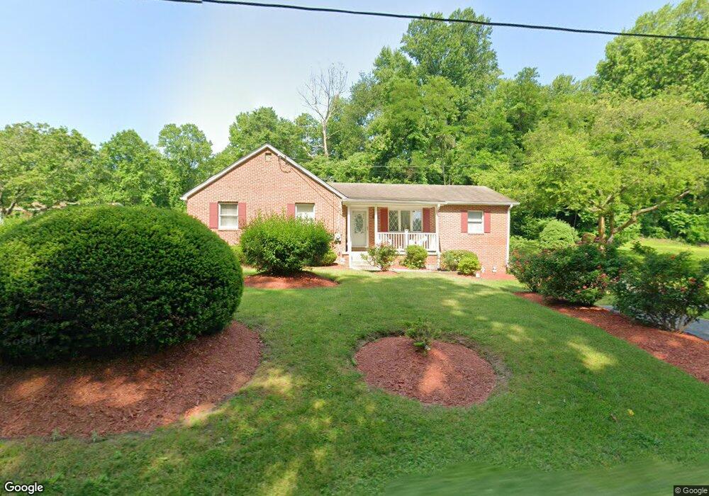
16909 Croom Rd Brandywine, MD 20613
Estimated Value: $314,590 - $566,000
Studio
1
Bath
1,410
Sq Ft
$286/Sq Ft
Est. Value
About This Home
This home is located at 16909 Croom Rd, Brandywine, MD 20613 and is currently estimated at $402,648, approximately $285 per square foot. 16909 Croom Rd is a home located in Prince George's County with nearby schools including Baden Elementary School, Gwynn Park Middle School, and Gwynn Park High School.
Ownership History
Date
Name
Owned For
Owner Type
Purchase Details
Closed on
Apr 19, 2006
Sold by
Brady William
Bought by
Brady William
Current Estimated Value
Home Financials for this Owner
Home Financials are based on the most recent Mortgage that was taken out on this home.
Original Mortgage
$244,000
Outstanding Balance
$135,725
Interest Rate
5.81%
Mortgage Type
Stand Alone Refi Refinance Of Original Loan
Estimated Equity
$266,923
Purchase Details
Closed on
Jul 22, 2005
Sold by
Brady William
Bought by
Brady William
Home Financials for this Owner
Home Financials are based on the most recent Mortgage that was taken out on this home.
Original Mortgage
$244,000
Interest Rate
5.81%
Mortgage Type
New Conventional
Purchase Details
Closed on
Aug 15, 1969
Sold by
Bowen John
Bought by
Brady William and Brady Thelma
Create a Home Valuation Report for This Property
The Home Valuation Report is an in-depth analysis detailing your home's value as well as a comparison with similar homes in the area
Purchase History
| Date | Buyer | Sale Price | Title Company |
|---|---|---|---|
| Brady William | -- | -- | |
| Brady William | -- | -- | |
| Brady William | $12,500 | -- |
Source: Public Records
Mortgage History
| Date | Status | Borrower | Loan Amount |
|---|---|---|---|
| Open | Brady William | $244,000 | |
| Previous Owner | Brady William | $244,000 |
Source: Public Records
Tax History
| Year | Tax Paid | Tax Assessment Tax Assessment Total Assessment is a certain percentage of the fair market value that is determined by local assessors to be the total taxable value of land and additions on the property. | Land | Improvement |
|---|---|---|---|---|
| 2025 | $2,624 | $270,900 | $80,800 | $190,100 |
| 2024 | $2,624 | $245,867 | -- | -- |
| 2023 | $2,511 | $220,833 | $0 | $0 |
| 2022 | $2,374 | $195,800 | $81,000 | $114,800 |
| 2021 | $2,285 | $191,200 | $0 | $0 |
| 2020 | $2,257 | $186,600 | $0 | $0 |
| 2019 | $2,214 | $182,000 | $81,000 | $101,000 |
| 2018 | $2,148 | $173,933 | $0 | $0 |
| 2017 | $2,097 | $165,867 | $0 | $0 |
| 2016 | -- | $157,800 | $0 | $0 |
| 2015 | $1,810 | $157,800 | $0 | $0 |
| 2014 | $1,810 | $157,800 | $0 | $0 |
Source: Public Records
Map
Nearby Homes
- 17207 Magruders Ferry Rd
- 0 Magruders Ferry Rd Unit MDPG2168582
- 0 Magruders Ferry Rd Unit MDPG2193714
- 17507 Magruders Ferry Rd
- 15602 Bennington Farms Ln
- 16661 Bald Eagle School Rd
- 16808 River Airport Rd
- 6132 Old Airpark Ln
- 0 Croom Rd
- 15226 Croom Rd
- 14602 Baden Westwood Rd
- 6400 Casey Way
- 0 Aquasco Rd Unit MDPG2193610
- 0 Aquasco Rd Unit MDPG2166924
- 0 Aquasco Rd Unit MDPG2188968
- 18217 Aquasco Rd
- 13801 Clemerra Way
- 6901 Ash Ct
- 3446 Chaneyville Rd
- 2550 Redbud Ln
- 17003 Croom Rd
- 16905 Croom Rd
- 16901 Croom Rd
- 17005 Croom Rd
- 17008 Croom Rd
- 16860 Croom Rd
- 16807 Croom Rd
- 17101 Croom Rd
- 16800 Croom Rd
- 17104 Croom Rd
- 17290 Croom Rd
- 17107 Croom Rd Unit A
- 17107 Croom Rd
- 17107 Croom Rd Unit B
- 17107 Croom Rd Unit C
- 16920 Croom Rd
- 16810 Croom Rd
- 17111 Croom Rd
- 16911 Croom Rd
- 16801 Croom Rd
Your Personal Tour Guide
Ask me questions while you tour the home.