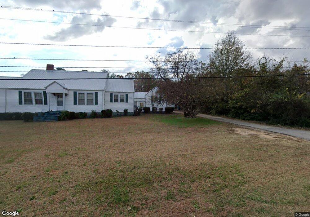
1691 E Broad St Greensboro, GA 30642
Estimated Value: $219,000 - $274,000
3
Beds
2
Baths
1,762
Sq Ft
$141/Sq Ft
Est. Value
About This Home
This home is located at 1691 E Broad St, Greensboro, GA 30642 and is currently estimated at $247,762, approximately $140 per square foot. 1691 E Broad St is a home located in Greene County with nearby schools including Greene County High School.
Ownership History
Date
Name
Owned For
Owner Type
Purchase Details
Closed on
Dec 1, 2020
Sold by
Kern Richard E
Bought by
Broad Street Potential Llc
Current Estimated Value
Purchase Details
Closed on
May 17, 2005
Sold by
Johnson Mae F Moore
Bought by
Kern Richard E
Home Financials for this Owner
Home Financials are based on the most recent Mortgage that was taken out on this home.
Original Mortgage
$109,250
Interest Rate
5.35%
Mortgage Type
New Conventional
Purchase Details
Closed on
Jul 23, 1999
Sold by
Johnson Robert M
Bought by
Johnson Mae F Moore
Purchase Details
Closed on
Jan 1, 1964
Bought by
Johnson Robert M
Create a Home Valuation Report for This Property
The Home Valuation Report is an in-depth analysis detailing your home's value as well as a comparison with similar homes in the area
Home Values in the Area
Average Home Value in this Area
Purchase History
| Date | Buyer | Sale Price | Title Company |
|---|---|---|---|
| Broad Street Potential Llc | $155,000 | -- | |
| Kern Richard E | $115,000 | -- | |
| Johnson Mae F Moore | -- | -- | |
| Johnson Robert M | -- | -- |
Source: Public Records
Mortgage History
| Date | Status | Borrower | Loan Amount |
|---|---|---|---|
| Previous Owner | Kern Richard E | $109,250 |
Source: Public Records
Tax History Compared to Growth
Tax History
| Year | Tax Paid | Tax Assessment Tax Assessment Total Assessment is a certain percentage of the fair market value that is determined by local assessors to be the total taxable value of land and additions on the property. | Land | Improvement |
|---|---|---|---|---|
| 2024 | $1,382 | $55,776 | $13,600 | $42,176 |
| 2023 | $959 | $56,500 | $13,600 | $42,900 |
| 2022 | $972 | $46,952 | $8,000 | $38,952 |
| 2021 | $944 | $42,712 | $8,000 | $34,712 |
| 2020 | $872 | $35,280 | $9,520 | $25,760 |
| 2019 | $905 | $35,280 | $9,520 | $25,760 |
| 2018 | $884 | $35,280 | $9,520 | $25,760 |
| 2017 | $835 | $35,346 | $9,520 | $25,826 |
| 2016 | $858 | $36,498 | $9,520 | $26,978 |
| 2015 | $819 | $36,497 | $9,520 | $26,978 |
| 2014 | $802 | $34,684 | $9,520 | $25,164 |
Source: Public Records
Map
Nearby Homes
- 1531 E Broad St
- LOT 1 Penfield
- 1131 Planing Mill Rd
- 1141 Planing Mill Rd
- 0 Railroad St Unit 218854
- 0 Railroad St Unit 10578007
- 0 Railroad St Unit 531919
- 1020 Horton Dr
- 1060 Twin Pines Cir
- 301 N East St
- 504 Martin Luther King Junior Dr
- 15 South St Unit Siloam Road
- 0 Canaan St
- 109 Reynolds Dr
- 314 W South St
- 105 Wilson St
- 805 S West St
- 0 Maple Cir
- 0 Union Point Hwy Unit 69532
- 0 Union Point Hwy Unit 7607786
- 0 E Broad St Unit 7597228
- 0 E Broad St
- 1681 E Broad St
- 1711 E Broad St
- 1671 E Broad St
- 1670 E Broad St
- 1721 E Broad St
- 1720 E Broad St
- 1661 E Broad St
- 1660 E Broad St
- 1740 E Broad St
- 1641 E Broad St
- 1040 Webb Ln
- 1070 Webb Ln
- 1011 Webb Ln
- 1630 E Broad St
- 1621 E Broad St
- 1760 E Broad St
- 1301 Webb Lake Dr
- 1610 E Broad St