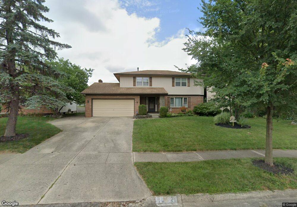
1692 Lynnhurst Rd Columbus, OH 43229
Northgate NeighborhoodEstimated Value: $326,673 - $348,000
4
Beds
3
Baths
2,146
Sq Ft
$157/Sq Ft
Est. Value
About This Home
This home is located at 1692 Lynnhurst Rd, Columbus, OH 43229 and is currently estimated at $337,418, approximately $157 per square foot. 1692 Lynnhurst Rd is a home located in Franklin County with nearby schools including Alpine Elementary School, Northgate Intermediate, and Woodward Park Middle School.
Ownership History
Date
Name
Owned For
Owner Type
Purchase Details
Closed on
Jun 18, 2001
Sold by
Rawdon Mark A and Rawdon Dolores A
Bought by
Cavanagh John M and Cavanagh Kelly M
Current Estimated Value
Home Financials for this Owner
Home Financials are based on the most recent Mortgage that was taken out on this home.
Original Mortgage
$149,150
Outstanding Balance
$56,980
Interest Rate
7.18%
Mortgage Type
Purchase Money Mortgage
Estimated Equity
$280,438
Purchase Details
Closed on
Mar 21, 1988
Bought by
Rawdon Mark A
Purchase Details
Closed on
May 1, 1984
Purchase Details
Closed on
Jan 1, 1984
Create a Home Valuation Report for This Property
The Home Valuation Report is an in-depth analysis detailing your home's value as well as a comparison with similar homes in the area
Home Values in the Area
Average Home Value in this Area
Purchase History
| Date | Buyer | Sale Price | Title Company |
|---|---|---|---|
| Cavanagh John M | $157,000 | Chicago Title West | |
| Rawdon Mark A | $90,000 | -- | |
| -- | $77,500 | -- | |
| -- | -- | -- |
Source: Public Records
Mortgage History
| Date | Status | Borrower | Loan Amount |
|---|---|---|---|
| Open | Cavanagh John M | $149,150 |
Source: Public Records
Tax History Compared to Growth
Tax History
| Year | Tax Paid | Tax Assessment Tax Assessment Total Assessment is a certain percentage of the fair market value that is determined by local assessors to be the total taxable value of land and additions on the property. | Land | Improvement |
|---|---|---|---|---|
| 2024 | $4,639 | $103,360 | $21,000 | $82,360 |
| 2023 | $4,579 | $103,355 | $21,000 | $82,355 |
| 2022 | $3,484 | $67,170 | $13,650 | $53,520 |
| 2021 | $3,490 | $67,170 | $13,650 | $53,520 |
| 2020 | $3,494 | $67,170 | $13,650 | $53,520 |
| 2019 | $3,176 | $52,360 | $10,920 | $41,440 |
| 2018 | $2,935 | $52,360 | $10,920 | $41,440 |
| 2017 | $3,075 | $52,360 | $10,920 | $41,440 |
| 2016 | $2,975 | $44,910 | $8,160 | $36,750 |
| 2015 | $2,701 | $44,910 | $8,160 | $36,750 |
| 2014 | $2,707 | $44,910 | $8,160 | $36,750 |
| 2013 | $1,484 | $49,910 | $9,065 | $40,845 |
Source: Public Records
Map
Nearby Homes
- 6035 Karl Rd
- 1549 Alpine Dr
- 1752 Pine Tree St S Unit H
- 1743 Pine Tree St N Unit A
- 6342 Bellmeadow Dr
- 6019 Beechcroft Rd
- 1390 E Dublin Granville Rd
- 1288 Oakfield Dr N
- 6245 Sharon Woods Blvd
- 6407 Faircrest Rd
- 1687 Brookfield Square S
- 6458 Faircrest Rd
- 6407 Skywae Dr
- 5732 Beechcroft Rd Unit B
- 1881 Brimfield Rd
- 5726 Beechcroft Rd Unit J
- 6355 Johnanne St
- 1492 Cottonwood Dr
- 6189 Northgap Dr
- 1171 Newbury Dr
- 1682 Lynnhurst Rd
- 1700 Lynnhurst Rd
- 1674 Lynnhurst Rd
- 1708 Lynnhurst Rd
- 1689 Lynnhurst Rd
- 1697 Lynnhurst Rd
- 1666 Lynnhurst Rd
- 1705 Lynnhurst Rd
- 1677 Lynnhurst Rd
- 1718 Lynnhurst Rd
- 1717 Lynnhurst Rd
- 1667 Lynnhurst Rd
- 1698 Sandhurst Rd
- 1659 Lynnhurst Rd
- 1726 Lynnhurst Rd
- 1727 Lynnhurst Rd
- 1706 Sandhurst Rd
- 1678 Sandhurst Rd
- 1650 Lynnhurst Rd
- 1686 Sandhurst Rd