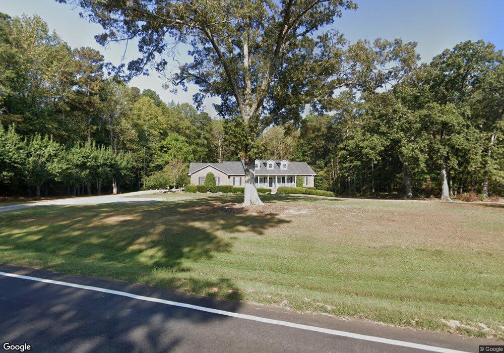
1693 Tyus Carrollton Rd Carrollton, GA 30117
Estimated Value: $399,413 - $494,000
3
Beds
3
Baths
2,396
Sq Ft
$186/Sq Ft
Est. Value
About This Home
This home is located at 1693 Tyus Carrollton Rd, Carrollton, GA 30117 and is currently estimated at $445,353, approximately $185 per square foot. 1693 Tyus Carrollton Rd is a home located in Carroll County with nearby schools including Roopville Elementary School, Central Middle School, and Central High School.
Ownership History
Date
Name
Owned For
Owner Type
Purchase Details
Closed on
Jun 24, 1998
Sold by
Crews Craig A and Crews Aman
Bought by
Crews Craig A and Crews Aman
Current Estimated Value
Purchase Details
Closed on
May 31, 1998
Sold by
Crews Craig A and Crews Aman
Bought by
Crews Craig A and Crews Amanda A
Purchase Details
Closed on
Apr 21, 1995
Sold by
Crews Craig A
Bought by
Crews Craig A and Crews Aman
Purchase Details
Closed on
Oct 5, 1994
Sold by
Payne Corrective
Bought by
Crews Craig A
Purchase Details
Closed on
Aug 3, 1990
Bought by
Payne
Purchase Details
Closed on
Aug 1, 1990
Sold by
Payne
Bought by
Payne Corrective
Create a Home Valuation Report for This Property
The Home Valuation Report is an in-depth analysis detailing your home's value as well as a comparison with similar homes in the area
Home Values in the Area
Average Home Value in this Area
Purchase History
| Date | Buyer | Sale Price | Title Company |
|---|---|---|---|
| Crews Craig A | -- | -- | |
| Crews Craig A | -- | -- | |
| Crews Craig A | -- | -- | |
| Crews Craig A | $17,500 | -- | |
| Payne | $9,000 | -- | |
| Payne Corrective | -- | -- |
Source: Public Records
Tax History Compared to Growth
Tax History
| Year | Tax Paid | Tax Assessment Tax Assessment Total Assessment is a certain percentage of the fair market value that is determined by local assessors to be the total taxable value of land and additions on the property. | Land | Improvement |
|---|---|---|---|---|
| 2024 | $2,982 | $160,936 | $18,037 | $142,899 |
| 2023 | $2,982 | $149,411 | $19,085 | $130,326 |
| 2022 | $2,497 | $117,386 | $12,723 | $104,663 |
| 2021 | $2,238 | $99,679 | $10,179 | $89,500 |
| 2020 | $2,036 | $88,326 | $9,253 | $79,073 |
| 2019 | $1,933 | $81,789 | $9,253 | $72,536 |
| 2018 | $1,786 | $72,210 | $6,538 | $65,672 |
| 2017 | $1,792 | $72,210 | $6,538 | $65,672 |
| 2016 | $1,792 | $72,210 | $6,538 | $65,672 |
| 2015 | $1,890 | $71,599 | $6,989 | $64,610 |
| 2014 | $1,899 | $71,599 | $6,989 | $64,610 |
Source: Public Records
Map
Nearby Homes
- 1531 Tyus Carrollton Rd
- 20 Camp Ct
- 105 Woodbine Dr
- 345 Piney Grove Rd
- 399 Old Camp Church Rd
- 95 Camp Ln
- 0 Bonner Rd Unit 10635754
- 3680 W Highway 166
- 450 Baxter Rd
- 21 Crabapple Place
- The Coleman Plan at Summerfield Place
- The Pearson Plan at Summerfield Place
- The Piedmont Plan at Summerfield Place
- The Harrington Plan at Summerfield Place
- The McGinnis Plan at Summerfield Place
- The Telfair Plan at Summerfield Place
- 0 Buffalo Creek Rd Unit 10624169
- 533 Buffalo Creek Rd
- 40 Red Holly Gap
- 102 Red Oak Dr
- 0 Bethesda Church Rd
- 0 Bethesda Church Rd Unit 7446141
- 0 Bethesda Church Rd Unit 7255535
- 0 Bethesda Church Rd Unit 3221231
- 0 Bethesda Church Rd Unit 8855756
- 0 Bethesda Church Rd Unit 8855295
- 0 Bethesda Church Rd Unit 8810155
- 0 Bethesda Church Rd Unit 8547292
- 0 Bethesda Church Rd Unit 8536522
- 0 Bethesda Church Rd Unit 8384690
- 0 Bethesda Church Rd Unit 8324865
- 0 Bethesda Church Rd Unit 7634887
- 0 Bethesda Church Rd Unit 8769618
- 0 Bethesda Church Rd Unit 8659687
- 0 Bethesda Church Rd Unit 8681820
- 0 Bethesda Church Rd Unit 3073512
- 0 Bethesda Church Rd Unit 7005234
- 0 Bethesda Church Rd Unit 8035278
- 1591 Tyus Carrollton Rd
- 19 Owensby Cemetary Rd